Search the Special Collections and Archives Portal
Search Results
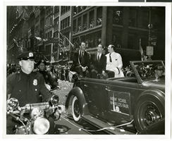
Photograph of Howard Hughes and his crew at a parade, New York, July 15, 1938
Date
1938-07-15
Archival Collection
Description
Description printed on back of photograph: "New York welcomes Howard Hughes. Grover Whalen also in car. 7/15/38."
Image
#69250: Melissa Rorie, new faculty member on August 15, 2013, 2013 August 15
Level of Description
File
Archival Collection
University of Nevada, Las Vegas Creative Services Records (2010s)
To request this item in person:
Collection Number: PH-00388-05
Collection Name: University of Nevada, Las Vegas Creative Services Records (2010s)
Box/Folder: Digital File 00
Collection Name: University of Nevada, Las Vegas Creative Services Records (2010s)
Box/Folder: Digital File 00
Archival Component
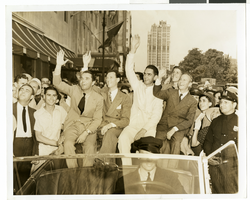
Photograph of Howard Hughes and crew at a parade, New York, July 15, 1938
Date
1938-07-15
Archival Collection
Description
Description printed on photograph's accompanying sheet of paper: "Members of the Howard Hughes flight around the world are (L-to-R) Thomas Thurlow, navigator; Richard Stoddart, radio engineer; Ed Lund, mechanic and H. P. Connor, co-navigator, as they rode in the welcoming parade in New York City 7-15-38."
Image
New faculty members on August 15, 2013: digital photographs
Date
2013-08-15
Archival Collection
Description
Photographs from the University of Nevada, Las Vegas Creative Services Records (2010s) (PH-00388-05). Client: Kristene Fisher, Vice Provost for Academic Affairs
Image
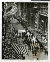
Photograph of Howard Hughes and his crew at a parade, New York, July 15, 1938
Date
1938-07-15
Archival Collection
Description
The view of Howard Hughes and his crew at a parade after he completed his Round-The-World flight in New York.
Image
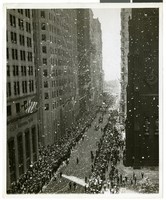
Photograph of a parade procession, New York, July 15, 1938
Date
1938-07-15
Archival Collection
Description
An overhead view of people looking up and waving during a parade procession.
Image
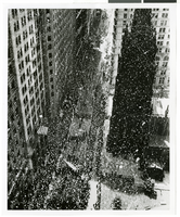
Photograph of a parade procession, New York, July 15, 1938
Date
1938-07-15
Archival Collection
Description
An overhead view of a parade procession celebrating Howard Hughes' completion of his round-the-world flight.
Image
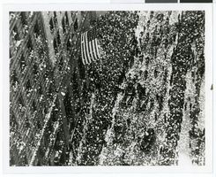
Photograph of a parade procession, New York, July 15, 1938
Date
1938-07-15
Archival Collection
Description
An overhead view of a parade procession celebrating Howard Hughes' completion of his round-the-world flight.
Image
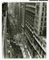
Photograph of a parade procession, New York, July 15, 1938
Date
1938-07-15
Archival Collection
Description
An overhead view of a parade procession celebrating Howard Hughes' completion of his round-the-world flight.
Image
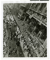
Photograph of a parade procession, New York, July 15, 1938
Date
1938-07-15
Archival Collection
Description
An overhead view of a parade procession celebrating Howard Hughes' completion of his round-the-world flight.
Image
Pagination
Refine my results
Content Type
Creator or Contributor
Subject
Archival Collection
Digital Project
Resource Type
Year
Material Type
Place
Language
Records Classification
