Search the Special Collections and Archives Portal
Search Results

Map of the city of Las Vegas, Nevada, June 1, 1946
Date
1946-06-01
Description
Scale [ca. 1:9,600. 1 in. to approx. 800 ft.]. Cadastral map. 'Compiled by Pioneer Title Insurance &Trust Company.' 'By Jack Asher, State Nev. Reg. Engr. No. 305.' 'Issue 5, 6/1/46.' Includes indexes. Pioneer Title Insurance &
Trust Company
Trust Company
Image

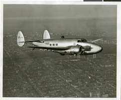
Photograph of the Lockheed 14 aircraft, July 1938
Date
1938-07
Archival Collection
Description
The black and white, skyline view of New York City with Lockheed 14 flying in the foreground. Typed onto script included with the image: "Howard Hughes plane in flight over New York City. July 1938."
Image

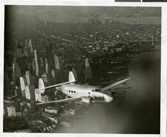
Photograph of the Lockheed 14 aircraft, July 1938
Date
1938-07
Archival Collection
Description
The black and white, skyline view of New York City with Lockheed 14 flying in the foreground. Typed onto script included with the image: "Howard Hughes plane in flight over New York City. July 1938."
Image

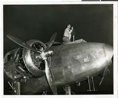
Photograph of Hiram "Tommy" Thurlow and the Lockheed 14, New York, New York, July 9, 1938
Date
1938-07-09
Archival Collection
Description
The black and white view of view of Hiram "Tommy" Thurlow and the Lockheed 14 aircraft in New York, New York. Typed on a piece of paper attached to the image: "Rolling Howard Hughes' plane of hangar at Floyd Bennett Field, with Lt. Thomas Thurlow, one of the navigators, calibrating the compass."
Image
Crowd at Floyd Bennett Airfield, New York, 1938 July
Level of Description
File
Archival Collection
Howard Hughes Public Relations Photograph Collection
To request this item in person:
Collection Number: PH-00373
Collection Name: Howard Hughes Public Relations Photograph Collection
Box/Folder: Folder 09
Collection Name: Howard Hughes Public Relations Photograph Collection
Box/Folder: Folder 09
Archival Component
Pagination
Refine my results
Content Type
Creator or Contributor
Subject
Archival Collection
Digital Project
Resource Type
Year
Material Type
Place
Language
Records Classification
