Search Results

Map of California and territories of New Mexico and Utah, circa 1861
Date
Description
Image
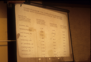
Slide presentation from a hearing at City Hall: photographic slide
Date
Archival Collection
Description
From the Sister Klaryta Antoszewska Photograph Collection (PH-00352). The slide reads: "Comparison of the cumulative estimated dose with diagnostic x-rays 1951 to 1958.
Image
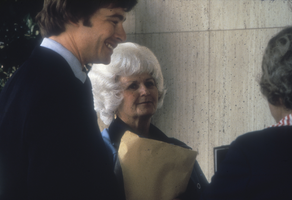
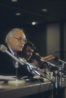
Unidentified persons at a hearing at a City Hall in Nevada: photographic slide
Date
Archival Collection
Description
From the Sister Klaryta Antoszewska Photograph Collection (PH-00352).
Image
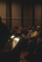
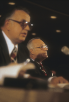
Unidentified persons at a hearing at a City Hall in Nevada: photographic slide
Date
Archival Collection
Description
From the Sister Klaryta Antoszewska Photograph Collection (PH-00352).
Image
Unidentified persons at a hearing at a City Hall in Nevada: photographic slide
Date
Archival Collection
Description
From the Sister Klaryta Antoszewska Photograph Collection (PH-00352).
Image
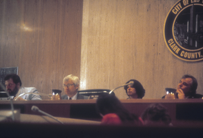
Unidentified persons at a hearing at a City Hall in Nevada: photographic slide
Date
Archival Collection
Description
From the Sister Klaryta Antoszewska Photograph Collection (PH-00352).
Image
Unidentified persons at a hearing at a City Hall in Nevada: photographic slide
Date
Archival Collection
Description
From the Sister Klaryta Antoszewska Photograph Collection (PH-00352).
Image
North Las Vegas and City Hall construction, 1940s-1960s
Level of Description
Archival Collection
Archival Component
Watercolor sketches: Central Park, New York City, New York, undated
Level of Description
Archival Collection
Archival Component
Wilbur Clark at a formal dinner, New York City, New York, 1958
Level of Description
Archival Collection
Archival Component