Search Results
Photograph of Hoover Dam, 1935-1940
Date
1935 to 1940
Archival Collection
Description
Hoover Dam was originally called the Boulder Dam from 1933-1947, but was renamed the Hoover Dam by a joint resolution of Congress. Site Name: Hoover Dam (dam)
Image

Photograph of Hoover Dam, 1935-1940
Date
1935 to 1940
Archival Collection
Description
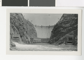
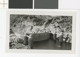
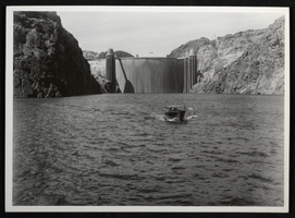
This is a photograph of Hoover Dam. Its crest and intake towers are visible in the photograph. Hoover Dam was named as such in 1947, but was previously named the Boulder Dam. "3." is written in the bottom left corner of the photo. Site Name: Hoover Dam (dam)
Image
Photograph of Hoover Dam, circa 1935
Date
1935
Archival Collection
Description
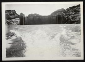
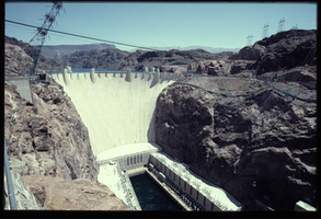
An image of the upstream face of Hoover Dam. The name was officially changed from Boulder Dam to Hoover Dam in 1947.
Image
Photograph of Hoover Dam, circa 1935
Date
1935
Archival Collection
Description
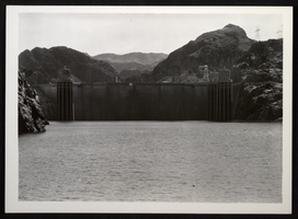
An image of the upstream face of Hoover Dam. The name was officially changed from Boulder Dam to Hoover Dam in 1947.
Image
Photograph of Hoover Dam, 1936-1940
Date
1936 to 1940
Archival Collection
Description
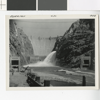
The filling of the Hoover Dam after the completion of the construction. It was previously called the Boulder Dam, and in 1947 it was officially renamed the Hoover Dam. Written on the top of the photo: "BDRA. NEV. 4.36 350." Site Name: Hoover Dam (dam)
Image
Photograph of Hoover Dam, 1935-1940
Date
1935 to 1940
Archival Collection
Description
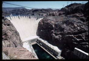
Hoover Dam upstream view with intake towers. Site Name: Hoover Dam (dam)
Image
Photograph of Hoover Dam, circa 1935
Date
1935
Archival Collection
Description
An image of the upstream face of Hoover Dam. The name was officially changed from Boulder Dam to Hoover Dam in 1947.
Image
The front face of Hoover Dam looking northeast from Hoover Dam, Nevada: photographic slide
Date
1983-08
Archival Collection
Description
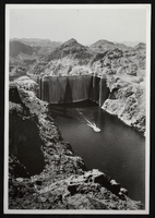
This series of photographs documents the historic water overflow at Hoover Dam as seen from the Arizona side of the dam. Taken in August of 1983, this overflow marked the first time the spillways were used during a flood. After initially being filled, the spillways were tested once in August of 1941.
Image
The front face of Hoover Dam looking northeast from Hoover Dam, Nevada: photographic slide
Date
1983-08
Archival Collection
Description
This series of photographs documents the historic water overflow at Hoover Dam as seen from the Arizona side of the dam. Taken in August of 1983, this overflow marked the first time the spillways were used during a flood. After initially being filled, the spillways were tested once in August of 1941.
Image
Photograph of Hoover Dam, circa 1935
Date
1935
Archival Collection
Description
An image of the upstream face of Hoover Dam. The name was officially changed from Boulder Dam to Hoover Dam in 1947.
Image