Search the Special Collections and Archives Portal
Search Results
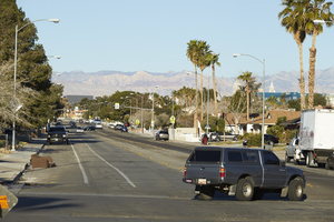
Looking west-southwest down Hacienda Avenue near Eastern Avenue, in Las Vegas, Nevada: digital photograph
Date
Archival Collection
Description
From the UNLV University Libraries Photographs of the Development of the Las Vegas Valley, Nevada (PH-00394). Part of the collection documents the entire 19 mile length of the north/south Eastern Avenue / Civic Center Drive alignment. This photograph was captured in the section of Eastern Avenue between Tropicana Avenue and Russell Road.
Image
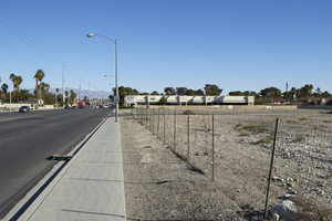
A vacant lot on Eastern Avenue north of Hacienda Avenue, looking north in Las Vegas, Nevada: digital photograph
Date
Archival Collection
Description
From the UNLV University Libraries Photographs of the Development of the Las Vegas Valley, Nevada (PH-00394). Part of the collection documents the entire 19 mile length of the north/south Eastern Avenue / Civic Center Drive alignment. This photograph was captured in the section of Eastern Avenue between Tropicana Avenue and Russell Road.
Image
Ground-breaking for new room addition to Hacienda Hotel in Las Vegas, Nevada: photographic print, approximately 1955 to 1969
Level of Description
Archival Collection
Collection Name: UNLV Libraries Single Item Accession Photograph Collection
Box/Folder: Folder 12
Archival Component
The intersection of Eastern and Hacienda Avenues, looking north-west in Las Vegas, Nevada: digital photograph, 2019 March 13
Level of Description
Archival Collection
Collection Name: UNLV University Libraries Photographs of the Development of the Las Vegas Valley, Nevada
Box/Folder: N/A
Archival Component
Hacienda Hotel and Casino: newspaper clippings, press releases, brochures and pamphlets, and "Guide to What's Happening NOW,", 1965 to 1990
Level of Description
Archival Collection
Collection Name: UNLV Libraries Collection of Hotel and Casino Promotional and Publicity Materials
Box/Folder: Box 08, Box 09
Archival Component
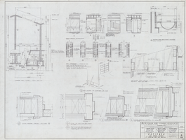
Architectural drawing of the Hacienda (Las Vegas), typical room plan, typical wall partitions, bath elevations and interior details, door frames detail, March 25, 1963
Date
Archival Collection
Description
Plans for hotel room and public area additions for the Hacienda from 1963-1965. J. L. Cusick and Associates, electrical engineers; Harold L. Epstein and Associates, structural engineers; W. L. Donley and Associates, mechanical engineers.
Site Name: Hacienda
Address: 3590 Las Vegas Boulevard South, Las Vegas, NV
Image
Las Vegas Nevada South Stake; Hacienda, Laurelwood, West Oquendo wards, addition and remodel project manual, 2003 June 10
Level of Description
Archival Collection
Collection Name: Alton Dean Jensen Architectural Records
Box/Folder: Box 272
Archival Component

Allegiant Stadium under construction as seen from Hacienda Avenue, looking south in Las Vegas, Nevada: digital photograph
Date
Archival Collection
Description
Photographed as part of the UNLV Special Collections and Archives' Building Las Vegas collecting initiative started in 2016. This photo is part of a series documenting ongoing construction work at the Allegiant Stadium.
Image
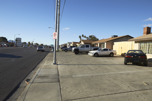
Homes along Eastern Avenue near Hacienda Avenue, looking south-southwest in Las Vegas, Nevada: digital photograph
Date
Archival Collection
Description
From the UNLV University Libraries Photographs of the Development of the Las Vegas Valley, Nevada (PH-00394). Part of the collection documents the entire 19 mile length of the north/south Eastern Avenue / Civic Center Drive alignment. This photograph was captured in the section of Eastern Avenue between Tropicana Avenue and Russell Road.
Image
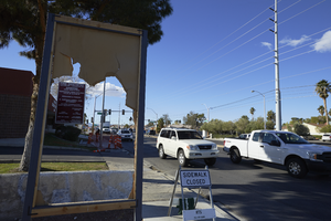
A damaged sign along Eastern Avenue near Hacienda Avenue, looking south in Las Vegas, Nevada: digital photograph
Date
Archival Collection
Description
From the UNLV University Libraries Photographs of the Development of the Las Vegas Valley, Nevada (PH-00394). Part of the collection documents the entire 19 mile length of the north/south Eastern Avenue / Civic Center Drive alignment. This photograph was captured in the section of Eastern Avenue between Tropicana Avenue and Russell Road.
Image
