Search the Special Collections and Archives Portal
Search Results
Bernada French oral history interview
Identifier
Abstract
Oral history interview with Bernada French conducted by James Doohan on March 16, 1977 for the Ralph Roske Oral History Project on Early Las Vegas. French discusses her career in geology and railroads in Southern Nevada.
Archival Collection
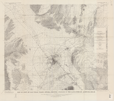
Map of part of Las Vegas Valley, Nevada, showing changes in the land-surface altitude, 1935-50
Date
Description
Image
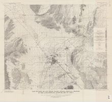
Map of part of Las Vegas Valley, Nevada, showing changes in the land-surface altitude, 1935 to 1940-41
Date
Description
Image
Letter from Jona L. Souder, Chief, Local Public Document Room Branch, Division of Rules and Records, Office of Administration and Resources Management, United States Nuclear Regulatory Commission to Mary Dale Deacon, Director of Libraries, University of Nevada, Las Vegas confirming the establishment of the James. R. Dickinson Library, as the Nuclear Regulatory Commission's (NRC) official local public document room (LPDR) for material related to the licensing of the Department of Energy's proposed high-level waste geologic repository site near Yucca Mountain, Nevada with Federal Register Notice, 1988 February 17
Level of Description
Archival Collection
Collection Name: Yucca Mountain Site Characterization Office Collection
Box/Folder: Box 01
Archival Component
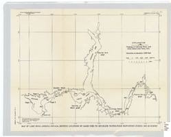
Map of Lake Mead, Arizona-Nevada, showing locations of gages used to establish water-stage elevations during 1947-49 survey
Date
Description
Image
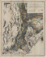
Map of Utah territory representing the extent of the irrigable, timber and pasture lands, 1878
Date
Description
Image
Franklin M. Murphy Photograph Collection
Identifier
Abstract
The Franklin M. Murphy Photograph Collection, dates from approximately 1929-1933 and consists of black-and-white photographic prints with 27 corresponding negatives. The majority of the images show locations in and around the current site of Hoover Dam and Lake Mead in southern Nevada and Arizona with a focus on the geology of the area; a smaller number show individuals and locations in Las Vegas, Nevada.
Archival Collection
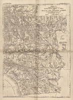
General map showing approximate location of better known springs and wells in the Mohave and adjacent deserts, southeastern California and southwestern Nevada, circa 1908-1909
Date
Description
224. Map is plate 1 from the U.S. Geological Survey Water-supply paper 224.
Image

