Search the Special Collections and Archives Portal
Search Results
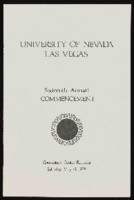
University of Nevada, Las Vegas (UNLV) 16th commencement program
Date
1979-05-19
Archival Collection
Description
Commencement program from University of Nevada, Las Vegas Commencement Programs and Graduation Lists (UA-00115).
Text
Wilhelm, Bruce Lee, 1933-
Bruce Lee Wilhelm was born on September 13, 1933, in Akron, Ohio. Bruce married his first wife Elizabeth on August 11, 1957, and they were married until her death on April 20, 1990. Bruce married his second wife, Mary, on March 15, 1992. Bruce had three children: John, Chad, and Lee.
Wilhelm was enlisted in the United States Marine Corps from 1953 to 1954.
Person

Interview with Katie McWilliam, July 9, 2004
Date
2004-07-09
Archival Collection
Description
Narrator affiliation: Consultant for Seismological Issues
Access note: Audio temporarily sealed
Access note: Audio temporarily sealed
Text
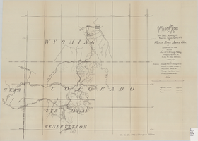
Wagon road from Fort Steele, Wyoming via Rawlins, Union Pacific R.R. to White River Agency, Colo., via cut-off from old road, October, 1878
Date
1878-10
Description
38 x 52 cm. "Topography: Colorado & Utah: U.S. Geolog. Survey Territories, Prof. Hayden in charge and from personal notes & obs--Wyoming: maps, General Land Office & personal notes." "October, 1878." Includes other wagon roads, trails, rivers, ranches, Indian agencies and military reservation. "Drawn by Lieutenant C. A. H. McCauley, 3rd Artillery." "Sen. Ex. Doc. No. 62, 45th Congress 3rd Sess." Original publisher: GPO, Series: Sen. ex. doc no. 62, 45th Congress, 3rd session.
Image
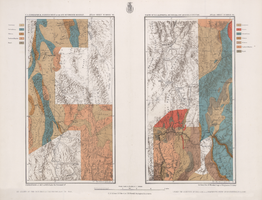
Maps of geographical surveys of parts of California, southeastern Nevada, Arizona and southwestern Utah, made under the command of George M. Wheeler, 1872-1873
Date
1872 to 1873
Description
At top of plate: 'U.S. geographical surveys west of the one-hundredth meridian. Parts of California, S.E. Nevada, Arizona & S.W. Utah.' At bottom of plate: 'Expeditions of 1872 & 1873, under the command of 1st Lieut. Geo. M. Wheeler, Corps of Engineers, U.S. Army.' 'G. K. Gilbert, A. R. Marvine, E. E. Howell, geological assistants.' 'By order of The Honorable The Secretary of War, under the direction of Brig. Gen. A. A. Humphries, Chief of Engineers, U.S. Army.' Published by Government Printing Office. 2 map sections on 1 sheet. Scale: 1 inch to 8 miles.
Image
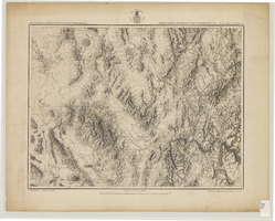
Map showing parts of eastern and southeastern Nevada and southwestern Utah, circa 1873
Date
1869
1872 to 1873
Archival Collection
Description
Scale 1:506,880. 1 in. to 8 miles (W 117°30--W 114°45/N 37°20--N 40°00). Relief shown by hachures and spot heights. At top left: 'Explorations & surveys west of the one-hundredth meridian.' At top right: 'Parts of Eastern & Southeastern Nevada & Southwestern Utah. Atlas sheet number 66.' At bottom left: 'Expeditions of 1869, 1872 & 1873.' At bottom right: ' 1st Lieut. Geo. M. Wheeler, Corps of Engineers, com'd'g.' Seal of the War Department, Corps of Engineers, U.S. Army at top center of map. Originally published as part of the geological atlas which is an appendix to the Survey's Report upon United States geographical surveys west of the one hundredth meridian, published in 1876?
Image
Pagination
Refine my results
Content Type
Creator or Contributor
Subject
Archival Collection
Digital Project
Resource Type
Year
Material Type
Place
Language
Records Classification


