Search the Special Collections and Archives Portal

Search Results

Display    Results Per Page
Displaying results 221 - 230 of 626940

Map of Las Vegas Rancho, Lincoln County, Nevada, September 15, 1904

Date

1904-09-15

Description

'Being part of Township 20 S. R.61 E. MT. D. B.&.M, containing 1864.49 acres. Division engineer's office at the front, AMB, September 15th, 1904. A.L. Jones, Division Engineer. Surveyed by W.G. Watson, Assistant Engineer. Dwg. 30296.' Includes traverse table. Shows land owned by the San Pedro, Los Angeles & Salt Lake Railroad, its right of way and the right of way for the Las Vegas & Tonopah Railroad, land owned by the Las Vegas Land & Water Company including Clark's Las Vegas Townsite with the Bucks Addition and the Wardie Addition, and parcels sold from the Las Vegas Land & Water Company land. Scale: [1:9,600]. 1 in. to 800 feet. Library's copies 1 and 4 have land owned by the San Pedro, Los Angeles & Salt Lake Railroad hand-colored in pink and the rest of the Las Vegas Rancho not owned by the Las Vegas Land & Water Company hand-colored in green. Library's copy 2 has buildings of the Stewart Ranch drawn in and labeled in pencil. Library's copy 3 has addition and subtraction problems in pencil on the verso. Library's copy 4 has "Original purchase--1864.49 acres R.R.C. + L.V.L. + W. Co.--In colors." written in pencil on the verso followed by "(1904)" in red pencil. Library's copy 4 also has label on verson made of brown paper with "No 5 Las Vegas Ranch being part township ( 1904)" typed on it.

Image

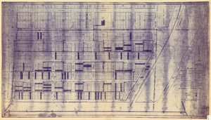
Plat of original townsite of Las Vegas, Clark County, Nevada, November 25, 1927

Date

1927-11-25

Description

Subtitle: 'On N 1/2 of SW 1/4 section 27, T 20 S, R 61 E, M.D. Mer. showing cast iron water mains. Including location and distances of valves, fire hydrants, house connections, etc. Constructed by Las Vegas Land &Water Company. Construction completed Nov. 25-1927. Cast iron pipe system throughout made at Provo, Utah by Pacific States Cast Iron Pipe Company. R.N. Clark, Construction Engineer. Map and survey made by J.T. McWilliams, C.E., Las Vegas, Nev.' Map shows ownership of some parcels of land. Scale [ca. 1:960]. 1 inch to 80 feet. Blueline print. Plat map.

Image

Map of Las Vegas, Nevada, July 1947

Date

1947

Description

'Prepared by Porter & White Agency. Typography by Marc Wilkinson.' 'Travel-Aid. A Ballinger publication, copyright, July 1947.' Panel title: 'Las Vegas, Nevada invites you! : see Boulder Dam, Lake Mead.' Includes information on Las Vegas, business directory, advertisements and directory of service clubs. Advertisements, map of Boulder City, and map of southern Nevada area with advertisements on verso. Ballinger Publishing Company.

Text

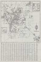
Map of Las Vegas and vicinity, Nevada, circa 1957-1961

Date

1957 to 1961

Description

70 x 68 cm. on sheet 106 x 71 cm. Includes indexes. Includes Nellis Air Force Base, Henderson, and inset maps of Boulder City, Nevada, and Las Vegas's geographical location in the Southwest. "H-654-32" on the lower right-hand corner. Page 2 contains a photograph of the Fremont Street in Downtown Las Vegas, featuring the Golden Nugget Gambling Hall and the Horseshoe Casino. Page 3 outlines local and regional attractions, as well as population information. Original publisher: R. L. Polk.

Image

T-Shirt Color: Navy Blue; Front: Chicago Police, State seal; Handwritten Text: The Following Officers From 006 Salute Our Heroes From 9-11-01: Bill Sweeney, Laura Sweeney, J. Wynn, J. Wilson, J. Hickey, J. Almonza, A. Cercers, Mile, Franco, K. Keel,, approximately 2001-2012

Level of Description

File

Archival Collection

New York-New York Hotel and Casino 9-11 Heroes Tribute Collection
To request this item in person:
Collection Number: MS-00459
Collection Name: New York-New York Hotel and Casino 9-11 Heroes Tribute Collection
Box/Folder: Box 377

Archival Component
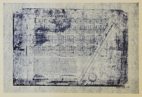
Original plat, townsite of Las Vegas, Lincoln Co., Nevada, January 13, 1905

Date

1905-01-13

Description

Subtitle: 'Embracing the N. 1/2 of S.W. 1/4 Sec. 27 Township 20S. R.61E. Mt. Diablo Meridian.' 'Book 1, page 17A" handwritten in lower right corner. Signed by Henry Lee, County Recorder, Lincoln County Nevada. 'Filed at request of J.T. Williams, January 13th A.D. 1905.' Backwards handwriting on right side. Map has a Lincoln County seal on the bottom near the center. In the dedication J.T. McWilliams states that he has surveyed and platted the townsite of Las Vegas subject to the right of way of the San Pedro, Los Angeles and Salt Lake Railroad Company. He signed the dedication on Jan. 13, 1905, and it was signed by witnesses Scale [ca. 1:2,520? 1 inch to approx. 210 feet?]. Copy of a blueline print.

Image
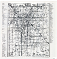
Map of greater Las Vegas area, 1964-1965

Date

1964 to 1965

Description

Scale [ca. 1:51,322] ; 1 map ; 55 x 43 cm ; Panel title: Front Boy's official 1964-1965 edition street map : detailed guide of North Las Vegas, Las Vegas, Paradise Valley and vicinity ; Originally folded to: 29 x 12 cm ; Relief shown by spot heights ; Includes notes and quotations ; Includes indexes; Alt Title: Front Boy's official 1964-1965 edition street map : detailed guide of North Las Vegas, Las Vegas, Paradise Valley and vicinity ; Alt Title: Official 1964-1965 edition street map Front Boy Service Co..

Text

Map of the Las Vegas Strip, 1953

Date

1953

Description

Scale [ca. 1:9,600. 1 in. to approx. 800 ft.] ; 1 map : col. ; 57 x 29 cm ; Cadastral map ; Campbell Realty Company.

Image

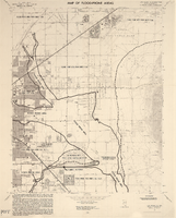
Las Vegas NE quadrangle

Date

1973

Description

'Prepared by the U.S. Department of the Interior, Geological Survey, in cooperation with the U.S. Department of Housing and Urban Development, Federal Insurance Administration. 1973.'

Image

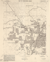
Las Vegas NW quadrangle

Date

1973

Description

'Prepared by the U.S. Department of the Interior, Geological Survey, in cooperation with the U.S. Department of Housing and Urban Development, Federal Insurance Administration. 1973.'

Image