
Search the Special Collections and Archives Portal

Search Results

Display    Results Per Page
Displaying results 141 - 150 of 582448

Architectural drawings of residential home in Las Vegas, Nevada, exterior elevations, 1955

Date

1955

Description

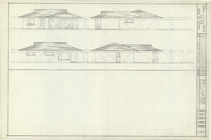
Drawings of exterior elevations of a ranch-style residential home in the Greater Las Vegas development in Las Vegas, Nevada. Handwritten underneath drawings at right: "Plan 14C - Elev. C."
Site Name: Greater Las Vegas

Architecture Period: Mid-Century Modernist

Image

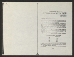
Law School Study for the University of Nevada, Las Vegas from Southwestern-Nevada Law Review

Date

1978

Description

A loose paper version of "Law School Study for the University of Nevada, Las Vegas" by Willard H. Pedrick and Lorne Seidman, photocopied from the Southwestern-Nevada Law Review, Volume 10, 1978. From the University of Nevada, Las Vegas William S. Boyd School of Law Records (UA-00048).

Text

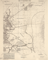
Redevelopment plan map for downtown Las Vegas, Nevada, November 18, 1987

Date

1987-11-18

Description

Scale [ca. 1:12,000. 1 inch equals approx. 1,000 feet]. 1 map ; on sheet 61 x 46 cm. "Nov. 18, 1987." "All land use designations on this map are to be interpreted in conformance with the community profiles component of the Las Vegas General Plan." City of Las Vegas?.

Image

Newspaper headline: “Thyroid Disease, Cancer Follows Micronesia Fallout.”: photographic slide

Date

1977-06-12

Description

From the Sister Klaryta Antoszewska Photograph Collection (PH-00352). Written on the newspaper: "Honolulu Adv./S.B June 12, 1977". 

Image

Map of the Las Vegas Strip, 1953

Date

1953

Description

Scale [ca. 1:9,600. 1 in. to approx. 800 ft.] ; 1 map : col. ; 57 x 29 cm ; Cadastral map ; Campbell Realty Company.

Image

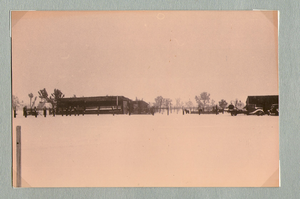
Ranch buildings following snowstorm at Walking Box Ranch, Nevada: photographic print

Date

1880 to 1979

Description

Bell Family Scrapbook scanning, Set 4, proofed 11.04.2010 Snow at the Walking Box Ranch. Various ranch buildings in the background

Image

Map of Las Vegas Rancho, Lincoln County, Nevada, September 15, 1904

Date

1904-09-15

Description

'Being part of Township 20 S. R.61 E. MT. D. B.&.M, containing 1864.49 acres. Division engineer's office at the front, AMB, September 15th, 1904. A.L. Jones, Division Engineer. Surveyed by W.G. Watson, Assistant Engineer. Dwg. 30296.' Includes traverse table. Shows land owned by the San Pedro, Los Angeles & Salt Lake Railroad, its right of way and the right of way for the Las Vegas & Tonopah Railroad, land owned by the Las Vegas Land & Water Company including Clark's Las Vegas Townsite with the Bucks Addition and the Wardie Addition, and parcels sold from the Las Vegas Land & Water Company land. Scale: [1:9,600]. 1 in. to 800 feet. Library's copies 1 and 4 have land owned by the San Pedro, Los Angeles & Salt Lake Railroad hand-colored in pink and the rest of the Las Vegas Rancho not owned by the Las Vegas Land & Water Company hand-colored in green. Library's copy 2 has buildings of the Stewart Ranch drawn in and labeled in pencil. Library's copy 3 has addition and subtraction problems in pencil on the verso. Library's copy 4 has "Original purchase--1864.49 acres R.R.C. + L.V.L. + W. Co.--In colors." written in pencil on the verso followed by "(1904)" in red pencil. Library's copy 4 also has label on verson made of brown paper with "No 5 Las Vegas Ranch being part township ( 1904)" typed on it.

Image

Map of Las Vegas Valley showing artesian wells, circa 1920

Date

1918 to 1922

Description

Scale not given ; 1 map ; 66 x 55 cm ; Blueline print ; Cadastral map ; Includes township and range grid ; Includes quotations McWilliams?

Image

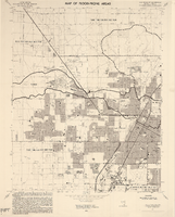
Las Vegas NE quadrangle

Date

1973

Description

'Prepared by the U.S. Department of the Interior, Geological Survey, in cooperation with the U.S. Department of Housing and Urban Development, Federal Insurance Administration. 1973.'

Image

Las Vegas NW quadrangle

Date

1973

Description

'Prepared by the U.S. Department of the Interior, Geological Survey, in cooperation with the U.S. Department of Housing and Urban Development, Federal Insurance Administration. 1973.'

Image