Search Results
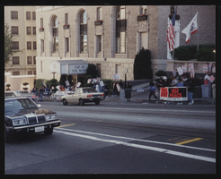
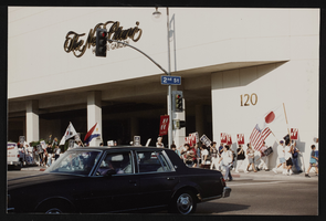
Sheraton Grand rally, Culinary Union, Los Angeles (Calif.), 1994 (folder 1 of 3), image 10
Date
1994
Description
Arrangement note: Series I. Demonstrations, Subseries I.B. Other Demonstrations and Strikes
Image
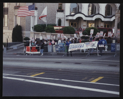
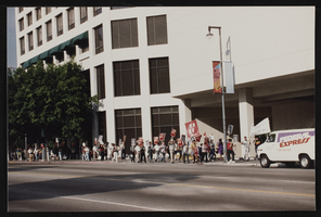
Sheraton Grand rally, Culinary Union, Los Angeles (Calif.), 1994 (folder 1 of 3), image 11
Date
1994
Description
Arrangement note: Series I. Demonstrations, Subseries I.B. Other Demonstrations and Strikes
Image
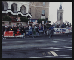
Sheraton Grand rally, Culinary Union, Los Angeles (Calif.), 1994 (folder 1 of 3), image 12
Date
1994
Description
Arrangement note: Series I. Demonstrations, Subseries I.B. Other Demonstrations and Strikes
Image
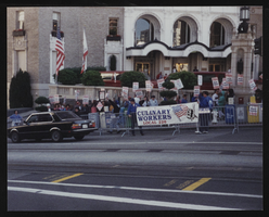
Sheraton Grand rally, Culinary Union, Los Angeles (Calif.), 1994 (folder 1 of 3), image 13
Date
1994
Description
Arrangement note: Series I. Demonstrations, Subseries I.B. Other Demonstrations and Strikes
Image
Sheraton Grand rally, Culinary Union, Los Angeles (Calif.), 1994 (folder 1 of 3), image 14
Date
1994
Description
Arrangement note: Series I. Demonstrations, Subseries I.B. Other Demonstrations and Strikes
Image
Sheraton Grand rally, Culinary Union, Los Angeles (Calif.), 1994 (folder 1 of 3), image 15
Date
1994
Description
Arrangement note: Series I. Demonstrations, Subseries I.B. Other Demonstrations and Strikes
Image

Sheraton Grand rally, Culinary Union, Los Angeles (Calif.), 1994 (folder 1 of 3), image 16
Date
1994
Description
Arrangement note: Series I. Demonstrations, Subseries I.B. Other Demonstrations and Strikes
Image
Sheraton Grand rally, Culinary Union, Los Angeles (Calif.), 1994 (folder 1 of 3), image 17
Date
1994
Description
Arrangement note: Series I. Demonstrations, Subseries I.B. Other Demonstrations and Strikes
Image
Sheraton Grand rally, Culinary Union, Los Angeles (Calif.), 1994 (folder 1 of 3), image 18
Date
1994
Description
Arrangement note: Series I. Demonstrations, Subseries I.B. Other Demonstrations and Strikes
Image

Sheraton Grand rally, Culinary Union, Los Angeles (Calif.), 1994 (folder 1 of 3), image 19
Date
1994
Description
Arrangement note: Series I. Demonstrations, Subseries I.B. Other Demonstrations and Strikes
Image