Search Results
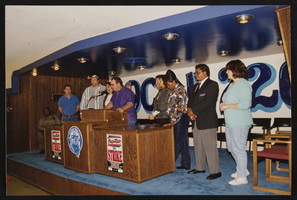
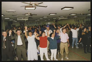
Frontier Victory announcement, Culinary Union, Las Vegas (Nev.), 1997 October 28 (folder 5 of 6), image 43
Date
1997-10-28
Description
Arrangement note: Series I. Demonstrations, Subseries I.A. Frontier Strike
Image
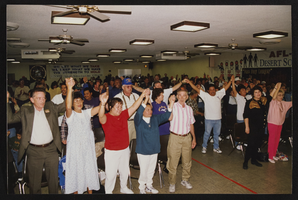
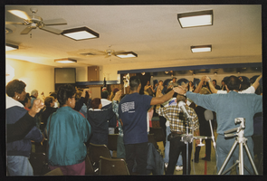
Frontier Victory announcement, Culinary Union, Las Vegas (Nev.), 1997 October 28 (folder 5 of 6), image 44
Date
1997-10-28
Description
Arrangement note: Series I. Demonstrations, Subseries I.A. Frontier Strike
Image
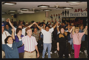
Frontier Victory announcement, Culinary Union, Las Vegas (Nev.), 1997 October 28 (folder 5 of 6), image 45
Date
1997-10-28
Description
Arrangement note: Series I. Demonstrations, Subseries I.A. Frontier Strike
Image
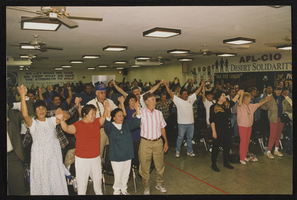
Frontier Victory announcement, Culinary Union, Las Vegas (Nev.), 1997 October 28 (folder 5 of 6), image 46
Date
1997-10-28
Description
Arrangement note: Series I. Demonstrations, Subseries I.A. Frontier Strike
Image
Frontier Victory announcement, Culinary Union, Las Vegas (Nev.), 1997 October 28 (folder 5 of 6), image 47
Date
1997-10-28
Description
Arrangement note: Series I. Demonstrations, Subseries I.A. Frontier Strike
Image

Frontier Victory announcement, Culinary Union, Las Vegas (Nev.), 1997 October 28 (folder 5 of 6), image 48
Date
1997-10-28
Description
Arrangement note: Series I. Demonstrations, Subseries I.A. Frontier Strike
Image

Frontier Victory announcement, Culinary Union, Las Vegas (Nev.), 1997 October 28 (folder 5 of 6), image 49
Date
1997-10-28
Description
Arrangement note: Series I. Demonstrations, Subseries I.A. Frontier Strike
Image

Frontier Victory announcement, Culinary Union, Las Vegas (Nev.), 1997 October 28 (folder 5 of 6), image 50
Date
1997-10-28
Description
Arrangement note: Series I. Demonstrations, Subseries I.A. Frontier Strike
Image

Frontier Victory announcement, Culinary Union, Las Vegas (Nev.), 1997 October 28 (folder 5 of 6), image 51
Date
1997-10-28
Description
Arrangement note: Series I. Demonstrations, Subseries I.A. Frontier Strike
Image
Frontier Victory announcement, Culinary Union, Las Vegas (Nev.), 1997 October 28 (folder 5 of 6), image 52
Date
1997-10-28
Description
Arrangement note: Series I. Demonstrations, Subseries I.A. Frontier Strike
Image