Search Results
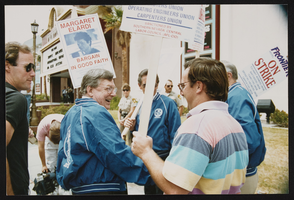
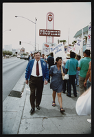
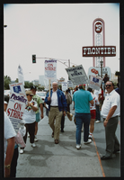
Frontier Strike: Jesse Jackson, Culinary Union, Las Vegas (Nev.), 1992 April 21 (folder 5 of 13), image 15
Date
1992-04-21
Description
Arrangement note: Series I. Demonstrations, Subseries I.A. Frontier Strike
Image
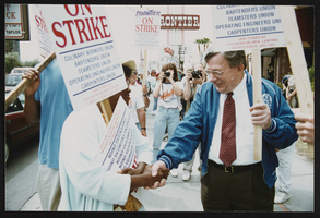
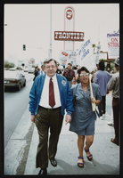
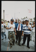
Frontier Strike: Jesse Jackson, Culinary Union, Las Vegas (Nev.), 1992 April 21 (folder 5 of 13), image 16
Date
1992-04-21
Description
Arrangement note: Series I. Demonstrations, Subseries I.A. Frontier Strike
Image
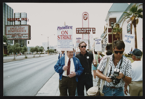
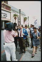
Frontier Strike: Jesse Jackson, Culinary Union, Las Vegas (Nev.), 1992 April 21 (folder 5 of 13), image 17
Date
1992-04-21
Description
Arrangement note: Series I. Demonstrations, Subseries I.A. Frontier Strike
Image
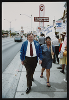
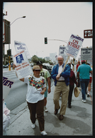
Frontier Strike: Jesse Jackson, Culinary Union, Las Vegas (Nev.), 1992 April 21 (folder 5 of 13), image 18
Date
1992-04-21
Description
Arrangement note: Series I. Demonstrations, Subseries I.A. Frontier Strike
Image
Frontier Strike: Jesse Jackson, Culinary Union, Las Vegas (Nev.), 1992 April 21 (folder 5 of 13), image 19
Date
1992-04-21
Description
Arrangement note: Series I. Demonstrations, Subseries I.A. Frontier Strike
Image
Frontier Strike: Jesse Jackson, Culinary Union, Las Vegas (Nev.), 1992 April 21 (folder 5 of 13), image 20
Date
1992-04-21
Description
Arrangement note: Series I. Demonstrations, Subseries I.A. Frontier Strike
Image
Frontier Strike: Jesse Jackson, Culinary Union, Las Vegas (Nev.), 1992 April 21 (folder 5 of 13), image 21
Date
1992-04-21
Description
Arrangement note: Series I. Demonstrations, Subseries I.A. Frontier Strike
Image
Frontier Strike: Jesse Jackson, Culinary Union, Las Vegas (Nev.), 1992 April 21 (folder 5 of 13), image 22
Date
1992-04-21
Description
Arrangement note: Series I. Demonstrations, Subseries I.A. Frontier Strike
Image
Frontier Strike: Jesse Jackson, Culinary Union, Las Vegas (Nev.), 1992 April 21 (folder 5 of 13), image 23
Date
1992-04-21
Description
Arrangement note: Series I. Demonstrations, Subseries I.A. Frontier Strike
Image
Frontier Strike: Jesse Jackson, Culinary Union, Las Vegas (Nev.), 1992 April 21 (folder 5 of 13), image 24
Date
1992-04-21
Description
Arrangement note: Series I. Demonstrations, Subseries I.A. Frontier Strike
Image