Search Results

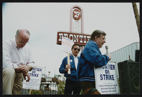
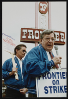
Frontier Strike: Jesse Jackson, Culinary Union, Las Vegas (Nev.), 1992 April 21 (folder 4 of 13), image 56
Date
1992-04-21
Description
Arrangement note: Series I. Demonstrations, Subseries I.A. Frontier Strike
Image
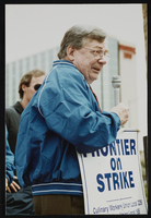
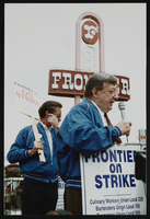
Frontier Strike: Jesse Jackson, Culinary Union, Las Vegas (Nev.), 1992 April 21 (folder 4 of 13), image 57
Date
1992-04-21
Description
Arrangement note: Series I. Demonstrations, Subseries I.A. Frontier Strike
Image

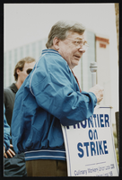
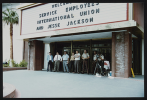
Frontier Strike: Jesse Jackson, Culinary Union, Las Vegas (Nev.), 1992 April 21 (folder 4 of 13), image 58
Date
1992-04-21
Description
Arrangement note: Series I. Demonstrations, Subseries I.A. Frontier Strike
Image
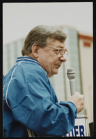
Frontier Strike: Jesse Jackson, Culinary Union, Las Vegas (Nev.), 1992 April 21 (folder 4 of 13), image 59
Date
1992-04-21
Description
Arrangement note: Series I. Demonstrations, Subseries I.A. Frontier Strike
Image
Frontier Strike: Jesse Jackson, Culinary Union, Las Vegas (Nev.), 1992 April 21 (folder 4 of 13), image 60
Date
1992-04-21
Description
Arrangement note: Series I. Demonstrations, Subseries I.A. Frontier Strike
Image
Frontier Strike: Jesse Jackson, Culinary Union, Las Vegas (Nev.), 1992 April 21 (folder 4 of 13), image 61
Date
1992-04-21
Description
Arrangement note: Series I. Demonstrations, Subseries I.A. Frontier Strike
Image

Frontier Strike: Jesse Jackson, Culinary Union, Las Vegas (Nev.), 1992 April 21 (folder 4 of 13), image 62
Date
1992-04-21
Description
Arrangement note: Series I. Demonstrations, Subseries I.A. Frontier Strike
Image
Frontier Strike: Jesse Jackson, Culinary Union, Las Vegas (Nev.), 1992 April 21 (folder 4 of 13), image 63
Date
1992-04-21
Description
Arrangement note: Series I. Demonstrations, Subseries I.A. Frontier Strike
Image
Frontier Strike: Jesse Jackson, Culinary Union, Las Vegas (Nev.), 1992 April 21 (folder 4 of 13), image 64
Date
1992-04-21
Description
Arrangement note: Series I. Demonstrations, Subseries I.A. Frontier Strike
Image
Frontier Strike: Jesse Jackson, Culinary Union, Las Vegas (Nev.), 1992 April 21 (folder 4 of 13), image 65
Date
1992-04-21
Description
Arrangement note: Series I. Demonstrations, Subseries I.A. Frontier Strike
Image