Search Results
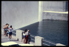
People along the observation deck watch water spill over the Arizona spillway, looking southeast at Hoover Dam, Arizona: photographic slide
Date
Archival Collection
Description
Image
People along the observation deck watch water spill over the Arizona spillway, looking southeast at Hoover Dam, Arizona: photographic slide
Date
Archival Collection
Description
Image
People along the observation deck watch water spill over the Arizona spillway, looking southeast at Hoover Dam, Arizona: photographic slide
Date
Archival Collection
Description
Image
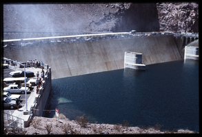
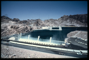
Water reaches the high point as automobiles and pedestrians cross the top of the dam as seen from above the Arizona spillway, looking southwest towards the Nevada side at Hoover Dam, Arizona: photographic slide
Date
Archival Collection
Description
Image
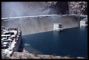
Recreational vehicles and automobiles sit in the parking lot as seen from above the Arizona spillway, looking south at Hoover Dam, Arizona: photographic slide
Date
Archival Collection
Description
Image
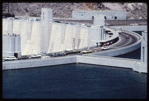
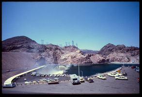
Water crashes over the Arizona spillway from a filled Lake Mead basin as seen from a lookout above the dam, looking west towards the Nevada side at Hoover Dam, Arizona: photographic slide
Date
Archival Collection
Description
Image
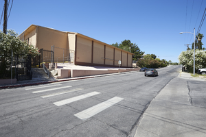
Photograph of Kolod Recreation and Youth Center at former Temple Beth Sholom building on Oakey Blvd., Las Vegas, Nevada, May 19, 2016
Date
Archival Collection
Description
The Ruby Kolod Recreation Center and Danny Kolod Youth Center at the former Temple Beth Sholom and Jewish Community Center facility at 1600 E. Oakey Boulevard now serve as recreation space for the Innovations International Charter School of Nevada. Kolod donated money to build the temple's Danny Kolod Youth Center in memory of his son, who was killed in a boating accident. Ruby Kolod died on August 11, 1967.
Image
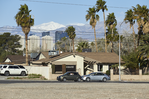
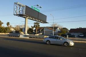
The Las Vegas Strip skyline seen above a single family home converted for business use on Eastern Avenue, looking west in Las Vegas, Nevada: digital photograph
Date
Archival Collection
Description
From the UNLV University Libraries Photographs of the Development of the Las Vegas Valley, Nevada (PH-00394). Part of the collection documents the entire 19 mile length of the north/south Eastern Avenue / Civic Center Drive alignment. This photograph was captured in the section of Eastern Avenue between Tropicana Avenue and Russell Road.
Image
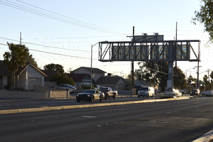
A directional sign for McCarran International Airport sits adjacent to single family homes on Russell Road near Eastern Avenue, looking north-west in Las Vegas, Nevada: digital photograph
Date
Archival Collection
Description
From the UNLV University Libraries Photographs of the Development of the Las Vegas Valley, Nevada (PH-00394). Part of the collection documents the entire 19 mile length of the north/south Eastern Avenue / Civic Center Drive alignment. This photograph was captured in the section of Eastern Avenue between Russell and Sunset Roads.
Image
A directional sign for McCarran International Airport sits adjacent to single family homes along Russell Road near Eastern Avenue, looking east-northeast in Las Vegas, Nevada: digital photograph
Date
Archival Collection
Description
From the UNLV University Libraries Photographs of the Development of the Las Vegas Valley, Nevada (PH-00394). Part of the collection documents the entire 19 mile length of the north/south Eastern Avenue / Civic Center Drive alignment. This photograph was captured in the section of Eastern Avenue between Russell and Sunset Roads.
Image