Search the Special Collections and Archives Portal
Search Results
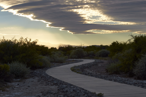
Clark County Wetlands Park, Clark County, Nevada: digital photograph
Date
2016-07-09
Archival Collection
Description
Late afternoon clouds provide a dramatic view for walkers along a path at the Clark County Wetlands Park.
Image
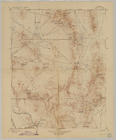
Map of Nevada, Nye County, Kawich Quadrangle, Nye County (Nev.), 1908
Date
1908
Description
Map of Nevada, Nye County, Kawich Quadrangle, Nye County (Nev.), 1908
Image
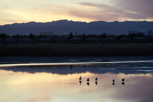
Clark County Wetlands Park, Clark County, Nevada: digital photograph
Date
2016-03-12
Archival Collection
Description
The sunset is reflected in a settling ponds at the Clark County Wetlands Park. The park is home to many different species of waterfowl and other animals finding respite in the desert.
Image
Public Improvements - Clark County - County Road, 1931
Level of Description
File
Archival Collection
Union Pacific Railroad Collection
To request this item in person:
Collection Number: MS-00397
Collection Name: Union Pacific Railroad Collection
Box/Folder: Box 69
Collection Name: Union Pacific Railroad Collection
Box/Folder: Box 69
Archival Component
Lease to Board of County Commissioners Lincoln County, 1914
Level of Description
File
Archival Collection
Union Pacific Railroad Collection
To request this item in person:
Collection Number: MS-00397
Collection Name: Union Pacific Railroad Collection
Box/Folder: Box 92
Collection Name: Union Pacific Railroad Collection
Box/Folder: Box 92
Archival Component
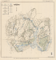
Generalized hydrogeologic map of lower Moapa-Lake Mead area, Clark County, Nevada, 1968
Date
1968
Description
'Hydrogeology by F.E. Rush, 1968. Geology adapted from Longwell and others 1965.' In lower left corner: ' Base: U.S. Geological Survey 1:250,000 topographic series; Las Vegas (1954).' At top of map: 'United States Department of the Interior, Geological Survey. Department of Conservation and Natural Resources, State of Nevada.' Relief shown by contoursIncludes township and range lines. Scale 1:250,000 (W 115°00´--W 114°15´/N 36°30´--N 36°15´). Series: Water resources-reconnaissance series report . Originally published as plate 1 in Water-resources appraisal of the lower Moapa-Lake Mead area, Clark County, Nevada / by F. Eugene Rush, published by State of Nevada Dept. of Conservation and Natural Resources in 1968 in volume 50 of the serial Water resources-reconnaissance series report.
Image
Pagination
Refine my results
Content Type
Creator or Contributor
Subject
Archival Collection
Digital Project
Resource Type
Year
Material Type
Place
Language
Records Classification

