Search Results

Geologic map of the Plutonium Valley quadrangle, Nye and Lincoln counties, Nevada, 1965
Date
Description
Image

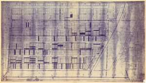
Plat showing original townsite and subdivisions, Las Vegas, Lincoln County, Nevada, May 1905
Date
Description
Land owned by the San Pedro, Los Angeles & Salt Lake Railroad is outlined. Scale: [ca. 1:12,000]. 1 inch = 1,000 feet. Cadastral map. Blueline print. Additional copy available in the J.T. McWilliams manuscript collection
Image
Plat of original townsite of Las Vegas, Clark County, Nevada, November 25, 1927
Date
Description
Subtitle: 'On N 1/2 of SW 1/4 section 27, T 20 S, R 61 E, M.D. Mer. showing cast iron water mains. Including location and distances of valves, fire hydrants, house connections, etc. Constructed by Las Vegas Land &Water Company. Construction completed Nov. 25-1927. Cast iron pipe system throughout made at Provo, Utah by Pacific States Cast Iron Pipe Company. R.N. Clark, Construction Engineer. Map and survey made by J.T. McWilliams, C.E., Las Vegas, Nev.' Map shows ownership of some parcels of land. Scale [ca. 1:960]. 1 inch to 80 feet. Blueline print. Plat map.
Image

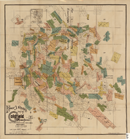
Map of Lincoln County, Nevada and Mohave County, Arizona area, 1892
Date
Description
polyconic proj. (W 115°--W 114°/N 37°--N 35°).
Image
Nye County county office remodel, 1991
Level of Description
Archival Collection
Collection Name: Alton Dean Jensen Architectural Records
Box/Folder: Box 267
Archival Component
County Accomplishments. Contains, by County, HWC accomplishments
Level of Description
Archival Collection
Collection Name: Howard Cannon Papers
Box/Folder: Box 05 (Las Vegas files)
Archival Component
Map of the Goldfield Mining District, Nye and Esmeralda Counties, Nevada, 1905
Date
Description
Image
Clark County, Nevada School District Annual Reports
Identifier
Abstract
The Clark County, Nevada School District Annual Reports include reports created by the Clark County School District from 1970 to 1980. Reports for the school years of 1972 to 1973, 1973 to 1974, and 1976 to 1977 are not included.
Archival Collection
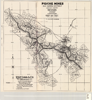
Map of Pioche mines, Ely Mining District, Lincoln County, Nevada, 1909
Date
Description
Image
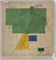
Map of Las Vegas and vicinity, Clark County, Nevada, April 15, 1951
Date
Description
Image