Search Results
Preservation Association of Clark County Photograph Collection
Identifier
PH-00060
Abstract
The Preservation Association of Clark County Photograph Collection consists of five black-and-white photographic prints and negatives from approximately 1980. Images depict scenes from the preservation process of the Old Las Vegas Mormon Fort as well as images of members of the Preservation Association of Clark County, University of Nevada, Las Vegas Libraries, and Nevada government officials in Las Vegas, Nevada.
Archival Collection
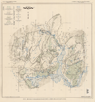
Generalized hydrogeologic map of lower Moapa-Lake Mead area, Clark County, Nevada, 1968
Date
1968
Description
'Hydrogeology by F.E. Rush, 1968. Geology adapted from Longwell and others 1965.' In lower left corner: ' Base: U.S. Geological Survey 1:250,000 topographic series; Las Vegas (1954).' At top of map: 'United States Department of the Interior, Geological Survey. Department of Conservation and Natural Resources, State of Nevada.' Relief shown by contoursIncludes township and range lines. Scale 1:250,000 (W 115°00´--W 114°15´/N 36°30´--N 36°15´). Series: Water resources-reconnaissance series report . Originally published as plate 1 in Water-resources appraisal of the lower Moapa-Lake Mead area, Clark County, Nevada / by F. Eugene Rush, published by State of Nevada Dept. of Conservation and Natural Resources in 1968 in volume 50 of the serial Water resources-reconnaissance series report.
Image

Las Vegas Valley map, Clark County, Nevada, June 1958
Date
1958
Description
'Compiled 1954. First revision - June 1958.' 'Area extends 9 miles north, 11 miles south, and 3 miles east, 3 miles west city limits of Las Vegas.' Original publisher: Campbell Realty. Scale [ca. 1:60,000. 1 in. to approx. 5,000 ft.]. Cadastral map. Hand-drawn red line around some sections on map.
Image

Map of Lincoln County, Nevada and Mohave County, Arizona area, 1892
Date
1892
Description
'Henry Gannett, chief geographer ; A.H. Thompson, geographer in charge ; triangulation by H.M. Wilson ; topography by H.M. Wilson and Powell survey.' 'Edition of Mar. 1892, reprinted 1929.' Handwritten legend on right-side margin of map. Original publisher: Dept. of the Interior, U.S. Geological Survey. Scale 1:250,000polyconic proj. (W 115°--W 114°/N 37°--N 35°).
Image
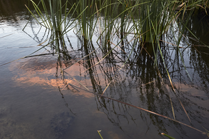
Clark County Wetlands Park, Clark County, Nevada: digital photograph
Date
2016-07-09
Archival Collection
Description
The sunset is reflected in a settling pond at the Clark County Wetlands Park.
Image
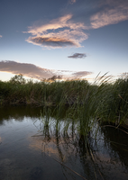
Clark County Wetlands Park, Clark County, Nevada: digital photograph
Date
2016-07-09
Archival Collection
Description
The sunset is reflected in a settling pond at the Clark County Wetlands Park.
Image
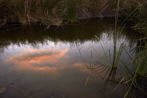
Clark County Wetlands Park, Clark County, Nevada: digital photograph
Date
2016-07-09
Archival Collection
Description
The sunset is reflected in a settling pond at the Clark County Wetlands Park.
Image
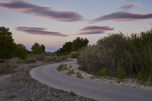
Clark County Wetlands Park, Clark County, Nevada: digital photograph
Date
2016-07-09
Archival Collection
Description
Dusk falls over a pathway through the Clark County Wetlands Park.
Image
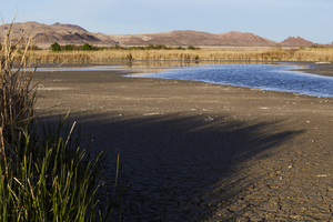
Clark County Wetlands Park, Clark County, Nevada: digital photograph
Date
2016-03-12
Archival Collection
Description
Water at the Clark County Wetlands Park rises and falls in settling ponds.
Image