Search the Special Collections and Archives Portal
Search Results

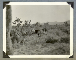
Cow grazing in the desert on Walking Box Ranch property: photograph
Date
Archival Collection
Description
From the Walking Box Ranch Photograph Collection (PH-00346)
Image
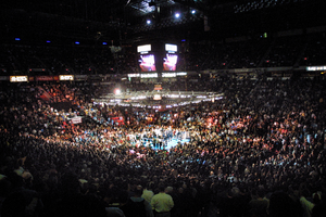
Las Vegas boxing matches (possible selects): 35mm slides, approximately 1977 to 1985
Level of Description
Archival Collection
Collection Name: Hank deLespinasse Photographs
Box/Folder: Box 23
Archival Component

Set of photographs of boxing lessons at Chuck's gym
Date
Archival Collection
Description
Photographer's notations: Chuck's Gym. Some photos from this set were previously online with the digital ID pho022082.
Image

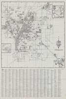
Map of Las Vegas and vicinity, Nevada, circa 1957-1961
Date
Description
Image

Four views of cowboys in action at Walking Box Ranch: photograph
Date
Archival Collection
Description
From the Walking Box Ranch Photograph Collection (PH-00346)
Image
Square orange ballot box with black lettering "Wally Cox Ballot Box"
Level of Description
Archival Collection
Collection Name: Dunes Hotel and Casino Records
Box/Folder: No Container 00
Archival Component

Original plat, townsite of Las Vegas, Lincoln Co., Nevada, January 13, 1905
Date
Description
Subtitle: 'Embracing the N. 1/2 of S.W. 1/4 Sec. 27 Township 20S. R.61E. Mt. Diablo Meridian.' 'Book 1, page 17A" handwritten in lower right corner. Signed by Henry Lee, County Recorder, Lincoln County Nevada. 'Filed at request of J.T. Williams, January 13th A.D. 1905.' Backwards handwriting on right side. Map has a Lincoln County seal on the bottom near the center. In the dedication J.T. McWilliams states that he has surveyed and platted the townsite of Las Vegas subject to the right of way of the San Pedro, Los Angeles and Salt Lake Railroad Company. He signed the dedication on Jan. 13, 1905, and it was signed by witnesses Scale [ca. 1:2,520? 1 inch to approx. 210 feet?]. Copy of a blueline print.
Image

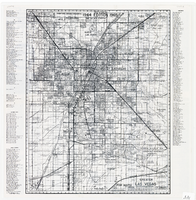
Map of greater Las Vegas area, 1964-1965
Date
Description
Text

