Search Results
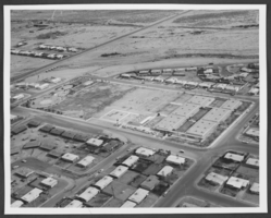
Aerial photograph of Lincoln Elementary School, North Las Vegas, Nevada, circa 1960s-1970s
Date
Archival Collection
Description
Image
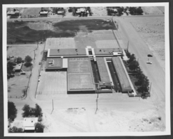
Aerial photograph of Mountain View Elementary School, Las Vegas, Nevada, circa 1960s-1970s
Date
Archival Collection
Description
Image
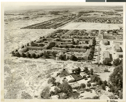
Aerial photograph of apartments and residential neighborhoods in North Las Vegas, Nevada, June 5, 1973
Date
Archival Collection
Description
Image
Aerial b-roll footage of Las Vegas during the day: video
Date
Archival Collection
Description
B-roll aerial footage of Las Vegas area including the Landmark, Tropicana, Sands, Desert Inn, El Rancho, and Sahara hotels. Original media U-matic S, color, aspect ratio 4 x 3, frame size 720 x 486. From The Production Company Audiovisual Collection (MS-00930) -- Digitized audiovisual material file.
Moving Image

Slide of an aerial view of the Las Vegas Strip, circa 1990s-2000s
Date
Archival Collection
Description
Image
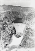
Film transparency of an aerial view of open valves, Hoover Dam, circa mid 1930s
Date
Archival Collection
Description
Image
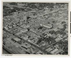
Aerial photograph of downtown Las Vegas with comments, Las Vegas (Nev.), June 23, 1962
Date
Archival Collection
Description
Mixed Content
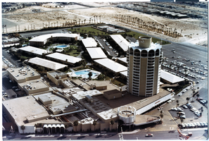
Aerial photograph of the Sands Hotel tower (Las Vegas), after 1967
Date
Archival Collection
Description
Aerial view of the Sands after the addition of the tower.
Site Name: Sands Hotel
Address: 3355 Las Vegas Boulevard South
Image
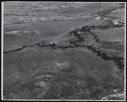
Aerial photograph of Binion's Ranch in Jordan, Montana, approximately 1940 to 1985
Date
Archival Collection
Description
Aerial view of Binion Ranch and surrounding land near Jordan, Montana. Stamp on back of photo: " Carp's Photo P. O. Box 1773 Billings, Montana".
Image
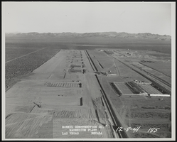
Photograph of aerial view of construction progress, Henderson (Nev.), December 8, 1941
Date
Archival Collection
Description
Image