Skip to main content
Main navigation
Finding Aids
Digital Projects
African American Experience in Las Vegas
Charles Saladino Landscape Architecture Collection
Culinary Union Photograph Collection
Dino at the Sands
Dreaming the Skyline
Entertainment
Historic Landscape of Nevada
Hoover Dam
Jamey Stillings
Menus: The Art of Dining
Nevada Test Site Oral History Project
Newspapers
Oral Histories Collection
Photograph Collections
Rebel Yell Newspaper
Showgirls
Southern Nevada: The Boomtown Years 1900-1925
Southern Nevada History in Maps
Southern Nevada Jewish Heritage Project
UNLV CSUN Records
Union Pacific Railroad Water Documents
Walking Box Ranch Collection
Welcome Home Howard
About
Request Images
Help
Provide Feedback
Special Collections Home
Search the Special Collections and Archives Portal
Search
Search
Breadcrumb
Home
Search Results
Display
List
Grid
Results Per Page
10
25
50
100
250
aerial
Displaying results 61 - 70 of 4006
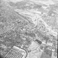
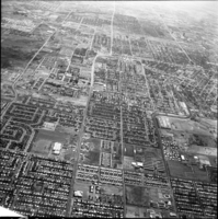
Aerial, February 28, 1973
View
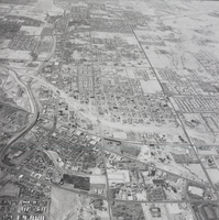
Aerial, February 28, 1973
View
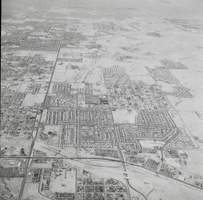
Aerial, February 28, 1973
View
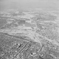
Aerial, February 28, 1973
View
Aerial, February 28, 1973
View
Aerial, February 28, 1973
View
Aerial, February 28, 1973
View
Aerial, February 28, 1973
View
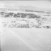
Aerial views, Image 01
View
Aerial view, Image 02
View
Pagination
First page
« First
Previous page
‹ Previous
…
Page
3
Page
4
Page
5
Page
6
Current page
7
Page
8
Page
9
Page
10
Page
11
…
Next page
Next ›
Last page
Last »
Go
Refine my results
Content Type
Digital Object (2553)
Archival Component (1387)
Archival Collection (43)
Organization (7)
Person (7)
Subject (6)
Webpage (3)
Creator or Contributor
Stillings, Jamey (400)
Mayes, Aaron, 1968- (94)
University of Nevada, Las Vegas. Libraries. Special Collections and Archives (91)
Standard Oil Company of California (43)
Rozaire, Charles E., 1927- (42)
United States. Bureau of Reclamation (35)
Mitchell, Jay Florian (28)
Martin, James (27)
Davis, Glenn A. (24)
The Production Company (21)
United States. Army Map Service (17)
Las Vegas News Bureau (16)
Cava, Greg, 1958- (15)
Boulder Dam Service Bureau (14)
Geological Survey (U.S.) (13)
Mancuso, Maggie, 1941- (11)
Davis, W. A. (10)
McNeil Construction Co. (10)
Stardust Resort and Casino (Las Vegas, Nev.) (8)
Union Pacific Railroad Company (8)
Myers, Harry, 1915-1982 (7)
Stan Davis Air Photo (7)
Elder, Henry (6)
Las Vegas Rotary Club (6)
Palevsky, Mary (6)
Ralph Roske Oral History Project on Early Las Vegas (6)
University of Nevada, Las Vegas. Creative Services (6)
Welsh, John Elliott (6)
Daily news (New York, N.Y. : 1920) (5)
Frashers Inc. (5)
KLAS-TV (Television station : Las Vegas, Nev.) (5)
KTNV-TV (Television station : Las Vegas, Nev.) (5)
Oakes Photo (5)
Stupak, Bob (5)
United States. Army Air Forces (5)
Basic Magnesium, Inc. (4)
Binion, Jack, 1937- (4)
Boulder Canyon Project (U.S.) (4)
Hertzog, E. E. (4)
Jones, Kenneth Charles "Ken", 1913-2000 (4)
KVBC Channel 3 (Television station : Las Vegas, Nev.) (4)
Las Vegas News Agency (4)
Press Association Inc. (4)
Spence Air Photos (Firm) (4)
United States. Bureau of Reclamation. Lower Colorado Region (4)
White, Claytee D. (4)
Boyer Early Las Vegas Oral History Project (3)
Buck, Joe (3)
English, Don C., 1913-1986 (3)
Oakes, L. J. (3)
Pitchford, G. I. (3)
Russell, William S. (3)
Ulloms (photo studio) (3)
UNLV TV (3)
Wide World Photos, Inc. (3)
Applegate, Shannon (2)
Bañuelos-Benitez, Laurents, 1994- (2)
Becker, Suzanne (2)
Belknap, William, Jr. (2)
Boulder City Library Oral History Project (2)
Burke, Howard (2)
Cooper Aerial Surveys (2)
Desert Sea News Bureau (2)
Fairchild Aerial Surveys, inc. (2)
Hughes Electronics Corporation (2)
Latinx Voices of Southern Nevada Oral History Project (2)
Lees, Dave (2)
Martin Stern Jr., A. I. A. Architect & Associates (2)
McBride, Dennis (2)
Nevada. Department of Highways (2)
Nevada Historical Society (2)
Pacific Coast Borax Company (2)
Sierra Nevada Museum of Art (2)
U.S. Atomic Energy Commission (2)
U.S. Coast and Geodetic Survey (2)
United States. Army. Air Corps (2)
United States. Army. Corps of Engineers (2)
Abbott, Jerry (1)
Acme Newspicture (New York, N. Y.) (1)
Adams, "Flash" (1)
Allen Photographers, Inc. (1)
Alpha Kappa Alpha Sorority. Theta Theta Omega Chapter (Las Vegas, Nev.) (1)
Barrett, Christine Khan, 1955- (1)
Bottega International Maps (1)
Brothers, Earl (1)
Building Las Vegas Oral History Project (1)
Cahlan, John F. (1)
Campbell, J.W. (1)
Campbell, John Frederick, 1943- (1)
Cannaday, Joshua (1)
Childers, Michael (1)
Clifton Family (1)
Cox, Norma (1)
Dawson, Marshall Mack (1)
Del E. Webb Corporation (1)
Desert Supply Company (1)
Donovan, Diane (1)
Earl, H. Wayne (1)
E G & G, Inc. (1)
English, Donald E., 1926- (1)
Evans, Stefani (1)
Fee, Linh, 1974- (1)
Fujii, Valerie (1)
Grier, Dorothy Jean (1)
Haft, Raymond (1)
Hernández, Monserrath (1)
Hess, Harrie Fox, Dr., 1929- (1)
Hodges, James Arnold (1)
Horden, Elinor, 1930-2014 (1)
Kaufmann, Oliver Wilhelm, 1918-2010 (1)
Kemple, Clifford, 1909-1985 (1)
Kinsley, John E. (1)
Knop, Siegfried (1)
Landiscor Aerial Photo, Inc. (1)
Las Vegas Convention/Visitors Authority (1)
Las Vegas Land and Water Company (1)
Las Vegas Review-Journal (1)
Lawrence, Duane L. (1)
Leavitt, Joan (1)
Lopez, Elsa (1)
Malmberg, Glenn T. (Glenn Thomas), 1925- (1)
Malmin, John (1)
Marnell Corrao Associates (1)
McCreary, John (1)
Mc Fadden Air Photos (1)
Meston's Travels (1)
Miachle, Robert (1)
Miller, Chelsea S. (1)
Mitrani, Frank, 1931- (1)
Morrison, Lillian B., 1908-2008 (1)
Nelson, Brad, 1944- (1)
Neon Museum (Las Vegas, Nev.) (1)
Nulty, John (1)
Paluzzi, Bob, 1920-2006 (1)
Patrick, Elizabeth Nelson, 1924-2001 (1)
Reflections: the Las Vegas Asian American and Pacific Islander Oral History Project (1)
Rissman & Rissman Associates (1)
Romero, Fernando, 1946- (1)
Ronshaugen, Stephen Craig (1)
Rudma Picture Company (1)
Sahara Boardwalk Corporation (1)
Saladino, Charles (1)
Salgado, Sergio (Sergio Checko), 1970- (1)
Screeton, Ed (1)
Spurlock, Janice (1)
Spurlock, Robert (1)
Starks, R. Marsh (1)
Tabach, Barbara (1)
Tavenner, Jack (1)
Taylor, F. Andrew (1)
Taylor, Rachel Stuczinksa, 1937- (1)
Thomson, David B. (David Browning), 1927- (1)
Tilman, Lee R., 1913-2007 (1)
Travel Graphics International (Firm) (1)
Ullom, G. L. (1)
Union Pacific Railroad Photo (1)
United Aerial Survey (1)
United States. Bureau of Land Management (1)
United States. Department of the Interior (1)
United States. Supreme Court (1)
University of Nevada, Las Vegas (1)
University of Nevada, Las Vegas. Libraries (1)
Weslowski, James W. (1)
West Charleston Neighborhoods: an Oral History Project of Ward 1 (1)
Wickliffe, Sydney (1)
Wilkes, Roscoe (1)
Wilkins, Paul (1)
Winchell, Cecilia (1)
Wyman, Richard Vaughn, 1927- (1)
Zavattaro, Peter (1937) (1)
Subject
Aerial views (695)
aerial photographs (540)
Mountains (449)
Deserts (364)
Solar energy (294)
Dams (287)
Canyons (274)
Buildings (245)
Ponds (235)
Cities and towns (226)
Electric power production (205)
Electric power-plants (202)
Electric power systems (202)
Salt (202)
United States, Department of Energy (202)
Reservoirs (198)
Rivers (164)
Roads (152)
Streets (133)
Dwellings (122)
Airplanes (121)
Casinos (115)
Automobiles (114)
Water (109)
Towers (97)
Hotels (93)
Electric utilities (89)
Bridges (88)
Universities & colleges (86)
Building (82)
Trees (79)
Dams--Design and construction (65)
Lakes (60)
Construction equipment (54)
Housing development (54)
Labor camps (53)
Airplanes--Wings (52)
Cityscapes (52)
Bridges--Design and construction (46)
Landscapes (46)
Resorts (45)
Dirt roads (40)
Views (40)
Arch bridges (39)
Arch bridges--Design and construction (37)
Parking lots (37)
People (36)
Real estate development (35)
Aerial tramways (32)
photographs (32)
Spillways (32)
Electric lines (30)
Schools (29)
Flood dams and reservoirs--Design and construction (28)
Hughes HK-1 Hercules (Flying Boat) (28)
Mines and mineral resources (27)
Seaplanes (26)
School facilities (24)
Bodies of water (22)
Central business districts (22)
Lockheed L-14 Super Electra (22)
Tunnels (22)
Soils (21)
Neighborhoods (18)
Swimming pools (18)
Airports (17)
Boats and boating (17)
Cartography (17)
Airplanes, Military (16)
Building sites (16)
Power plants (16)
Construction workers (15)
Railroads (15)
Windows (15)
Bellagio Hotel and Casino (14)
Harbors (14)
Nevada--Las Vegas (14)
Ranches (14)
Rocks (14)
University of Nevada, Las Vegas (14)
Valleys (14)
Air bases (13)
Cranes, derricks, etc. (13)
Crowds (13)
Hotels (public accommodations) (13)
Hotels--Design and construction (13)
Islands (13)
Las Vegas (Nev.) (13)
Nuclear weapons -- Testing (13)
Clouds (12)
Factories (12)
Girders (12)
Lawns (12)
National security (12)
Facades (11)
Men (11)
Trucks (11)
Clark County (Nev.) (10)
Electric signs (10)
Las Vegas Strip (Nev.) (10)
Roads--Design and construction (10)
Buildings, Temporary (9)
City and town life (9)
Mine buildings (9)
Molasky Group of Companies (Las Vegas, Nev.) (9)
Nevada--Las Vegas Region (9)
Oral history (9)
Palmer & Krisel (9)
United States. Air Force. Thunderbirds (9)
Convention facilities (8)
Hoover Dam (Ariz. and Nev.) (8)
Industrial buildings (8)
Military air shows (8)
Moving of buildings, bridges, etc. (8)
Runways (Aeronautics) (8)
Warehouses (8)
Automobile driving (7)
Casinos (Architecture) (7)
Construction industry (7)
Fire fighters (7)
Flight (7)
Flood dams and reservoirs--Recreational use (7)
Golf courses (7)
Housing (7)
Land use (7)
Las Vegas (Nev.) -- History (7)
Nuclear fallout (7)
Piers (7)
Postcards (7)
Signs and signboards (7)
Stunt driving (7)
Airport terminals (6)
Basic Magnesium, Inc. (6)
Businesspeople (6)
Clubs (6)
Floods (6)
Magnesium industry and trade (6)
maps (documents) (6)
Mining camps (6)
Newsletters (6)
Panoramic views (6)
Shrubs (6)
Stadiums (6)
Apartment houses (5)
Architecture (5)
Baseball fields (5)
Beaches (5)
Constellation (Transport planes) (5)
Construction projects (5)
Dedications (5)
Excavation (5)
Golf (5)
Grasses (5)
Land subdivision (5)
Mills and mill-work (5)
Nevada (5)
Night (5)
Plaques, plaquettes (5)
Police (5)
Railroad tracks (5)
Ranch houses (5)
Sewage (5)
Sewage disposal, Rural (5)
Sewage disposal, Rural--Environmental aspects (5)
Skyscrapers (5)
Snow (5)
Accidents--Prevention (4)
Air pilots, Military (4)
Antinuclear movement (4)
Atomic bomb -- Testing (4)
Fires (4)
Gambling (4)
Henderson (Nev.) (4)
Homes (4)
Industries (4)
Marquees (4)
Metallurgical furnace industry (4)
Mining districts (4)
Neon sculpture (4)
Neon signs (4)
Nevada National Security Site (Nev.) (4)
Night photography (4)
Parking garages (4)
Railroad cars (4)
Ships (4)
Soldiers (4)
Southern Nevada (4)
Stratosphere Hotel and Casino (1996-2020) (4)
Synagogues (4)
Vegas World Hotel Casino (4)
Aerial ladders (3)
Architectural drawings (visual works) (3)
Boundaries (3)
College buildings (3)
Dams--Location (3)
Ephemeral streams (3)
Farms (3)
Floods--Cleaning (3)
Fountains (3)
High schools (3)
Hoisting machinery (3)
Hughes H-1 Racer (3)
Hughes XF-11 (3)
Journalists (3)
Kiel Ranch (3)
Landforms (3)
Libraries (3)
Lifting and carrying (3)
Logos (Symbols) (3)
Machinery (3)
McCarran International Airport (Nev.) (3)
Medals (3)
Mining machinery (3)
Mobile homes (3)
Mountain resorts (3)
Parades (3)
Pipelines (3)
Prefabricated houses (3)
Racetracks (Horse racing) (3)
Reflection (Optics) (3)
Restaurants (3)
Sahara Hotel and Casino (3)
Scaffolding (3)
Scientists (3)
Signs and symbols (3)
Suspension bridges (3)
Synagogue architecture (3)
Trailers (3)
Transportation (3)
Urban renewal (3)
Women (3)
World War, 1939-1945 (3)
Accidents (2)
Advertising (2)
Airplanes--Equipment and supplies (2)
Airships (2)
Animal experimentation (2)
Archaeology (2)
Arden, Donn, 1917-1994 (2)
Arizona (2)
Bluebell Girls (Dance company) (2)
Blue Diamond (Nev.) (2)
Blue Diamond Mine (Clark County, Nev.) (2)
Boulder City (Nev.) (2)
Boulders (2)
Buses (2)
Business enterprises (2)
California (2)
California, Southern (2)
Casinos -- Marketing (2)
Chemical industry (2)
Church buildings (2)
Circus Circus Hotel-Casino (Las Vegas, Nevada) (2)
Cisterns (2)
Cities and towns--Growth (2)
Civil engineering (2)
Colorado River (Colo.-Mexico) (2)
Compass (2)
Dancers (2)
Dunes Hotel and Casino (Las Vegas, Nev.) (2)
Elementary schools (2)
Employees (2)
Entertainers (2)
Excavations (Archaeology) (2)
Express highways (2)
Fairs (2)
Families (2)
Fire departments (2)
Fire engines (2)
Folies-Bergère (2)
Fortification (2)
Fuel tanks (2)
Health care (2)
Housing, Rural (2)
Huts (2)
Implements, utensils, etc. (2)
Industrial water supply (2)
Irrigation (2)
Kennecott Copper Corporation. Western Mining Division (2)
Kiel Ranch (North Las Vegas, Nev.) (2)
Kleven, Cherina, 1958- (2)
Labor unions (2)
Landscape photography (2)
Las Vegas Fire & Rescue (2)
Latter Day Saints (2)
Law (2)
Lost architecture (2)
Lumber (2)
Master plans (orthographic projections) (2)
Mead, Lake (Ariz. and Nev.) (2)
Mexican Americans (2)
MGM Grand Hotel (1973-1986) (2)
Military dependents--Housing (2)
Miners (2)
Mining (2)
Mining districts -- Nevada (2)
Moulin Rouge (Hotel-Casino : Las Vegas, Nev.) (2)
Nellis Air Force Base (Nev.) (2)
Nevada--Las Vegas Metropolitan Area (2)
Nuclear power (2)
Nye County (Nev.) (2)
Oil well drilling rigs (2)
Parachutes (2)
Performances (2)
Photograph albums (2)
Politicians (2)
Politics and government (2)
Radioactive substances (2)
Railroad rails (2)
Railroad repair shops (2)
Railroad yards (2)
Real estate agents (2)
Real estate development -- Nevada -- Las Vegas (2)
Real property (2)
Recreation (2)
Restaurant management -- Las Vegas (Nev.) (2)
Rooms (2)
Sailboats (2)
School buildings (2)
Shopping centers (2)
Shopping malls (2)
Silverbird Hotel and Casino (Las Vegas, Nev.) (2)
Single-family dwellings (2)
Smoke (2)
Stardust Resort and Casino (Las Vegas, Nev.) (2)
Surveying (2)
Tanks (2)
Temple Beth Sholom (Las Vegas, Nev.) (2)
Tents (2)
Tourists (2)
United States--Death Valley Region (2)
United States--Lake Mead (2)
United States--Mojave Desert (2)
Universities and colleges--Design and construction (2)
University of Nevada, Las Vegas. School of Architecture (2)
Urban Planning -- Las Vegas -- Nevada (2)
Water-supply--Sources (2)
Water conservation (2)
Water utilities (2)
World War (1939-1945) (2)
Writing (2)
Accounting (1)
Administrative agencies (1)
Advertising -- Lotteries (1)
Aerialists (1)
Aerial surveys (1)
Agriculture (1)
Air conditioning -- Equipment and supplies (1)
Airlines (1)
Airplane factories (1)
Airplanes--Cockpits (1)
Airplanes--Turbine-propeller engines (1)
Air shows (1)
Air travel (1)
Alamo Airways (1)
Amusement parks (1)
Animals (1)
Arboretums (1)
Arenas (sports buildings) (1)
Arizona--Mohave County (1)
Arizona Charlie's Hotel and Casino (1)
Arms control (1)
Art (1)
Artists (1)
Arts and Humanities -- Las Vegas (1)
Aviation (1)
Banks and banking (1)
Barracks (1)
Bars (1)
Bars (Drinking establishments) (1)
Bartenders (1)
Bats (1)
Biography (1)
black-and-white photographs (1)
black-and-white transparencies (1)
Boardwalks (1)
Boundary stones (1)
Bow and arrow (1)
Boxing (1)
Boyd, Sam A., 1910-1993 (1)
Boyd, William S., 1931- (1)
Boyd Gaming Corporation (1)
Budget (1)
Budget process (1)
Buildings, Reinforced concrete (1)
Businesspeople--Nevada--Las Vegas (1)
Cabanas (1)
Caesars Palace Las Vegas Hotel and Casino (1)
Camping (1)
Camps (1)
Cancer (1)
Capitols--Buildings (1)
Casino de Paris (Las Vegas, Nev.)--History (1)
Casinos -- Nevada -- Las Vegas (1)
Central Telephone Company. Southern Nevada Division (1)
Chabad of Southern Nevada (1)
Charts, diagrams, etc. (1)
Children of immigrants (1)
Circus (1)
Circus performers (1)
Cities and towns -- Growth (1)
City and town life--Henderson (Nev.) (1)
City halls (1)
City planning (1)
City planning--Growth (1)
Clark's Las Vegas Townsite (1)
Clark County (Nev.)--History (1)
Clark County (Nev.) -- Politics and government (1)
Clark County Community College (1)
Cliffs (1)
Climbing (1)
College buildings--Design and construction (1)
College environment (1)
College graduates (1)
College student government (1)
College students (1)
Commencement ceremonies (1)
Communication (1)
Community colleges (1)
Concentration camps (1)
Concrete (1)
Congregation Ner Tamid (Henderson, Nev.) (1)
Conservation -- Nevada (1)
Construction (1)
contact sheets (1)
Cooper Aerial Survey Company (1)
Cornero, Tony (Anthony Stralla), 1899-1995 (1)
Costume (1)
Courthouses (1)
Courtyards (1)
Cows (1)
Culinary Workers Union Local 226 (1)
Cultural relations (1)
Dam construction -- Nevada -- Boulder City -- 1930-1940 (1)
Dance (1)
Death Valley (Calif. and Nev.) (1)
Delta Dart (Jet fighter plane) (1)
Democratic Party of Nevada (1)
Dental hygienists (1)
Desert Inn Hotel and Casino (1)
Desert National Wildlife Range (Nev.) (1)
Desert plants (1)
digital photographs (1)
Discrimination (1)
Documents (1)
Domes (1)
Dormitories (1)
Drilling (1)
Drug abuse--Prevention (1)
Drug traffic (1)
Dunes Hotel and Country Club (1)
Dyer, Elmer (1)
Education (1)
Education--Finance (1)
Educational law and legislation (1)
Educators (1)
Electric apparatus and appliances (1)
Electric lines--Poles and towers (1)
Elevators (1)
Elks (Fraternal order) (1)
Employment (1)
Engineering (1)
Entertainment (1)
Environmental impact statements (1)
Environmentalism (1)
Environmental protection (1)
Erickson, Stanley R. (1)
Explosions (1)
Fences (1)
Field crops (1)
Fire chiefs (1)
Flamingo Hotel and Casino (1)
Fletcher, Ron, 1921-2011 (1)
Flood control (1)
Flood control channels (1)
Flowers (1)
Food service (1)
Football (1)
Frederiksen, Sigurd, 1881-1965 (1)
Fremont Street (Las Vegas, Nev.) (1)
Frontier Hotel and Casino (1)
Gabbs Valley (Nev.) (1)
Gambling--Nevada (1)
Gambling -- United States (1)
Geology (1)
Geology -- Nevada (1)
Goldfield (Nev.) (1)
Gold mines and mining (1)
Governors -- Election (1)
Groundwater (1)
Groundwater flow--Measurement (1)
Hall, James, 1900-1940 (1)
Harlow, Jean, 1911-1937 (1)
Helldorado Parade (Las Vegas, Nev.) (1)
Henderson (Nev.) (1)
Historic sites (1)
Holography--Materials (1)
Hoover Dam (Ariz. and Nev.)--Design and construction (1)
Horses (1)
Hospitality industry (1)
Hotel management (1)
Hotels--Nevada--Las Vegas (1)
Housing -- Nevada -- Las Vegas (1)
Hughes, Howard, 1905-1976 (1)
Hughes Flying-boat (Seaplane) (1)
Icehouses (1)
Ice industry (1)
Interstate Highway System (1)
Interviews (1)
Jewish children in the Holocaust (1)
Jewish families (1)
Jews -- Las Vegas (Nev.) -- History (1)
Judges (1)
Kelly, Margaret, 1910-2004 (1)
Laboratories (1)
Ladders (1)
Lake Mead National Recreation Area (Ariz. and Nev.) (1)
Landmark Hotel and Casino (Las Vegas, Nev.) (1)
Landmarks--Nevada--Las Vegas (1)
Landscape design (1)
Land settlement--Maps (1)
Land titles -- Nevada -- Clark County (1)
Land use, Rural (1)
Las Vegas Jaycees (1)
Las Vegas Mormon Fort (Nev.) (1)
Latinxs (1)
Lawyers (1)
LeBoutillier, Oliver Colin, 1894-1983 (1)
Lido de Paris (Las Vegas, Nev.) (1)
Lightning (1)
Lime industry (1)
Limekilns (1)
Lincoln County (Nev.) (1)
Lockheed XFP-80 Shooting Star (1)
Locomotives (1)
Lodging-houses (1)
Log cabins (1)
Lyon, Ben, 1901-1979 (1)
Magnesium industry and trade (1)
Magnesium industry and trade--Environmental aspects (1)
Mandalay Resort Group (1)
Mansions (1)
Marinas (1)
McWilliams' Original Las Vegas Townsite (1)
Medical screening (1)
Meetings (1)
MGM Grand Las Vegas (1)
Mike O'Callaghan-Pat Tillman Memorial Bridge (Ariz. and Nev.) (1)
Military bases (1)
Military service (1)
Minerals (1)
Mines and mineral resources--Equipment and supplies (1)
Miniatures (1)
Mining--Nevada (1)
Mining corporations (1)
Music-halls (1)
Musicians (1)
National parks and reserves (1)
Neon Lighting (1)
Nevada--Clark County (1)
Nevada--Las Vegas Valley (1)
Nevada--Nevada Test Site (1)
Nevada Association of Latin Americans (1)
Nevada Southern University (1)
Newton, Wayne (1)
Nissen, Greta, 1906-1988 (1)
North America -- Colorado River (1)
North Las Vegas (Nev.) (1)
Nuclear excavation (1)
Nuclear power plants (1)
Nuclear reactors (1)
Office buildings (1)
Offices (1)
Office workers (1)
Oral histories (document genres) (1)
Outbuildings (1)
Parks (1)
Passes (Transportation) (1)
Patios (1)
Penstocks (1)
Perry, Harry, 1888-1985 (1)
Petroglyphs (1)
Pharmacy (1)
Photographers (1)
Photography (1)
Pipelines--Design and construction (1)
Plant conservation (1)
Playing cards (1)
Political campaigns (1)
Pollution (1)
Portrait photography (1)
Postage stamps (1)
Postal service (1)
Presentation drawings (proposals) (1)
Prival, Lucien, 1901-1994 (1)
Professional sports (1)
Publicity (1)
Public lands--Nevada (1)
Public utilities (1)
Radiation (1)
Railroad passes (1)
Railroads--Design and construction (1)
Railroad stations (1)
Railroad trains (1)
Rain and rainfall (1)
Ranchers (1)
Recreation areas (1)
Red-light districts (1)
Red Rock Canyon National Conservation Area (Nev.) (1)
Religious buildings (1)
Remote sensing (1)
Renderings (drawings) (1)
Research (1)
Restaurants -- Menus (1)
Richthofen, Manfred, Freiherr von, 1892-1918 (1)
Riesenfeld, Hugo, 1879-1939 (1)
Rites and ceremonies (1)
Riviera Hotel & Casino (Las Vegas Strip, Nev.) (1)
Rockets (Aeronautics) (1)
Rodeos (1)
Rosenthal, Frank, 1928-2008 (1)
Ruined buildings (1)
School boards (1)
School districts--Maps (1)
Scrapbook (1)
Security systems (1)
Service stations--U.S. states (1)
Sewage disposal plants (1)
Sewage disposal plants--Design and construction (1)
Showboat Hotel and Casino (Las Vegas, Nevada) (1)
Showgirls (1)
Showgirls -- Las Vegas (Nev.) (1)
Siegfried and Roy (1)
Signs and symbols--Religious aspects (1)
Sky (1)
Skydiving (1)
Spouses (1)
Stables (1)
Storage facilities (1)
Streets--Maps (1)
Strikes and lockouts (1)
Structural frames (1)
Student Organization of Latinos (1)
Stupak, Bob (1)
Swimmers (1)
Swimming (1)
Tandler, Adolf (1)
Teachers (1)
Telephone lines (1)
Television commercials (1)
Tiles (1)
Tonopah (Nev.) (1)
Tourism (1)
Trenches (1)
Twitty, Conway (1)
U.S. Atomic Energy Commission (1)
Union Pacific Railroad Company (1)
United States--Hoover Dam (1)
United States--Lake Mead Region (1)
United States. Army (1)
United States. Congress. Senate (1)
University and college buildings (1)
University of Nevada, Las Vegas. Architecture Studies Library (1)
University of Nevada, Las Vegas. Marjorie Barrick Museum of Art (1)
University of Nevada, Reno (1)
Valley of Fire State Park (Nev.) (1)
Vietnamese Americans (1)
Von Tobel Family (1)
Waitresses (1)
War memorials (1)
War work (1)
Water--Measurement (1)
Water-supply (1)
Water-supply--Management (1)
Watercolor painting (1)
Waterfronts (1)
Watersheds (1)
Water towers (1)
Water use (1)
West, Dottie, 1932-1991 (1)
Williams, Marvin R. (1)
Workshops (1)
World War, 1914-1918 -- Aerial operations (1)
Xeriscaping (1)
Young Electric Sign Company (1)
Archival Collection
Jamey Stillings Photograph Collection (572)
L. F. Manis Photograph Collection (377)
Basic Magnesium, Inc. (BMI) Records and Photographs (225)
University of Nevada, Las Vegas Creative Services Records (2010s) (209)
University of Nevada, Las Vegas Photograph Collection (120)
Brian Jones Collection of Henderson, Nevada Aerial Photographs (111)
UNLV University Libraries Photographs of the Development of the Las Vegas Valley, Nevada (92)
North Las Vegas Library Photograph Collection on North Las Vegas, Nevada (82)
Charles Rozaire Collection on Tule Springs, Nevada (79)
Howard Hughes Professional and Aeronautical Photographs (76)
Southern Nevada Historical Society Photograph Collection on Basic Magnesium, Inc. (58)
UNLV Libraries Single Item Accession Photograph Collection (54)
CER Corporation Photograph Collection of Henderson, Nevada Aerials (49)
UNLV University Libraries Collection of Aerial Photographs (47)
Bill Willard Photograph Collection (46)
Elbert Edwards Photograph Collection (44)
Culinary Workers Union Local 226 Las Vegas, Nevada Photographs (42)
The Production Company Audiovisual Collection (42)
Darrell Bradford Photograph Collection (40)
Blue Diamond Mine Photograph Collection (38)
Bureau of Reclamation Photographs of the Hoover Dam and Boulder City, Nevada (36)
Fred and Maurine Wilson Photograph Collection (31)
Elton and Madelaine Garrett Photograph and Architectural Drawing Collection (25)
Greg Cava Photograph Collection (25)
Howard Hughes Public Relations Photograph Collection (25)
Stardust Resort and Casino Records (25)
Martin Stern Architectural Records (24)
Mary and Arthur Ackerman Aerial Photograph Collection (22)
Ray Cutright Collection of Winthrop A. Davis Photographs (22)
Army Mapping Service Aerial Photographs of Southern and Western Nevada (21)
Nye County, Nevada Photograph Collection (21)
Sands Hotel Photograph Collection (19)
Jacob E. Von Tobel Photograph Collection (17)
James Cashman Sr. Photograph Collection (17)
Dorothy Dorothy Photograph Collection (16)
Glenn Davis Photograph Collection (16)
Virginia Logan Photograph Collection (16)
Chester R. Longwell Professional Papers (15)
Harrah’s Entertainment, Inc. Photograph Collection (15)
Morgan Sweeney Photograph Collection (15)
United States National Park Service Photograph Collection (15)
Bob Stupak Professional Papers (14)
Howard Hughes Film Production Records (14)
Las Vegas Sun Photographs (14)
Murphy-Farmer Family Photograph Collection (14)
Franklin M. Murphy Photograph Collection (13)
Frank Reynolds Professional Papers (13)
Frank Mitrani Photographs (12)
Nevada Test Site Oral History Project Records (12)
Dennis McBride Photograph Collection (11)
Greg Clemens Photograph Collection (11)
Maggie Mancuso Collection of Film Locations (11)
Nevada Research Labs Photographs (11)
Sherwin "Scoop" Garside Photographs (11)
University of Nevada, Las Vegas Creative Services Records (1970s) (11)
Homer Rissman Architectural Records (10)
Florence Lee Jones Cahlan Photographs (9)
Henderson Public Library Photograph Collection on Henderson, Nevada (9)
Junior League of Las Vegas Photograph Collection (9)
University of Nevada, Las Vegas Creative Services Records (1980s) (9)
Binion’s Horseshoe Club Photograph Collection (8)
David A. Davis Collection of Aerial Photographs (8)
Fayle Family Photographs (8)
Ferron and Bracken Photograph Collection (8)
Gary Guy Wilson Architectural Drawings (8)
Oran K. Gragson Photographs (8)
Sister Klaryta Antoszewska Photograph Collection (8)
Union Pacific Railroad Photographs (8)
Union Plaza Photograph Collection (8)
University of Nevada, Las Vegas Creative Services Records (2000s) (8)
Dunes Hotel Photograph Collection (7)
Frank D. Rathbun Photograph Collection (7)
Mary Kinnear Photograph Collection (7)
MGM Mirage Records on Mandalay Resort Group (7)
Nellis Air Force Base Photograph Collection (7)
Union Pacific Railroad Collection (7)
UNLV TV Audiovisual Collection (7)
Verna Mortensen Photograph Collection (7)
Walking Box Ranch Photograph Collection (7)
Ward Lindquist Photograph Collection on Lake Mead (7)
Fayle Family Papers (6)
Frank E. Partridge Photographs (6)
Nevada Mining Photograph Collection (6)
Ruthe Scott Photographs of Las Vegas, Nevada Hotels and Casinos (6)
Stuart and Flora Mason Photographs (6)
Virginia "Teddy" Fenton Photograph Collection on the Hoover Dam and Boulder City, Nevada (6)
William N. Thompson Photographic Slide Collection (6)
C. A. Earle Rinker Photograph Collection of Goldfield, Nevada (5)
Edith Giles Barcus Family Photograph Collection (5)
Erle A. Taylor Photograph Collection (5)
Historic Building Survey Photograph Collection (5)
James H. Down Jr. Photograph Collection (5)
Jay Sarno Photograph Collection (5)
Archie C. Grant Photograph Collection (4)
Beckley Family Photograph Collection (4)
Billie Mae Polson Photograph Collection (4)
Boulder City 31ers Photograph Collection (4)
Central Nevada Historical Society Photograph Collection (4)
David Donovan Collection on Hydrology and Geology (4)
Gene Hertzog Professional Papers (4)
John W. Steiger Photograph Collection (4)
Lincoln County Museum Photograph Collection (4)
Mary Griffith Toleno Photograph Collection (4)
Victor Kunkel Photograph Collection (4)
Von Tobel Family Papers (4)
William Hillman Shockley Photograph Collection (4)
Young Electric Sign Company (YESCO) Corporate Records (4)
Amie Williams video footage for "Stripped and Teased: Tales from Las Vegas Women" (3)
Blue Diamond Mine Corporate Records (3)
Bob Paluzzi Panoramic Photographs (3)
Donn Arden Photographs (3)
Dow Metals, Incorporated Photograph Collection on Basic Magnesium, Incorporated (3)
Dunes Hotel and Casino Records (3)
James B. McDaniel Architectural Records (3)
John Janney Photograph Collection on Pioche, Nevada (3)
KLVX Steamboats on the Colorado Photograph Collection (3)
Lois Wright Potter and Logan Wright Photograph Collection (3)
Patrick Egger Southern Nevada Real Estate Records (3)
Thomas J. Osborne Photograph Collection (3)
Thomas P. O'Farrell Papers (3)
UNLV University Libraries Collection of Boulder City, Hoover Dam, and Lake Mead National Recreation Area Maps and Brochures (3)
UNLV University Libraries Photographs of the Jewish Community of Southern Nevada (3)
Yucca Mountain Site Characterization Office Collection (3)
"Las Vegas: Snapshots of History" Photograph Collection (2)
Alice Lake-Rockwell and Earl Rockwell Photographs (2)
Antonio Morelli Photograph Collection (2)
Archaeo-Nevada Society Records (2)
Cherina Kleven Papers (2)
Delores Brownhofer Neonis Papers (2)
Elizabeth Nelson Patrick Photograph Collection (2)
H. E. "Hap" Hazard Photograph Collection (2)
H. E. Hazard Real Estate Maps and Photographs (2)
Harold Stocker Photographs (2)
Hazel Baker Denton Photograph Collection (2)
Hotel Last Frontier Photograph Collection (2)
Jeff Gale Photographs (2)
Jeff Van Ee Papers (2)
Las Vegas News Bureau Photograph Collection (2)
Leon Rockwell Photograph Collection (2)
Margaret Kelly Collection on the Bluebell Girls (2)
Marta and Pedro Ortiz Family Papers (2)
Maurine and Fred Wilson and Dr. William S. Park Photograph Albums (2)
Murl Emery Photograph Collection (2)
Neon in Nevada Photograph Collection (2)
North Las Vegas Bicentennial Committee Photographs and Drawings of Kiel Ranch (2)
Peg and George E. Crockett Family Photographs (2)
Six Companies, Inc. Hoover Dam Photograph Collection (2)
Tropicana Hotel and Casino Records (2)
University of Nevada, Las Vegas Creative Services Records (1990s) (2)
UNLV Libraries Collection of UNLV Campus Architectural Drawings and Photographs (2)
Alan Bible Photograph Collection (1)
Alpha Kappa Alpha Sorority, Incorporated, Theta Theta Omega Chapter Records (1)
Art Sloan Collection of Las Vegas Memorabilia (1)
Binion's Horseshoe Casino Records on Poker (1)
Blackstone Edge Studios Collection (1)
Blue Diamond History Committee Collection (1)
Bob Hampton Photographs of Construction Projects in Southern Nevada (1)
Brad Nelson oral history interview (1)
Bruce Turner Collection on Transportation and Water in Southern Nevada (1)
Chester Longwell Photograph Collection (1)
Clifford Kemple oral history interview (1)
Colorado River Commission of Nevada Reference Library Collection (1)
Consolidated Students of the University of Nevada, Las Vegas Records (1)
Delores Brownhofer Neonis Photograph Collection (1)
Denny Lynch Photograph Collection (1)
Domingo Cambeiro Corporation Architectural Records (1)
Doris Hancock Photograph Collection (1)
Edward G. Halligan Photograph Collection on the Nevada Test Site (1)
Elinor Horden oral history interview (1)
Elmo C. Bruner Architectural and Real Estate Appraisal Records (1)
Eric A. Jamieson Photographs (1)
F. Andrew Taylor oral history interview (1)
Fernando Romero oral history interview (1)
Frontier Hotel and Casino Collection (1)
Generations of the Shoah - Nevada Records (1)
Georgia Lewis Photograph Collection (1)
Gilbert Buck Papers (1)
Greenpeace Pacific Southwest Records (1)
Harry Hayden Whiteley Architectural Records (1)
Horden-Graglia Family Photographs (1)
International Food Service Executives Association Records (1)
J. T. McWilliams Photograph Collection (1)
Jack K. Leavitt Collection on Las Vegas Land and Real Estate (1)
James D. O'Brien Photographs (1)
Janice and Robert Spurlock oral history interview (1)
Jay Sarno Papers (1)
JMA Architecture Studio Records (1)
John F. Cahlan oral history interview (1)
John Levy Lighting Productions, Inc. Records (1)
Jon E. Cobain Papers (1)
Kiel Ranch Preservation Committee Records (1)
Lake-Eglington Family Photograph Collection (1)
Las Vegas Land & Water Company Records from the Las Vegas Valley Water District (1)
Lee Tilman oral history interviews (1)
Leslie H. Smith Papers (1)
Lillian Morrison oral history interviews (1)
Linh Fee oral history interview (1)
Marion Brooks Photograph Collection (1)
Marshall L. Wright Photograph Collection (1)
Marshall Mack Dawson oral history interview (1)
May Bradford Photograph Collection (1)
Minnie Perchetti Photograph Collection (1)
Nat Hart Professional Papers (1)
New York-New York Hotel and Casino 9-11 Heroes Tribute Collection (1)
Northern Nevada Neon Photograph Collection (1)
North Las Vegas Library District Collection on Nevada (1)
Pueblo Grande de Nevada Photograph Collection (1)
Ralph Roske Photographs (1)
River Mountains Trail Partnership Records (1)
Robbins Family Photograph Collection (1)
Robert Worts Photographs (1)
Roscoe Wilkes oral history interview (1)
Senator Chic Hecht Political Papers (1)
Sergio "Checko" Salgado oral history interview (1)
Southern Nevada Neon Survey Records (1)
Stanley Mitchell Photograph Collection (1)
Steven Segal Postcard Collection (1)
Sydney Wickliffe oral history interview (1)
The Vista Group Records (1)
Timothy Peters Postcard Collection (1)
U.S. Department of Energy Photograph Collection on the Nevada Test Site (1)
University of Nevada, Las Vegas Commencement Programs and Graduation Lists (1)
University of Nevada, Las Vegas Creative Services Thematic Slides and Prints (1)
University of Nevada, Las Vegas School of Architecture Records (1)
Wayne Earl oral history interview (1)
Yucca Mountain Environmental Safety Reports Collection (1)
Digital Project
Jamey Stillings Collection (401)
Culinary Workers Union Local 226 Photographs (170)
The Historic Landscape of Nevada: Development, Water and Natural Environment (107)
Welcome Home, Howard (78)
Dreaming the Skyline: Resort Architecture and the New Urban Space (70)
Southern Nevada and Las Vegas, History in Maps (20)
Nevada Test Site Oral History Project (12)
African American Experience in Las Vegas (9)
Southern Nevada The Boomtown Years 1900-1925 (8)
Southern Nevada Jewish Heritage Project (4)
Walking Box Ranch Collection (3)
Historic Landscape of Nevada (2)
Neon Survey (2)
Menus: The Art of Dining (1)
UNLV CSUN Minutes (1)
Resource Type
Image (1373)
Still Image (897)
Text (60)
Moving Image (37)
Year
We are sorry, but this facet only works with JavaScript enabled. Please check your browser's settings.
Material Type
photographs (2179)
photographic prints (854)
color photographs (650)
digital photographs (599)
aerial photographs (565)
slides (photographs) (295)
photographic transparencies (170)
black-and-white photographs (129)
transparencies (44)
Kodachrome (TM) (42)
maps (documents) (37)
moving images (37)
panoramic photographs (37)
oral histories (literary works) (28)
transcripts (28)
postcards (25)
landscapes (representations) (17)
contact sheets (11)
negatives (photographs) (6)
newsletters (6)
architectural drawings (visual works) (4)
audiovisual materials (4)
bird's-eye perspectives (3)
books (3)
cards (information artifacts) (3)
ephemera (general object genre) (3)
proposals (3)
clippings (information artifacts) (2)
correspondence (2)
freehand drawings (drawings) (2)
ink washes (2)
presentation drawings (proposals) (2)
press releases (2)
renderings (drawings) (2)
scrapbooks (2)
agendas (administrative records) (1)
biography (general genre) (1)
booklets (1)
diazotypes (copies) (1)
documents (object genre) (1)
government records (1)
laws (legal concept) (1)
line drawings (drawings) (1)
manuals (instructional materials) (1)
measured drawings (1)
mechanical drawings (tool-aided drawings) (1)
minutes (administrative records) (1)
newspaper clippings (1)
notes (documents) (1)
petitions (1)
photograph albums (1)
press kits (1)
programs (documents) (1)
reports (1)
scale drawings (1)
typescripts (1)
Place
Las Vegas (462)
Crescent Dunes Solar Energy Project (202)
Hoover Dam (143)
San Bernardino County (123)
Clark County (119)
Lake Mead (89)
Boulder City (84)
Henderson (71)
Las Vegas Strip (39)
North Las Vegas (35)
Nevada (31)
Blue Diamond Mine (19)
Arizona (14)
Colorado River (14)
Las Vegas Valley (13)
Stateline (13)
Pioche (11)
Mohave County (8)
Black Canyon (6)
Fremont Street (6)
West Las Vegas (Las Vegas, Nev.) (6)
McCarran International Airport (5)
Tonopah (5)
Goldfield (4)
Jordan (4)
Nevada Test Site (4)
Paradise Valley (4)
Reno (4)
Lincoln County (3)
Nellis Air Force Base (3)
Nelson (3)
Pahrump (3)
Paris (3)
University of Nevada-Las Vegas (3)
Yuma (3)
Big Smoky Valley (2)
California (2)
Candelaria Mining District (2)
Cathedral Canyon (2)
Death Valley (2)
Gabbs Valley (2)
Goodsprings (2)
Las Vegas-Henderson-Paradise, NV Metro Area (2)
Mojave Desert (2)
Mount Charleston (2)
Mount Diablo Mine (2)
Nye County (2)
Panaca (2)
Pickhandle Gulch (2)
Round Mountain (2)
Searchlight (2)
Alamo (1)
Anaheim (1)
Aurora (historical) (1)
Beatty (1)
Berlin (1)
Blair (1)
Caliente (1)
Carson City (1)
Delamar (1)
East Las Vegas (1)
Europe (1)
Frenchman Flat (1)
Grand Canyon (1)
Hawaii (1)
Hemenway Wash (1)
Hidden Hills Ranch (1)
Las Vegas Mormon Fort (historical) (1)
Las Vegas Wash (1)
Leadfield (1)
Little Fish Lake Valley (1)
Los Angeles (1)
Manhattan (1)
McGill (1)
Meadow Valley Wash (1)
Pahrump Valley (1)
Pennsylvania (1)
Portland (1)
Rawhide (1)
Red Rock Canyon National Conservation Area (1)
Rhyolite (1)
Saint George (1)
San Diego County (1)
San Francisco (1)
Sentinel Island (1)
Spanish Springs (1)
Sunrise Mountain (1)
Tropicana Hotel and Casino (1)
United States (1)
US Marine Corps War Memorial (1)
Valley of Fire State Park (1)
Language
English (1601)
Records Classification
Photograph collections (32)
Manuscript collections (9)
Oral Histories (1)
University Archives (1)