Search Results
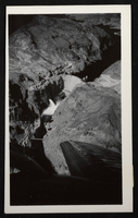
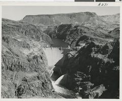
Aerial photograph of Hoover Dam, Colorado River, Black Canyon, circa 1934-1935
Date
Archival Collection
Description
Image
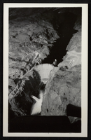
Aerial photograph of Hoover Dam, Colorado River, Black Canyon, circa 1934-1935
Date
Archival Collection
Description
Image
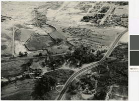
Aerial photograph of Cashman Field and remains of the Mormon Fort, 1960
Date
Archival Collection
Description
Aerial view of Cashman Field and Old Mormon Fort looking southeast.
Image
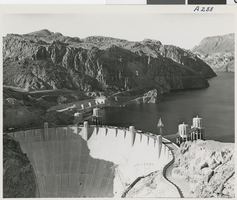
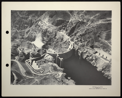
Aerial photograph of the completed dam, Hoover Dam, circa 1930s
Date
Archival Collection
Description
Image
Aerial photograph of Fortification Mountain, Hoover Dam, circa 1930s
Date
Archival Collection
Description
Image

Aerial photograph of Las Vegas looking northwest, late 1950s
Date
Archival Collection
Description
Aerial view of Las Vegas looking northwest. Fremont Street in center, running west.
Transcribed Notes: Notes on photo sleeve: Aerial view of Las Vegas looking west. Fremont Street in center, running west.
Image
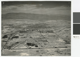
Aerial photograph of Las Vegas looking north, circa 1974
Date
Archival Collection
Description
Aerial view of Las Vegas looking north. The Strip, Paradise Road, and UNLV are visible in the photograph.
Transcribed Notes: Transcribed from photo sleeve: "Aerial view landing strip, Las Vegas Airport, 3-16-70"
Image
Aerial views of the Sahara and Las Vegas Strip (night): video
Date
Archival Collection
Description
B-roll aerial footage taken from a helicopter of the Las Vegas Strip at night; views of Silverbird and the entire Las Vegas Strip, and then mostly 360 views of the Sahara sign advertising the Jerry Lewis telethon. Original media U-matic S, color, aspect ratio 4 x 3, frame size 720 x 486. From The Production Company Audiovisual Collection (MS-00930) -- Digitized audiovisual material file.
Moving Image
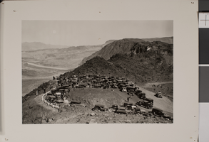
Aerial photograph of the a gathering for a prayer of thanks, circa late 1920s
Date
Archival Collection
Description
Image
Aerial photograph of Hoover Dam, Colorado River, Black Canyon, circa 1934-1935
Date
Archival Collection
Description
Image