Search the Special Collections and Archives Portal
Search Results
H. E. Hazard Real Estate Maps and Photographs
Identifier
MS-00876
Abstract
H. E. Hazard Real Estate Maps and Photographs date from 1960 to 1980 and contain maps and aerial photographs, primarily of Las Vegas and Clark County, Nevada. Compiled by former Nevada legislator and realtor Harry Edward "Hap" Hazard (1894-1971), the collection includes more than sixty plat, topographic, engineering, sales, utility, zoning, and real estate maps, as well as twenty-two black-and-white aerial photographs.
Archival Collection
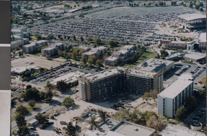
Photograph of University of Nevada, Las Vegas campus, circa early 2000s
Date
2000 to 2005
Archival Collection
Description
An aerial view of the UNLV campus looking northeast. At the top of the image is a portion of the Thomas & Mack parking lot with the Cox Pavilion at top right. Dorms line the parking lot and large building at bottom is a nearly completed new dormitory.
Image
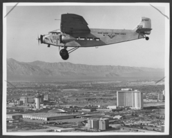
Photograph of a plane, Las Vegas, December 10, 1978
Date
1978-12-10
Archival Collection
Description
An aerial view looking northwest towards Las Vegas Hilton, Landmark Hotel, and Las Vegas Convention Center. Grand Canyon Scenic Airways plane is visible in the sky.
Image
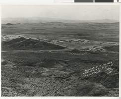
Photograph of Boulder City (Nev.), 1930
Date
1930
Archival Collection
Description
A black and white aerial view of the Hoover Dam Project area before the construction started. Written on the photo is: "Boulder City, Hoover Dam Project near Las Vegas, Nevada. Oakes #175."
Image

Film transparency of Hoover Dam, circa mid 1950s
Date
1953 to 1956
Archival Collection
Description
An image showing an aerial view of Hoover Dam and Lake Mead. Note: Boulder Dam was officially renamed Hoover Dam in 1947.
Image
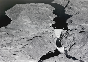
Film transparency of Hoover Dam, circa late 1930s-1950s
Date
1936 to 1959
Archival Collection
Description
An aerial view showing Hoover Dam, Lake Mead, and diversion tunnels in use.
Image
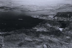
Slide of Lake Mead, circa 1935-1940
Date
1935 to 1940
Archival Collection
Description
An image showing an aerial view of Lake Mead. Hoover Dam in visible on the right side of the image. Note: Boulder Dam was officially renamed Hoover Dam in 1947.
Image
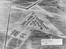
Film transparency of Nellis Air Force Base, Nevada, 1941
Date
1941
Archival Collection
Description
Black and white image showing an aerial view of Nellis Air Force Base, taken from the book, "Epitome of the History of Nellis Air Force Base" by James R. Hinds, found in the Nellis Air Force Base Library (call #: U634.5N3H56). Site Name: Nellis Air Force Base (Nev.)
Image
Pagination
Refine my results
Content Type
Creator or Contributor
Subject
Archival Collection
Digital Project
Resource Type
Year
Material Type
Place
Language
Records Classification


