Search Results
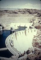
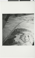
Slide of aerial view of Hoover Dam, circa late 1930s
Date
1935 to 1939
Archival Collection
Description
An image showing an aerial view of Hoover Dam in Black Canyon. Note: Boulder Dam was officially renamed Hoover Dam in 1947.
Image
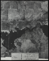
Aerial view of the Boulder Canyon quadrant in Arizona-Nevada: photographic print
Date
1950
Archival Collection
Description
From the Army Mapping Service Aerial Photographs of Southern and Western Nevada (PH-00285). Aerial photographs, composites, and indices. High altitude aerial photographs, Quad. Boulder Canyon 4, State: Arizona - Nevada. U.S. Geological Survey, Army Map Service. Flight Scale I-47200Project-GS-LJ. Index copied -8-26-50. Flying Comp. -7-26-50
Image
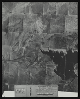
Aerial view of the Boulder Canyon quadrant in Arizona-Nevada: photographic print
Date
1950
Archival Collection
Description
From the Army Mapping Service Aerial Photographs of Southern and Western Nevada (PH-00285). Aerial photographs, composites, and indices. High altitude aerial photographs, Quad. Boulder Canyon 3, State: Arizona - Nevada. U.S. Geological Survey, Army Map Service. Flight Scale I-47200Project-GS-LJ. Index copied -8-26-50. Flying Comp. -7-26-50
Image
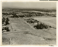
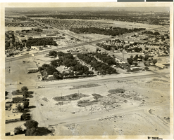
Aerial photograph of North Las Vegas, Nevada, June 5, 1973
Date
1973-06-05
Archival Collection
Description
Aerial view of North Las Vegas, Nevada. Handwritten on back of photograph: "Pecos & Cheyenne, looking south." Hotels in Las Vegas skyline seen in background in upper right.
Image
Photograph of aerial view of the Flamingo, Las Vegas (Nev.), circa 1947
Date
1946 to 1948
Archival Collection
Description
Black and white aerial view of the Flamingo hotel and casino on the Las Vegas strip. Site Name: Flamingo Hotel and Casino (Las Vegas, Nev.)
Image
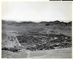
Aerial photograph of Boulder City (Nev.), 1940s-1950s
Date
1940 to 1959
Archival Collection
Description
Aerial view of Boulder City, Nevada.
Image
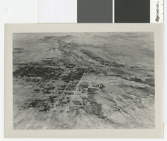
Aerial photograph of Las Vegas looking west, 1930
Date
1930
Archival Collection
Description
Aerial view of Las Vegas in 1930
Transcribed Notes: Notes on photo sleeve: Aerial view of Las Vegas, probably winter of 1930. (Credit: W.A. Davis)
Image

Aerial photograph of downtown Las Vegas, Nevada, circa 1963
Date
1962 to 1964
Archival Collection
Description
Aerial photograph of downtown Las Vegas, Nevada looking southeast from the Union Pacific Railroad Station (curved Art Deco building in lower left). The Overland Hotel, Golden Gate, the Mint, Horseshoe Club, Hotel Fremont, Las Vegas Club and Golden Nugget are seen on Fremont Street.
Image
Aerial photograph of North Las Vegas, Nevada, June 5, 1973
Date
1973-06-05
Archival Collection
Description
Aerial view of North Las Vegas, Nevada, looking southwest from Cheyenne Avenue near North Pecos Road. Caption on back of photograph: "Project: Land use. Location: Cheyenne Ave., Las Vegas Blvd. No., Pecos (No. & So.)." Hotels in Las Vegas skyline are seen in distance in upper right.
Image
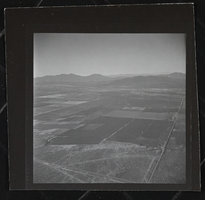
Photograph of aerial view of Pahrump (Nev.), 1950-1969
Date
1950 to 1969
Archival Collection
Description
Aerial view of Pahrump, Nevada.
Image