Search the Special Collections and Archives Portal

Search Results
Display    Results Per Page
Displaying results 6041 - 6050 of 17677

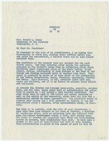
Letter from Harold J. Stocker (Clark County, Nevada) to Harold L. Ickes (Washington, D.C.) February 26, 1940

Date

1940-02-26

Description

Clark County commissioner asking the Secretary of the Interior to use some of the funds from the Arid Lands Fund to create a drinking water system in the Moapa Valley.

Text
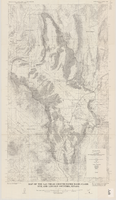
Map of the Las Vegas ground-water basin, Clark, Nye, and Lincoln Counties, Nevada, 1965

Date

1965

Description

At top of map: 'United States Department of the Interior, Geological Survey. Water-supply paper 1780, plate 1.' At bottom of map: 'Base from Army Map Service sheets NJ 11-9, NJ 11-12, and NI 11-3 (1947).' 'Boundary between bedrock and alluvium in Clark County, Nev., compiled by Ben Boyer, E. H. Pampeyan and C. R. Longwell. In Lincoln and Nye Counties, contact determined from aerial photographs.' 'Interior--Geological Survey, Washington, D.C.--1965--W63358.' Includes township and range lines.Relief shown by contours. Thematic map. Scale 1:250,000 (W 116°--W 114°45´/N 37°00´--N 35°30´). Series: Water-supply paper (Washington, D.C.), 1780. Originally published as plate 1 of Available water supply of the Las Vegas ground-water basin, Nevada, by Glenn T. Malmberg, published by the Geological Survey in 1965 as its Water-supply paper 1780.

Image
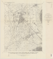
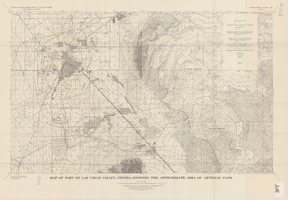
Map of part of Las Vegas Valley, Nevada, showing the approximate area of artesian flow, 1965

Date

1965

Description

At top of map: 'United States Department of the Interior, Geological Survey. Water supply paper 1780, plate 2.' At bottom of map: 'Base from U.S. Geological Survey Las Vegas (1952) and Henderson (1952) quadrangles.' 'Interior--Geological Survey, Washigton, D.C.--1965--W63358.' Relief shown by contours. Includes township and range lines. Thematic map. Scale 1:62,500 (W 115°15´--W 114°45´/N 36°15´--N 36°00´). Series: Water-supply paper (Washington, D.C.)
1780. Originally published as plate 2 of Available water supply of the Las Vegas ground-water basin, Nevada, by Glenn T. Malmberg, published by the Geological Survey in 1965 as its Water-supply paper 1780.

Image

Map of part of Las Vegas Valley, Nevada, showing the approximate altitude of the water table in the near-surface reservoir in February 1956

Date

1965

Description

Genre/Form: Thematic maps. Scale 1:62,500 (W 115°15´--W 115°00´/N 36°15´--N 36°00´). 1 map ; 45 x 36 cm. Series: Water-supply paper (Washington, D.C.) ; 1780. Relief shown by contours. Originally published as plate 8 of Available water supply of the Las Vegas ground-water basin, Nevada, by Glenn T. Malmberg, published by the Geological Survey in 1965 as its Water-supply paper 1780. Includes township and range lines. Interior, Geological Survey

Image

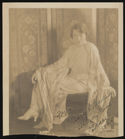
Grace Hayes in a floor-length cape-sleeved dress: photographic print

Date

1925

Archival Collection

Description

A portrait of Grace Hayes in a floor-length cape-sleeved dress. The photograph is signed "For = Mary & Madeline, All my love Grace 1925". Ernest Solomon (sp?) photo.

Image

Maurine and Fred Wilson and Dr. William S. Park Photograph Albums

Identifier

PH-00222

Abstract

The Maurine and Fred Wilson and Dr. William S. Park Photograph Albums (1900-1930s) consist of twelve albums containing black-and-white photographic prints and three black-and-white photographic negatives. The photographs are primarily related to the families of William S. Park, John S. Park, and Fred and Maurine Hubbard Wilson. Included are images of the Park homes in Las Vegas, Nevada; Park and Wilson family members; scenes of early Las Vegas, Nevada; outdoor activities, and vacation trips to California, Colorado, and Mexico.

Archival Collection