Search Results
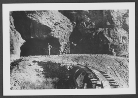
Horse freight team hauling supplies from Manville to Beatty, Nevada, approximately 1900-1910
Level of Description
File
Archival Collection
Nevada Mining Photograph Collection
To request this item in person:
Collection Number: PH-00361
Collection Name: Nevada Mining Photograph Collection
Box/Folder: Oversized Box SH-066 (Restrictions apply)
Collection Name: Nevada Mining Photograph Collection
Box/Folder: Oversized Box SH-066 (Restrictions apply)
Archival Component
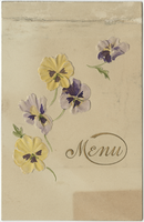
Dinner given on the occasion of Mrs. Elly Kissel's birthday, December 11, 1900, at Tivoli Restaurant
Date
1900-12-11
Archival Collection
Description
Restaurant: Tivoli Restaurant Location: 65 Strand, W.C., London, England
Text
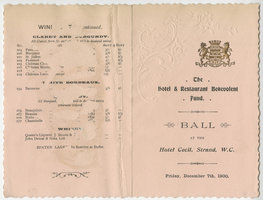
The Hotel and Restaurant Benevolent Fund, ball party, menu, Friday, December 7, 1900, at Hotel Cecil
Date
1900-12-07
Archival Collection
Description
Note: Scalloped borders Menu insert: Wine lists; Spirits lists Restaurant: Hotel Cecil (London, England) Location: Strand, W.C., London, England
Text
First schoolhouse in Las Vegas located at 2nd and Lewis streets, approximately 1900-1910
Level of Description
File
Archival Collection
Helen J. Stewart Photographs
To request this item in person:
Collection Number: PH-00104
Collection Name: Helen J. Stewart Photographs
Box/Folder: Oversized Box SH-060
Collection Name: Helen J. Stewart Photographs
Box/Folder: Oversized Box SH-060
Archival Component
House in Milford, Utah; Walter Bracken's house in Las Vegas, Nevada, approximately 1900-1910
Level of Description
File
Archival Collection
Ferron and Bracken Photograph Collection
To request this item in person:
Collection Number: PH-00001
Collection Name: Ferron and Bracken Photograph Collection
Box/Folder: Oversized Box 11
Collection Name: Ferron and Bracken Photograph Collection
Box/Folder: Oversized Box 11
Archival Component
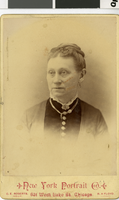
Carte de visite of Sophia Weinman Feldman, circa mid 1800s to early 1900s
Date
1850 to 1910
Archival Collection
Description
Portrait of Sophia Weinman Feldman.
Image
Photograph of Ed Carbary at Potosi Mine, Nevada, circa late 1800s to early 1900s
Date
1870 to 1939
Archival Collection
Description
Ed Carbary standing at the entrance to Potosi Mine in Nevada.
Image
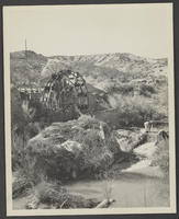
Photograph of irrigation system near Logandale, Nevada, circa late 1800s - mid 1900s
Date
1870 to 1959
Archival Collection
Description
A view of a water wheel used to irrigate fields near Logandale, Nevada.
Image
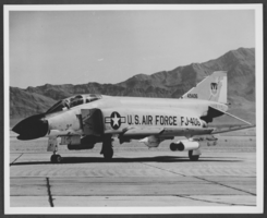
Photograph of F-4C airplane at Nellis Air Force Base, Nevada, circa mid 1900s
Date
1935 to 1965
Archival Collection
Description
A F-4C airplane on flight line at Nellis Air Force Base in Nevada.
Image