Search Results
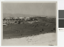
Photograph of North Las Vegas golf course, northwest direction, circa 1965
Date
Archival Collection
Description
North Las Vegas golf course with Parks and Recreation Building and city water tanks.
Transcribed Notes: Notes from photo sleeve: "North Las Vegas Golf Course (Par 3) with Parks and Recreation Building and city water storage tanks"; Notes on back: "NLV Par 3 Golf Course with P & R Bldg. and city water storage tanks."
Image
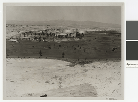
Photograph of North Las Vegas golf course, westward direction, circa 1965
Date
Archival Collection
Description
North Las Vegas golf course with Parks and Recreation Building and city water tanks.
Transcribed Notes: Notes from photo sleeve: "North Las Vegas Golf Course (Par 3) with Parks and Recreation Building and city water storage tanks"; Notes on back: "NLV Par 3 Golf Course with P & R Bldg. and city water storage tanks."
Image
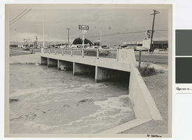
Photograph of water running high in flood channel and North Las Vegas Boulevard flood channel
Date
Archival Collection
Description
Flood channel with water running high under North Las Vegas Boulevard. Signs on front for 91 and 93 freeways
Transcribed Notes: Notes from photo sleeve: "Las Vegas Boulevard North and North Las Vegas flood channel, ca. 1970s." Notes on back: "Las Vegas Blvd North and NLV flood channel."
Image
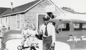
One of the first pictures taken at Carver's Station: photographic print
Date
Archival Collection
Description
From the Nye County, Nevada Photograph Collection (PH-00221) -- Series V. Smoky Valley, Nevada and Round Mountain, Nevada -- Subseries V.A. Carver, Carver-Duhme, and Carver-Book Families (Smoky Valley). One of the first pictures taken at Carver’s Station, Smoky Valley, Nevada, when it was originally known as Carver’s Rainbow Ranch Bar and Café. Driver of the Las Vegas-Tonopah-Reno Stage Line, which traveled through Tonopah to Winnemucca every other day, is pictured with Dick and Gary Carver.
Image