Search the Special Collections and Archives Portal
Search Results
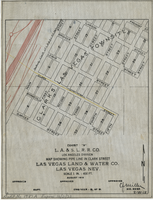
Map showing water pipeline in Clark Street, Las Vegas, Nev., August 1919
Date
1919-08
Archival Collection
Description
'Exhibit A. L.A & S.L. R.R. Co., Los Angeles Division.' ' Las Vegas Land & Water Co., Las Vegas, Nev.' 'August 1919' (?) 'Approved [signed] C.F. Miller Div. Engr. '2-W-18.' Handwritten in lower left margin: 'Audit No.1987A. Expires 12/31/23.' Pipeline marked in yellow. Area of Las Vegas in map labeled as 'Clark's Las Vegas Townsite.' Scale: 1 in. = 400 ft.
Image

Map showing water connection for Moapa School District No. 17, Moapa, Nevada, August 1920
Date
1920-08
Archival Collection
Description
'Exhibit A.' 'L.A. & S.L. R.R. Co., Los Angeles Division.' 'August 1920.' 'Approved, [signed] C.F. Miller, Div. Engr.' '2-W-49' hand-printed in lower right corner.'Audit # 3309 12/31/24" hand-printed in lower left margin. Scale: 1 in. = 100 ft
Image
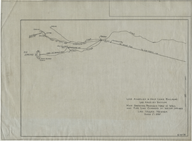
Map showing proposed new 12" well and pipe line changes at Water Springs, Las Vegas, Nevada, circa 1920
Date
1916 to 1925
Archival Collection
Description
In lower right corner: '6-W-74.' Scale: 1" = 500'.
Image

Map showing possible industrial users' connections to railroad pipelines in Las Vegas, Nevada, December 4, 1930
Date
1930-12-04
Archival Collection
Description
Stamped portion near lower right corner reads 'Union Pacific System, L.A. & S.L. R.R. Scale: 1" = 100'. Date: 12-4-30. Office Division, Eng'r. Los Angeles. Drg. No. 916.' 10 3/4 in. x 33 3/4 in. Scale: 1" = 100"..
Image
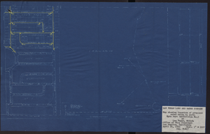
Map showing location of proposed water mains to serve Hyde Park Subdivision No. 2 at Las Vegas, Nevada, April 21, 1953
Date
1953-04-21
Archival Collection
Description
'Drawing B-617.' 'Office of Vice President, Los Angeles,California.' Accompanies: L. R. Maag letter to Thomas A. Campbell, June 15, 1953 (Box 14 Folder W26 File No. 1).
Image
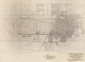
Map to accompany agreement with Las Vegas Land and Water Company covering furnishing of water by UPRRCo. to LVL&WCo. at Las Vegas, Nevada, October 4, 1950
Date
1950-10-04
Archival Collection
Description
'Los Angeles & Salt Lake Railroad Company, Union Pacific Railroad Company, Exhibit A.' 'Office of Vice President-LVL&WCompany, Los Angeles, California, October 4, 1950.'
Image
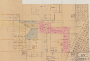
Map to accompany Appraisal of water lands of Los Angeles & Salt Lake Railroad Company, Las Vegas, Nevada, August 19, 1952
Date
1952-08-19
Archival Collection
Description
'Office of General Land and Tax Agent, Los Angeles, California, August 19, 1952.' 'Parcels numbered as shwon on Water District map.' Scale: 1" = 600'.
Image
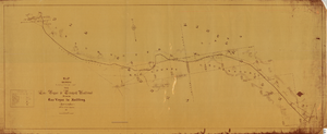
Map showing location of the Las Vegas & Tonopah Railroad from Las Vegas to Bullfrog, Nevada, 1906
Date
1906
Archival Collection
Description
'Office of Chief Engineer' printed on map above date.
Image
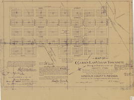
Map of Clark's Las Vegas Townsite, May 8, 1905
Date
1905-05-08
Archival Collection
Description
'Book 1, Page 37.' 'Dated: May 8th, 1905.' Subtitle: 'Being a sub-division of parts of the W.1/2 and the W.1/2 of the N.E.1/4 of Section 34 and the S.1/2 of the S.W.1/4 of Section 27 T.20 S.R. 61 E, Mount Diablo Base and Meridian, Lincoln County, Nevada. A Plat map. Blueline print. Scale [ca. 1:2,400]. 1 in. to 200 feet.
Text
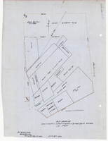
Plat showing cultivated land in the Stewart Ranch, Las Vegas, Nevada, December 8, 1902
Date
1902-12-08
Archival Collection
Description
'John T. McWilliams, U.S.M. Surveyor, Goodsprings, Nevada.' 'Dec. 8th 1902.' '60-A-Pt.II' handwritten in upper right corner. This is map of the Stewart Ranch, which was originally the Las Vegas Ranch, site of the Old Mormon Fort. Drawn with ink and colored pencil. Two holes punched on right side..
Image
Pagination
Refine my results
Content Type
Creator or Contributor
Subject
Archival Collection
Digital Project
Resource Type
Year
Material Type
Place
Language
Records Classification
