Search the Special Collections and Archives Portal
Search Results
Stoebling, David, New Vegas, 1982 July 08
Level of Description
File
Archival Collection
Frank Mitrani Photographs
Pagination
- Previous page ‹‹
- Page 2
Archival Component
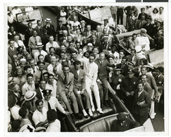
Photograph of a parade procession, New York, July 15, 1938
Date
1938-07-15
Archival Collection
Description
An overhead view of people looking up and waving during a parade procession.
Image
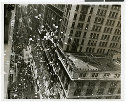
Photograph of a parade procession, New York, July 15, 1938
Date
1938-07-15
Archival Collection
Description
An overhead view of a parade procession celebrating Howard Hughes' completion of his round-the-world flight.
Image
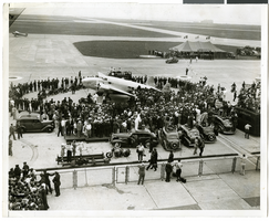
Photograph of crowds at Floyd Bennett Airfield, New York, July 1938
Date
1938-07-14
Archival Collection
Description
The black and white view of Howard Hughes' Lockheed 14 aircraft after performing its final landing on the Round the World flight at Floyd Bennett Airport, New York. Description printed on back of photograph: "General view of welcoming ceremony. 7/14/1938"
Image
#67121: Valdex, Jesus (Student) Interns at New York-New York, 2009 July 09
Level of Description
File
Archival Collection
University of Nevada, Las Vegas Creative Services Records (2000s)
Pagination
- Previous page ‹‹
- Page 2
Archival Component
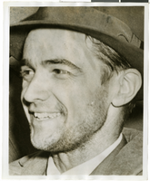
Photograph of Howard Hughes in New York, July 1938
Date
1938-07
Archival Collection
Description
A close-up photograph of Howard Hughes..
Image
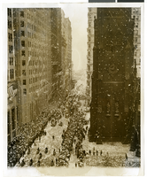
Photograph of a parade procession, New York, July 15, 1938
Date
1938-07-15
Archival Collection
Description
Description printed on photograph's accompanying sheet of paper: "New York reception for Howard Hughes and his four companions after they completed a round the world flight. 7/15/38."
Image
Report: "Marketing Casino Gambling and a Local Lottery in New York City" by the Council of the City of New York for the Committee on Economic Development, 1991
Level of Description
File
Archival Collection
Eugene Martin Christiansen Papers
Pagination
- Previous page ‹‹
- Page 2
Archival Component
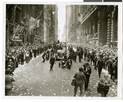
Photograph of a parade procession, New York, July 15, 1938
Date
1938-07-15
Archival Collection
Description
Description printed on photograph's accompanying sheet of paper: "New York reception for Howard Hughes and his companions after completing a round the world flight. 7-15-38 (Press Association)."
Image
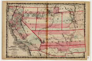
Map of California and Territories of New Mexico and Utah, 1862
Date
1862
Description
Scale [ca. 1:3,231,360. 1 in. to approx. 51 miles] (W 125°00--W 103°30/N 42°00--N 31°45) ; 1 map : hand col. ; 40 x 60 cm., on sheet 46 x 68 cm ; Relief indicated by hachures and spot heights ; Prime meridians: Greenwich and Washington, D.C ; Decorative border ; Hand colored ; Atlas p. numbers in upper margin: 58-59 ; Date est. from territorial borders and county configuration ; Shows natural features, locations of Indian tribes, proposed railroad routes, routes of explorers, trails, county boundaries and populated places ; Johnson and Ward
Image
Pagination
Refine my results
Content Type
Creator or Contributor
Subject
Archival Collection
Digital Project
Resource Type
Year
Material Type
Place
Language
Records Classification
