Search the Special Collections and Archives Portal
Search Results
Lockheed 14 aircraft over New York City, 1938 July
Level of Description
File
Archival Collection
Howard Hughes Public Relations Photograph Collection
Pagination
- Previous page ‹‹
- Page 4
Archival Component
Garden Pier, Atlantic City, New Jersey: photograph, 1936 to 1937
Level of Description
Item
Archival Collection
Larry Fotine Music collection
Pagination
- Previous page ‹‹
- Page 4
Archival Component
Steel Pier marquee, Atlantic City, New Jersey: photograph, 1951
Level of Description
Item
Archival Collection
Larry Fotine Music collection
Pagination
- Previous page ‹‹
- Page 4
Archival Component
Steel Pier marquee, Atlantic City, New Jersey: photograph, 1939
Level of Description
Item
Archival Collection
Larry Fotine Music collection
Pagination
- Previous page ‹‹
- Page 4
Archival Component
Steel Pier marquee, Atlantic City, New Jersey: photograph, 1939
Level of Description
Item
Archival Collection
Larry Fotine Music collection
Pagination
- Previous page ‹‹
- Page 4
Archival Component
Coate, Douglas and Gary Ross, "The Effect of OTB in New York City on Revenues to the City and State Governments", 1975
Level of Description
File
Archival Collection
Eugene Martin Christiansen Papers
Pagination
- Previous page ‹‹
- Page 4
Archival Component

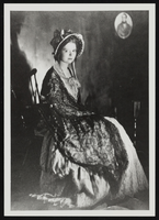
Clara Bow after winning the National Fame and Fortune Contest in New York City, New York: photographic print
Date
1921
Description
From the Nan Doughty Photograph Collection (PH-00240). Clara at age 16.
Image

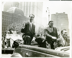
Photograph of Howard Hughes at his parade for Round the World flight, New York City, July 15, 1938
Date
1938-07-15
Archival Collection
Description
The black and white view of Howard Hughes (left) and Mayor Fiorello Laguardia (center) seated in an automobile that was used in a parade dedicated to Hughes' completion of his Round the World flight in New York City, New York.
Image
Edward P. Mulrooney, City of New York, New York Police Commissioner, foreword on gun control, approximately 1930 to 1931
Level of Description
File
Archival Collection
Howard Hughes Film Production Records
Pagination
- Previous page ‹‹
- Page 4
Archival Component
Some Effects of an Increase in Police Manpower in the 20th Precinct of New York City by S. James Press, the New York City Rand Institute, 1971 October
Level of Description
File
Archival Collection
Ardis Kearns Papers
Pagination
- Previous page ‹‹
- Page 4
Archival Component
Pagination
Refine my results
Content Type
Creator or Contributor
Subject
Archival Collection
Digital Project
Resource Type
Year
Material Type
Place
Language
Records Classification
