Search Results
Four actresses in costume for 1 Million Years, B.C., Valley of Fire, Nevada: photographic print and negative, approximately 1936 to 1937
Level of Description
File
Archival Collection
Nevada Division of State Parks Photograph Collection
To request this item in person:
Collection Number: PH-00105
Collection Name: Nevada Division of State Parks Photograph Collection
Box/Folder: Folder 03, Box SH-021
Collection Name: Nevada Division of State Parks Photograph Collection
Box/Folder: Folder 03, Box SH-021
Archival Component
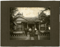
Photograph of members of the Hubbard Family outside of their home, circa 1900s
Date
1900 to 1910
Archival Collection
Description
Front row, standing: A. E. Hubbard; seated, left to right: Mary Ellen Hubbard, J. E. Hubbard, Maurine Hubbard. Back row left to right, J. B. Hubbard, Ola B. Hubbard, F. B. Hubbard, Ida Mae Hubbard.
Image
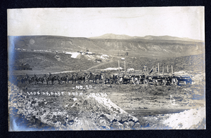
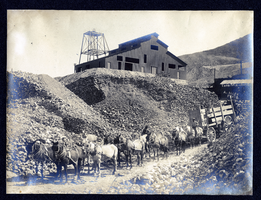
Photograph of horse team pulling wagons loaded with ore, Goldfield (Nev.), early 1900s
Archival Collection
Description
Caption: No. 20 - Looking East. From. Jombo
Image
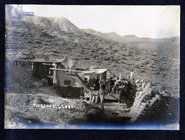
Photograph of men with stacks of sacked ore at Florence Lease, Tonopah (Nev.), early 1900s
Archival Collection
Description
Caption: 13 Florence. Lease
Image
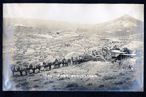
Photograph of men loading sacks of ore at Florence Lease, Goldfield (Nev.), early 1900s
Archival Collection
Description
Caption: No. 22. Loading. Ore. At. Florence.
Image
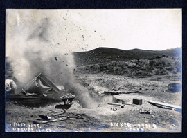
Photograph of explosion at Velvet Lease and Ricker-Ryder Lease, Goldfield (Nev.), early 1900s
Archival Collection
Description
Caption: First. Shot. Velvet. Lease. Ricker-Ryder Lease
Image
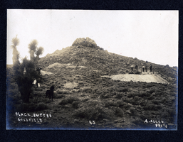
Photograph of men standing at mine near Black Butte, Goldfield (Nev.), early 1900s
Archival Collection
Description
Caption: Black. Buttes Goldfield 45
Image

Photograph of men loading sacked ore at Tonopah Mine, Tonopah (Nev.), early 1900s
Archival Collection
Description
Caption: Tonopah Mine - 69 -
Image
Photograph of Tonopah Mine ore being hauled to mill, Tonopah (Nev.), early 1900s
Archival Collection
Description
Caption: Tonopah Mine
Image
Glass plate negatives of geological formations, approximately 1900 to 1974
Level of Description
File
Archival Collection
Chester R. Longwell Professional Papers
To request this item in person:
Collection Number: MS-00017
Collection Name: Chester R. Longwell Professional Papers
Box/Folder: Box 29, Box 30, Box 31, Box 32, Box 33
Collection Name: Chester R. Longwell Professional Papers
Box/Folder: Box 29, Box 30, Box 31, Box 32, Box 33
Archival Component