Search the Special Collections and Archives Portal
Search Results

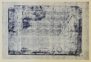
Original plat, townsite of Las Vegas, Lincoln Co., Nevada, January 13, 1905
Date
Description
Subtitle: 'Embracing the N. 1/2 of S.W. 1/4 Sec. 27 Township 20S. R.61E. Mt. Diablo Meridian.' 'Book 1, page 17A" handwritten in lower right corner. Signed by Henry Lee, County Recorder, Lincoln County Nevada. 'Filed at request of J.T. Williams, January 13th A.D. 1905.' Backwards handwriting on right side. Map has a Lincoln County seal on the bottom near the center. In the dedication J.T. McWilliams states that he has surveyed and platted the townsite of Las Vegas subject to the right of way of the San Pedro, Los Angeles and Salt Lake Railroad Company. He signed the dedication on Jan. 13, 1905, and it was signed by witnesses Scale [ca. 1:2,520? 1 inch to approx. 210 feet?]. Copy of a blueline print.
Image

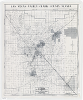
Map of Las Vegas Valley, Clark County, Nevada, 1954
Date
Description
Image

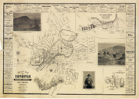
Map of Tonopah Mining District, Nye County, Nevada, 1902
Date
Description
Text
Unknown author. Horse racing: war boom brings greatest betting year, Life 17(17), 1944 October 23
Level of Description
Archival Collection
Collection Name: UNLV Libraries Collection of Articles on Gaming and Las Vegas, Nevada Topics
Box/Folder: Box 10
Archival Component
Kelley, Elizabeth Lorain, "Validation of current body composition estimation equations for men over 60 years of age", 1992 Fall
Level of Description
Archival Collection
Collection Name: University of Nevada, Las Vegas Theses, Dissertations, and Honors Papers
Box/Folder: Box 081
Archival Component
Blakey, Linda S, "Food Utilization and Habitat Preference of youn-of-the-year Largemouth Bass [Micripterus Salmoides] in the Atchafelaya Basin, Louisiana.", 1982
Level of Description
Archival Collection
Collection Name: University of Nevada, Las Vegas Theses, Dissertations, and Honors Papers
Box/Folder: Box 001
Archival Component
Text: transcript (with holograph notations), instructions and record booklet for 4-H for third year clothing construction and care, consists of U.S. Department of Agriculture Farmers' Bulletin, compiled by University of Nevada Agriculture Extension Division, 1926-1928
Level of Description
Archival Collection
Collection Name: Arlene Mathews Smith Papers
Box/Folder: Box 01
Archival Component

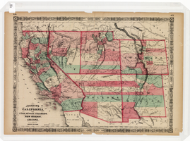
Map of California, Utah, Nevada, Colorado, New Mexico and Arizona, 1864
Date
Description
Text
#71486: Agency Mentor-Protege Agreement of the Year, Nasa Small Business Industry Awards, April 6, 2017, 2017 April 06
Level of Description
Archival Collection
Collection Name: University of Nevada, Las Vegas Creative Services Records (2010s)
Box/Folder: Digital File 01
Archival Component

UNLV Professor Brendan O'Toole, and an undergraduate intern from Rutgers University join Yong Dawson in helping to take measurements from Dawson's 4-year-old daughter Hailey Dawson: digital photographs
Date
Archival Collection
Description
Image
