Search the Special Collections and Archives Portal
Search Results

UNLV Boyd School of Law Alum of the Year Judge Linda Marquis poses at the Regional Justice Facility August 19, 2015: digital photographs
Date
2015-08-19
Archival Collection
Description
Photographs from the University of Nevada, Las Vegas Creative Services Records (2010s) (PH-00388-05).
Image

UNLV Alumna of the Year Kris Engelstad McGarry poses in her Engelstad Family Foundation office October 1, 2015 in Las Vegas: digital photographs
Date
2015-10-01
Archival Collection
Description
Photographs from the University of Nevada, Las Vegas Creative Services Records (2010s) (PH-00388-05).
Image
T-Shirt Color: Navy Blue; Front: Interagency Hotshots R-1 Lolo NF Missoula, Montana 40 Years 1961-2001, Dept. Emblem; Back: Interagency Hotshots R-1 40 Years 1961-2001 Lolo, Dept. Emblem, approximately 2001-2012
Level of Description
File
Archival Collection
New York-New York Hotel and Casino 9-11 Heroes Tribute Collection
To request this item in person:
Collection Number: MS-00459
Collection Name: New York-New York Hotel and Casino 9-11 Heroes Tribute Collection
Box/Folder: Box 264
Collection Name: New York-New York Hotel and Casino 9-11 Heroes Tribute Collection
Box/Folder: Box 264
Archival Component

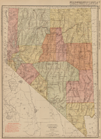
Rand-McNally new commercial atlas map of Nevada, 1912
Date
1912
Description
Original publisher: Rand, McNally & Co. Scale [ca. 1:1,203,840). 1 inch to 19 miles. Originally published as p. 316-317 of Rand McNally's commercial atlas of America. Title in right margin: Nevada : commercial atlas of America. Includes township and range grid. Includes index to Nevada railroads and index to principal cities with their populations. Index on verso to counties, towns and natural features in Oregon and Nevada.
Image
Clark County Mother of Year Award Ceremony; contains correspondence, newspaper clippings, press releases, and biographies of recepients
Level of Description
File
Archival Collection
Clark County Mother of the Year Records
To request this item in person:
Collection Number: MS-00306
Collection Name: Clark County Mother of the Year Records
Box/Folder: N/A
Collection Name: Clark County Mother of the Year Records
Box/Folder: N/A
Archival Component

Studio portrait of Hazel and Floyd Denton's daughter, Betty Jeanne Denton, at one and a half years: photographic print
Date
1900 (year approximate) to 1965 (year approximate)
Archival Collection
Description
From the Hazel Baker Denton Photograph Collection (PH-00312)
Image

Map showing ground-water chemistry and hydrochemical facies, Nevada Test Site and vicinity, southern Nevada, 1965
Date
1965
Description
'United States Department of the Interior, Geological Survey. Professional paper 712-C, plate 3.' 'Prepared on behalf of the Atomic Energy Commission.' 'Base from U.S. Geological Survey Caliente, Death Valley, Goldfield, and Las Vegas, 1954.' 'Hydrochemistry by I. J. Winograd, 1965.' 'Interior--Geological Survey, Reston, Virginia--1975.' Relief shown by contours. Contour interval 200 feet. Shows township and range lines. Scale 1:250,000 (W 117°--W 115°/N 38°--N 36°). Series: Professional paper (Geological Survey (U.S.))
712-C. Issued as plate 3 from U.S. Geological Survey professional paper 712-C, Hydrogeologic and hydrochemical framework, south-central Great Basin, Nevada-California, with special reference to the Nevada Test Site, by I.J. Winograd, and William Thordarson, published in 1975 by the U.S. Geological Survey.
712-C. Issued as plate 3 from U.S. Geological Survey professional paper 712-C, Hydrogeologic and hydrochemical framework, south-central Great Basin, Nevada-California, with special reference to the Nevada Test Site, by I.J. Winograd, and William Thordarson, published in 1975 by the U.S. Geological Survey.
Image
Bonner. L. J., P. E. Elliot, L. P. Etchemendy, and J. R. Swartwood. 1998. Water Resources Data Nevada Water Year 1997, WDR-NV-97-1, in cooperation with the State of Nevada and other agencies. Water Resources Division, U.S. Geological Survey, U.S. Department of the Interior. Carson City, Nevada, 1998
Level of Description
File
Archival Collection
Environmental Radiation Protection Standards for Yucca Mountain, Nevada
To request this item in person:
Collection Number: MS-00603
Collection Name: Environmental Radiation Protection Standards for Yucca Mountain, Nevada
Box/Folder: Box 03
Collection Name: Environmental Radiation Protection Standards for Yucca Mountain, Nevada
Box/Folder: Box 03
Archival Component
Bostic. R. E., R. L. Kane, K. M. Kipfer. and A. W. Johnson. 1997, Water Resources Data Nevada Water Year 1996, WDR-NV-96-1, in cooperation with the State of Nevada and other agencies. Water Resources Division. U.S. Geological Survey, U.S. Department of the Interior. Carson City, Nevada, 1997
Level of Description
File
Archival Collection
Environmental Radiation Protection Standards for Yucca Mountain, Nevada
To request this item in person:
Collection Number: MS-00603
Collection Name: Environmental Radiation Protection Standards for Yucca Mountain, Nevada
Box/Folder: Box 04
Collection Name: Environmental Radiation Protection Standards for Yucca Mountain, Nevada
Box/Folder: Box 04
Archival Component

Map showing railroads in Nevada, 1904
Date
1904
Description
Relief shown by hachures. Added title: Rand McNally's new business map of Nevada. Shows range and township grid. Shows railroads. Color used to show boundaries of counties. Includes index to cities. On verso: Indexes to counties, lakes, mountains, rivers, towns, etc. Published by Rand McNally & Co. Scale [ca. 1:1,710,720]. 1 in. equals 27 miles (W 120°--W 114°/N 42°--N 35°). Originally published as pages 263 and 264 of Rand-McNally indexed atlas.
Text
Pagination
Refine my results
Content Type
Creator or Contributor
Subject
Archival Collection
Digital Project
Resource Type
Year
Material Type
Place
Language
Records Classification
