Search the Special Collections and Archives Portal
Search Results
DOT (U.S. Department of Transportation), Undated, Biennial Report on Hazardous Materials Transportation in Calendar Years 1992-1993, Research and Special Programs Administration, Washington. D.C., undated
Level of Description
File
Archival Collection
Environmental Radiation Protection Standards for Yucca Mountain, Nevada
To request this item in person:
Collection Number: MS-00603
Collection Name: Environmental Radiation Protection Standards for Yucca Mountain, Nevada
Box/Folder: Box 25
Collection Name: Environmental Radiation Protection Standards for Yucca Mountain, Nevada
Box/Folder: Box 25
Archival Component

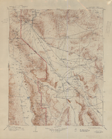
Topographic map of the Furnace Creek quadrangle, Nevada and California, 1947
Date
1947
Description
'E.M. Douglas, geographer. R.H. Chapman, in charge of section. Topography by R.H. Chapman, B.D. Stewart, J.E. Blackburn and D.F.C. Moor. Traingulation by R.H. Chapman and D.F.C. Moor. Surveyed in1905-1906.' 'Edition of Apr. 1910, reprinted 1947.' Scale 1:250,000 ; polyconic proj. (W 117°00´--W 116°00´/N 37°00´--N 36°00´). Relief shown by contours and spot heights. 'North American datum.' 'Contour interval 100 feet.' 'Datum is mean sea level.' Text and illustrations from the Topographic maps of the United States series on verso. Series: The topograhic maps of the United States. United States, Dept. of the Interior, Geological Survey
Text
Beck, Evelyn Ruth, "A five year trend analysis of attitudes of female high school seniors toward post-high school work and education possibilities", 1993 Spring
Level of Description
Item
Archival Collection
University of Nevada, Las Vegas Theses, Dissertations, and Honors Papers
To request this item in person:
Collection Number: UA-00082
Collection Name: University of Nevada, Las Vegas Theses, Dissertations, and Honors Papers
Box/Folder: Box 084
Collection Name: University of Nevada, Las Vegas Theses, Dissertations, and Honors Papers
Box/Folder: Box 084
Archival Component

Hotel Nevada billboard, Ely, Nevada
Date
2016 (year approximate) to 2020 (year approximate)
Archival Collection
Description
View of the Hotel Nevada billboard reading "Hotel Nevada Western Hospitality."
501 E Aultman St, Ely, NV 89301
Image
#71385: Cody Hughes, associate professor in residence UNLV School of Dental Medicine and School of Dental Medicine alumni of the year on February 16, 2017, 2017 February 16
Level of Description
Item
Archival Collection
University of Nevada, Las Vegas Creative Services Records (2010s)
To request this item in person:
Collection Number: PH-00388-05
Collection Name: University of Nevada, Las Vegas Creative Services Records (2010s)
Box/Folder: Digital File 01
Collection Name: University of Nevada, Las Vegas Creative Services Records (2010s)
Box/Folder: Digital File 01
Archival Component
State of Nevada Educational Directories, Bulletins, and Certification Requirements
Identifier
MS-00700
Abstract
The State of Nevada Educational Directories, Bulletins, and Certification Requirements (1934-1991) contain bi-monthly bulletins, yearly directories, information to certify teachers, and retirement salaries.
Archival Collection

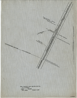
Map showing water pipeline serving H. C. Wheeler, Arden, Nevada, November 1929
Date
1929-11
Archival Collection
Description
Hand-drawn map. '2-W-214' hand-printed in lower right corner. Scale: 1" = 400'.
Image
Nye County Nuclear Waste Repository Project Office 2001. Independent Scientific Investigations Program Final Report. Fiscal Years 1996—2001 NWRPO-2001-04 (Pahrump, Nevada): U. S. Department of Energy. Nye County Nuclear Waste Repository Project Office, 2001
Level of Description
File
Archival Collection
Environmental Radiation Protection Standards for Yucca Mountain, Nevada
To request this item in person:
Collection Number: MS-00603
Collection Name: Environmental Radiation Protection Standards for Yucca Mountain, Nevada
Box/Folder: Box 43
Collection Name: Environmental Radiation Protection Standards for Yucca Mountain, Nevada
Box/Folder: Box 43
Archival Component
#68215: Landscape, Grounds & Arboretum facility supervisor Sandra Obenour-Dowd was named the Classified Staff Rookie of the Year on August 18, 2011, 2011 August 18
Level of Description
File
Archival Collection
University of Nevada, Las Vegas Creative Services Records (2010s)
To request this item in person:
Collection Number: PH-00388-05
Collection Name: University of Nevada, Las Vegas Creative Services Records (2010s)
Box/Folder: Digital File 00
Collection Name: University of Nevada, Las Vegas Creative Services Records (2010s)
Box/Folder: Digital File 00
Archival Component

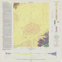
Geologic map of the Frenchman Flat quadrangle, Nye, Lincoln, and Clark Counties, Nevada, 1965
Date
1965
Description
58 x 47 cm., on sheet 81 x 81 cm., folded in envelope 30 x 24 cm. Relief shown by contours and spot heights. "Geology mapped in 1962. Contours on pre-Cenozoic rocks by D. L. Healey and C. H. Miller, 1958-63." Includes text, col. cross section and quadrangle location map. "Prepared in cooperation with the U.S. Atomic Energy Commission." Original publisher: Interior, Geological Survey, Series: Geologic quadrangle map GQ, Scale: 1:24 000.
Image
Pagination
Refine my results
Content Type
Creator or Contributor
Subject
Archival Collection
Digital Project
Resource Type
Year
Material Type
Place
Language
Records Classification
