Search the Special Collections and Archives Portal
Search Results
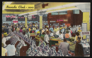
The Nevada Club in Reno, Nevada: postcard, image 001
Description
The Nevada Club in Reno, Nevada.
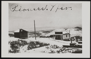
Panoramic view of Pioneer, Nevada: photographic print
Date
1900 to 1940
Archival Collection
Description
View of Pioneer, Nevada.
Image
Union Pacific Railroad: contains architectural and structural drawings of passenger and freight stations in Ontario, California and San Bernardino, California. Includes station yard layout plans, Ontario street maps (1939), and San Berdino tract maps (1928), 1925 December 31-1943 August 14
Level of Description
File
Archival Collection
Union Pacific Railroad Collection
To request this item in person:
Collection Number: MS-00397
Collection Name: Union Pacific Railroad Collection
Box/Folder: Flat File 192
Collection Name: Union Pacific Railroad Collection
Box/Folder: Flat File 192
Archival Component
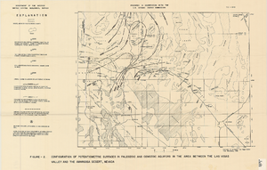
Map showing configuration of potentiometric surfaces in Paleozoic and Cenozoic aquifers in the area between the Las Vegas Valley and the Amargosa Desert, Nevada, 1963
Date
1963
Description
'Department of the Interior, United States Geological Survey. TEI-840.' 'Prepared in cooperation with the U.S. Atomic Energy Commission.' 'Contours in northwest Las Vegas Valley from Malmberg, 1961.' Relief shown by contours. Shows township and range lines. Scale [ca. 1:253,440. 1 in.=aprrox. 4 miles] (W 114°00´--W 115°00´--N 37°00´/N 36°00´). Originally published in A summary of the ground-water hydrology of the area between the Las Vegas Valley and the Amargosa Desert, Nevada : with special reference to the effects of possible new withdrawals of ground water / by Isaac J. Winograd, published by the U.S. Geological Survey in 1963 as number 840 of the Trace elements investigations report.
Image

Exterior view of the Golden Hotel in Las Vegas, Nevada: postcard
Date
1900 (year approximate) to 1999 (year approximate)
Archival Collection
Description
From the UNLV Libraries Single Item Accession Photograph Collection (PH-00171). Located 200 S. 1st Street, Las Vegas, Nevada. Also shown is an interior view of the hotel lobby and hotel room.
Image
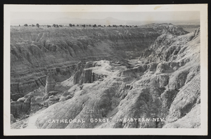
Photographic postcard of Cathedral Gorge in Eastern Nevada: postcard
Date
1900 (year approximate) to 1965 (year approximate)
Archival Collection
Description
From the Hazel Baker Denton Photograph Collection (PH-00312
Image
University of Nevada, Las Vegas Department of English Records
Identifier
UA-00126
Abstract
The University of Nevada, Las Vegas Department of English Records (approximately 1970-1989) contain materials from the Department of English including the Fern first-year newsletter, the Commonplace essays from English 101 students, English as a second language program information, and the Southern Nevada Writing Project.
Archival Collection
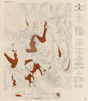
Hydrogeologic map of Nevada Test Site and vicinity, southern Nevada, 1965
Date
1965
Description
At top of map: ' United States Department of the Interior, Geological Survey. Professional paper 712-C, plate 1. Prepared on behald of the U.S. Atomic Energy Commission.' At bottom of map: 'Base from U.S. Geological Survey, Caliente, Death Valley, Goldfield and Las Vegas, 1954. 100,00-foot grid based on Nevada coordinate system, central zone.' 'Hydrogeology by I. J. Winograd, 1965; geology by William Thordarson.' Relief shown by contours and spot heights. Shows township and range lines. Includes diagram of downward and upward cross-flow of water. Includes bibliographical references and index. Contour interval 200 feet. Scale 1:250,000 (W 117°--W 115°/N 38°--N 36°). Series: Professional paper (Geological Survey (U.S.), 712-C. Issued as plate 1 from Hydrogeologic and hydrochemical framework, south-central Great Basin, Nevada-California with special reference to the Nevada Test Site. Prepared on behalf of the U.S. Atomic Energy Commission by Isaac J. Winograd and William Thordarson. Published 1975 by U.S. Govt. Print. Off. in Washington.
Image
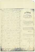
Plat of H.F.M & M addition to city of Las Vegas, Clark County, Nevada, comprising the west 1/2 of N.W. 1/4 Sec. 27, Twp. 20 S., R. 61 E., M.D.B & M, March 8, 1924
Date
1924-03-08
Description
Blue-line print ; 74 x 36 cm on sheet 79 x 61 cm. Survey was competed on March 8, 1924. Signed by the owners of the piece of property for the addition Roy W. Martin, Forest R. Mildren, William E. Ferron, and A. W. Ham, signed by the surveyor J.T. McWilliams, and notarized on March 31, 1924. Approved by the Board of City Commissioners and signed by the major W. C. German and by Florence S. Doherty, city clerk, on April 1, 1924. Recorded in Book 1 of plats, page 47. Includes township and range grid.
Image
Pagination
Refine my results
Content Type
Creator or Contributor
Subject
Archival Collection
Digital Project
Resource Type
Year
Material Type
Place
Language
Records Classification

