Search the Special Collections and Archives Portal
Search Results
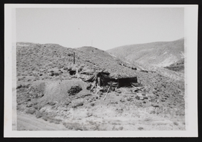
Candelaria Ruins of Mt. Diablo, Nevada: photographic prints
Date
1971-03-09
Description
From the Nan Doughty Photograph Collection (PH-00240). Candelaria Ruins of Mt. Diablo superintendent's house in Pickhandle Gulch, mouth of tunnel, behind fallen roof is where William H. Shockley kept milk and butter cool and stored books and papers during his absence.
Image
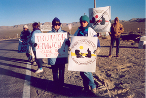
Protestors of the Nevada-Semipatatinsk antinuclear movement: photographic print
Date
1980 (year approximate) to 2000 (year approximate)
Archival Collection
Description
Unidentified protestors hold posters in representation of the Nevada-Semipatatinsk Antinuclear movement at the Nevada Test Site circa 1980-1999.
Image
Boulder City, Nevada Financial Reports and Budgets
Identifier
MS-00695
Abstract
Collection is comprised of annual budgets, financial statements, and auditor's reports dating from 1976 to 1989 created for the city of Boulder City, Nevada and adopted by the City Council.
Archival Collection
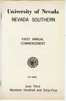
Nevada Southern First Annual Commencement program
Date
1964-06-03
Archival Collection
Description
University of Nevada, Nevada Southern, First Annual Commencement, Las Vegas, June 3, 1964.
Text
Photograph of Governor Mike O'Callaghan signing bill establishing four-year nursing program at UNLV; also shows Dorothy Button, Ruth Flanigan, Jo Albaugh, Senator Norman Hilbrecht, and Elizabeth Hilbrecht, 1971
Level of Description
File
Archival Collection
University of Nevada, Las Vegas School of Nursing Records
To request this item in person:
Collection Number: UA-00011
Collection Name: University of Nevada, Las Vegas School of Nursing Records
Box/Folder: Box 02
Collection Name: University of Nevada, Las Vegas School of Nursing Records
Box/Folder: Box 02
Archival Component

Map of Lincoln County, Nevada and Mohave County, Arizona area, 1892
Date
1892
Description
'Henry Gannett, chief geographer ; A.H. Thompson, geographer in charge ; triangulation by H.M. Wilson ; topography by H.M. Wilson and Powell survey.' 'Edition of Mar. 1892, reprinted 1929.' Handwritten legend on right-side margin of map. Original publisher: Dept. of the Interior, U.S. Geological Survey. Scale 1:250,000
polyconic proj. (W 115°--W 114°/N 37°--N 35°).
polyconic proj. (W 115°--W 114°/N 37°--N 35°).
Image
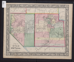
County map of Utah and Nevada, 1865
Date
1865
Description
'Entered according to Act of Congress in the year 1865 by S. Augustus Mitchell, Jr. in the Clerk's office of the District Court of the U.S. for the Eastern District of Pennsylvania . Drawn and engraved by W.H. Gamble, Philadelphia.' Shows roads, overland telegraph route, and other features. Relief shown by hachures and spot heights. Prime meridians: Greenwich and Washington. Scale [ca. 1:2,787,840] (W 120°--W 109°/N 43°--N 36° 59?).
Image
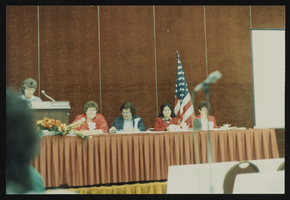
Panel at the Nevada Nurses Association conference in Las Vegas, Nevada: photographic print
Date
1960 (year approximate) to 1990 (year approximate)
Archival Collection
Description
From the Nevada Nurses Association Photograph Collection (PH-00274) -- Meeting of Nevada Nurses Association, Sahara Hotel, Las Vegas, n.d.
Image
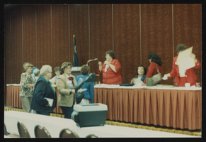
Panel at the Nevada Nurses Association conference in Las Vegas, Nevada: photographic print
Date
1960 (year approximate) to 1990 (year approximate)
Archival Collection
Description
From the Nevada Nurses Association Photograph Collection (PH-00274) --Meeting of Nevada Nurses Association, Sahara Hotel, Las Vegas, n.d.
Image
Pagination
Refine my results
Content Type
Creator or Contributor
Subject
Archival Collection
Digital Project
Resource Type
Year
Material Type
Place
Language
Records Classification

