Search the Special Collections and Archives Portal
Search Results

Map of Las Vegas Rancho, Lincoln County, Nevada, September 15, 1904
Date
1904-09-15
Description
'Being part of Township 20 S. R.61 E. MT. D. B.&.M, containing 1864.49 acres. Division engineer's office at the front, AMB, September 15th, 1904. A.L. Jones, Division Engineer. Surveyed by W.G. Watson, Assistant Engineer. Dwg. 30296.' Includes traverse table. Shows land owned by the San Pedro, Los Angeles & Salt Lake Railroad, its right of way and the right of way for the Las Vegas & Tonopah Railroad, land owned by the Las Vegas Land & Water Company including Clark's Las Vegas Townsite with the Bucks Addition and the Wardie Addition, and parcels sold from the Las Vegas Land & Water Company land. Scale: [1:9,600]. 1 in. to 800 feet. Library's copies 1 and 4 have land owned by the San Pedro, Los Angeles & Salt Lake Railroad hand-colored in pink and the rest of the Las Vegas Rancho not owned by the Las Vegas Land & Water Company hand-colored in green. Library's copy 2 has buildings of the Stewart Ranch drawn in and labeled in pencil. Library's copy 3 has addition and subtraction problems in pencil on the verso. Library's copy 4 has "Original purchase--1864.49 acres R.R.C. + L.V.L. + W. Co.--In colors." written in pencil on the verso followed by "(1904)" in red pencil. Library's copy 4 also has label on verson made of brown paper with "No 5 Las Vegas Ranch being part township ( 1904)" typed on it.
Image

Postcard showing view from Mount Whitney Highway across Owens Valley, Lone Pine, California, circa mid 1900s
Date
1920 to 1959
Archival Collection
Description
An image of the Mount Whitney Highway across Owens Valley in Lone Pine, California. Transcribed upon the bottom of the image: "View from new Mt. Whitney Highway across Owens Valley, Alabama Hills, oldest formations in U.S. middle distance, Lone Pine, California."
Image
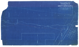
Blueprint showing proposed pipeline for gravity water supply at Las Vegas, Nevada, February 16, 1905
Date
1905-02-16
Description
'Office of Chief Engineer, Los Angeles, Cal., Feb. 16, 1905.' '2-18-17' hand-printed in lower right corner. Proposed pipeline is printed in red. Scale [1:6,000]. 1 inch to 500 feet. San Pedro, Los Angeles & Salt Lake Railroad Company. Office of Chief Engineer
Image
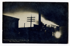
Fire in Goldfield, Nevada: postcard
Description
Fire in Goldfield, Nevada, night of April 15th '09. There is a handwritten message on back. Photographer credit: Bertram.
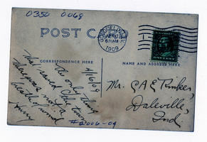
Fire in Goldfield, Nevada: postcard
Description
Fire in Goldfield, Nevada, night of April 15th '09. There is a handwritten message on back. Photographer credit: Bertram.
Offsite Environmental Monitoring Report: Radiation Monitoring Around United States Nuclear Test Areas, Calendar Year 1991, EPA, 1992 January
Level of Description
File
Archival Collection
Yucca Mountain Site Characterization Office Collection
To request this item in person:
Collection Number: MS-00091
Collection Name: Yucca Mountain Site Characterization Office Collection
Box/Folder: Box 48
Collection Name: Yucca Mountain Site Characterization Office Collection
Box/Folder: Box 48
Archival Component
Don Schuyler Sr., approximately 1-2 years old with his maternal grandfather Levi Schaefle in Los Angeles, California: photographic print, approximately 1906
Level of Description
Item
Archival Collection
Schuyler Family Photograph Collection
To request this item in person:
Collection Number: PH-00038
Collection Name: Schuyler Family Photograph Collection
Box/Folder: Digital File 00
Collection Name: Schuyler Family Photograph Collection
Box/Folder: Digital File 00
Archival Component
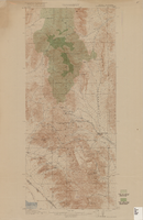
Topographic map of Goodsprings quadrangle, Nevada and California, 1919
Date
1919
Description
'R.B. Marshall, Chief Geographer; Geo. R. Davis, Geographer in charge; Topography by N.E. Ballmer and Roscoe Reeves; Control by J.E. Blackburn and L.F. Biggs. Surveyed in 1915-1916.' 'Edition of 1919.' Relief shown by hachures and spot heights. Title in lower right margin: Goodsprings. In center of top margin: Topography. Includes compilation diagram. Indicates location and density of cedar trees. Shows small portion of San Bernardino County, California. Published by U.S. Geological Survey. Scale 1:62,500 (W 115°35'00"--W 115°24'00"/N 36°02'30"--N 35°42'30"). 'Contour interval 50 feet. Datum is mean sea level.'
Text
New York: Volberg, Rachel A., "Gambling and Problem Gambling in New York: A 10-Year Replication Survey, 1986 to 1996" report, 1996 July
Level of Description
File
Archival Collection
Katherine A. Spilde Papers on Native American Gaming
To request this item in person:
Collection Number: MS-00092
Collection Name: Katherine A. Spilde Papers on Native American Gaming
Box/Folder: Box 15
Collection Name: Katherine A. Spilde Papers on Native American Gaming
Box/Folder: Box 15
Archival Component
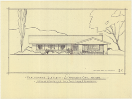
Architectural drawing of residential home in Boulder City, Nevada, preliminary elevation, 1962
Date
1962
Archival Collection
Description
Preliminary drawing of front exterior elevation of a ranch-style residential home in Boulder City, Nevada.
Architecture Period: Mid-Century ModernistImage
Pagination
Refine my results
Content Type
Creator or Contributor
Subject
Archival Collection
Digital Project
Resource Type
Year
Material Type
Place
Language
Records Classification
