Search the Special Collections and Archives Portal
Search Results
Reproduction of an original image from early 1900s of Lois Kellogg posed in a regal outfit: photographic print, approximately 1950 to 1990
Level of Description
Item
Archival Collection
Denny Lynch Photograph Collection
To request this item in person:
Collection Number: PH-00255
Collection Name: Denny Lynch Photograph Collection
Box/Folder: Folder 05
Collection Name: Denny Lynch Photograph Collection
Box/Folder: Folder 05
Archival Component
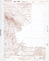
Map of Ely Range Quadrangle, Lincoln County, Nevada, 1921
Date
1921
Description
'Edition of 1921.' 'W. H. Herron, Acting Chief Geographer; Geo. R. Davis, Geographer In Charge; Topography by H. H. Hodgeson, N. E. Ballmer, and W. B. Upton, Jr.; Control by H. H. Hodgeson, Roscoe Reeves, and D. S. Birkett. Surveyed in 1916.' At top of map: ' Topography, State of Nevada.' At upper left corner: ' Department of the Interior, Albert B. Fall, Secretary; U.S. Geological Survey, George Otis Smith, Director.' Southern Nevada Mining Map Collection. 15 minute series (topographic) Nevada.
Image
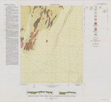
Geologic map of the Lathrop Wells quadrangle, Nye County, Nevada, 1970
Date
1970
Description
58 x 47 cm., on sheet 74 x 84 cm., folded in envelope 30 x 24 cm. Relief shown by contours and spot heights. "Bedrock geology mapped by B.C. Burchfiel, 1961, and by E.J. McKay and K.A. Sargent, 1965-66. Surficial geology mapped by A.T. Fernald, 1968." Includes cross sections, description of map units, and location map. "Prepared in cooperation with the U. S. Atomic Commission." Original publisher: Interior, Geological Survey, Series: Geologic quadrangle map GQ, Scale: 1:24 000.
Image
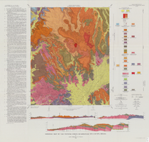
Geologic map of the Topopah Spring quadrangle, Nye County, Nevada, 1970
Date
1970
Description
58 x 46 cm., on sheet 84 x 88 cm., folded in envelope 30 x 24 cm. Relief shown by contours and spot heights. "Geology mapped in 1962-63." Includes description of map units, colored columnar section, 3 colored cross sections, and quadrangle location map. "Prepared in cooperation with the U. S. Atomic Commission." Original publisher: Interior, Geological Survey, Series: Geologic quadrangle map GQ, Scale: 1:24 000.
Image
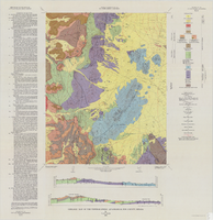
Geologic map of the Tippipah Spring quadrangle, Nye County, Nevada, 1963
Date
1963
Description
58 x 46 cm., on sheet 84 x 81 cm., folded in envelope 30 x 24 cm. Relief shown by contours and spot heights. "Geology by P.P. Orkild, 1959-60, paleotopography by D.L. Healey and C.H. Miller, 1959-60." Series statement from envelope. Includes description of map units, 2 col. cross sections, and quadrangle location map. "Prepared in cooperation with the U. S. Atomic Commission." Original publisher: Interior, Geological Survey, Series: Geologic quadrangle map GQ, Scale: 1:24 000.
Image
New Year's Address for 1857: As Ye Sow, so shall Ye Reap by A.L.O.E.. Edinburgh: Gall & Ingliss, 1857
Level of Description
Item
Archival Collection
Mavis Eggle "Books as They Were Bought" Collection
To request this item in person:
Collection Number: MS-01144
Collection Name: Mavis Eggle "Books as They Were Bought" Collection
Box/Folder: Box 28
Collection Name: Mavis Eggle "Books as They Were Bought" Collection
Box/Folder: Box 28
Archival Component
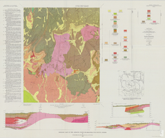
Geologic map of the Ammonia Tanks quadrangle, Nye County, Nevada, 1967
Date
1967
Description
58 x 46 cm., on sheet 84 x 100 cm., folded in envelope 30 x 24 cm. Relief shown by contours and spot heights. "Base by U.S. Geological Survey, 1961." "Geology mapped in 1961-65." "Contour interval 20 feet." Includes 3 col. cross sections, 1 index map, text with bibliography, and quadrangle location map. "Prepared in cooperation with the U. S. Atomic Commission." Original publisher: Interior, Geological Survey, Series: Geologic quadrangle map GQ, Scale: 1:24 000.
Image
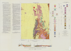
Geologic map of the Belted Peak quadrangle, Nye County, Nevada, 1967
Date
1967
Description
45 x 36 cm., on sheet 64 x 89 cm., fold. in envelope 30 x 24 cm. Relief shown by contours and spot heights. "Contour interval 40 feet." "Prepared in cooperation with the U.S. Atomic Energy Commission." "Geology mapped in 1962-63." Includes text, 2 col. cross sections, and quadrangle location map. Original publisher: U.S. Geological Survey, Series: Geologic quadrangle map GQ, Scale: 1:62 500.
Image
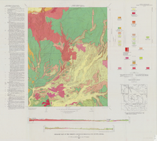
Geologic map of the Thirsty Canyon quadrangle, Nye County, Nevada, 1966
Date
1966
Description
57 x 46 cm., on sheet 83 x 91 cm., folded in envelope 30 x 24 cm. Relief shown by contours and spot heights. "Geology mapped in 1963." Includes 2 colored cross sections, index map, text, and quadrangle location map. "Prepared in cooperation with the U. S. Atomic Commission." Original publisher: Interior, Geological Survey, Series: Geologic quadrangle map GQ, Scale: 1:24 000.
Image
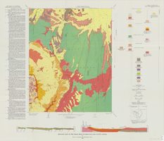
Geologic map of the Trail Ridge quadrangle, Nye County, Nevada, 1968
Date
1968
Description
58 x 46 cm., on sheet 79 x 91 cm., folded in envelope 30 x 24 cm. Relief shown by contours and spot heights. "Prepared in cooperation with the U.S. Atomic Energy Commission." "Base by U.S. Geological Survey, 1962." "Geology mapped in 1963." "Contour interval 20 feet." Includes text, 2 col. cross sections, quadrangle location map, and 1 index map. Original publisher: Interior, Geological Survey, Series: Geologic quadrangle map GQ, Scale: 1:24 000.
Image
Pagination
Refine my results
Content Type
Creator or Contributor
Subject
Archival Collection
Digital Project
Resource Type
Year
Material Type
Place
Language
Records Classification
