Search the Special Collections and Archives Portal
Search Results

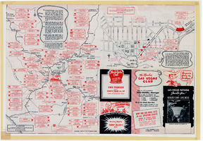
Map of Las Vegas, Nevada, July 1947
Date
Description
Text

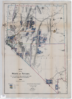
Map of the state of Nevada to accompany the annual report of the Commr. Genl. Land Office, October 2, 1866
Date
Description
Image

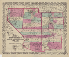
Map of the territories of New Mexico, Arizona, Colorado, Nevada, and Utah, 1855
Date
Description
Image

Architectural drawings of Fine Arts Building, University of Nevada Southern Regional Branch, Las Vegas, Nevada, east and north exterior elevations, July 15, 1963
Date
Archival Collection
Description
East and north exterior elevations of the Fine Arts Building (later to become the Judy Bayley Theatre) at the University of Nevada Southern Regional Branch, Las Vegas, Nevada (later University of Nevada, Las Vegas). Scale: 1/8" = 1'-0". "Sheet A-9 of 26." "Drawn: JM. Checked: JBM. Date 10 July 63. Submittal dates: preliminary 12-7-62; intermediate 3-17-63; final 7-15-63." "Bolt , Beranek and Newman Inc., consultants in acoustics. D'autremont-Helms & Assoc., consulting mechanical engineers. Helin Engineering Co., electrical engineers." "Fund code no. 82301." "State of Nevada Planning Board, Carson City, Nevada."
Site Name: University of Nevada. Southern Regional Division
Address: 4505 S. Maryland Parkway
Image

Architectural drawings of Fine Arts Building, University of Nevada Southern Regional Branch, Las Vegas, Nevada, west and south exterior elevations, July 15, 1963
Date
Archival Collection
Description
West and south exterior elevations of the Fine Arts Building (later to become the Judy Bayley Theatre) at the University of Nevada Southern Regional Branch, Las Vegas, Nevada (later University of Nevada, Las Vegas). Scale: 1/8" = 1'-0". "Sheet A-10 of 26." "Drawn: JM. Checked: JBM. Date 10 July 63. Submittal dates: preliminary 12-7-62; intermediate 3-17-63; final 7-15-63." "Bolt , Beranek and Newman Inc., consultants in acoustics. D'Autremont-Helms & Assoc., consulting mechanical engineers. Helin Engineering Co., electrical engineers." "Fund code no. 82301." "State of Nevada Planning Board, Carson City, Nevada."
Site Name: University of Nevada. Southern Regional Division
Address: 4505 S. Maryland Parkway
Image

Topographic map of Goodsprings quadrangle, Nevada and California, 1919
Date
Description
Text

Map of Ely Range Quadrangle, Lincoln County, Nevada, 1921
Date
Description
Image

UNLV Professor Brendan O'Toole, and an undergraduate intern from Rutgers University join Yong Dawson in helping to take measurements from Dawson's 4-year-old daughter Hailey Dawson: digital photographs
Date
Archival Collection
Description
Image
Kelley, Elizabeth Lorain, "Validation of current body composition estimation equations for men over 60 years of age", 1992 Fall
Level of Description
Archival Collection
Collection Name: University of Nevada, Las Vegas Theses, Dissertations, and Honors Papers
Box/Folder: Box 081
Archival Component
Blakey, Linda S, "Food Utilization and Habitat Preference of youn-of-the-year Largemouth Bass [Micripterus Salmoides] in the Atchafelaya Basin, Louisiana.", 1982
Level of Description
Archival Collection
Collection Name: University of Nevada, Las Vegas Theses, Dissertations, and Honors Papers
Box/Folder: Box 001
Archival Component
