Search Results
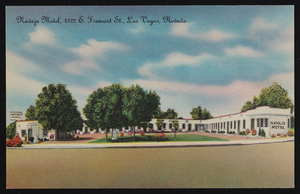
Artistic rendition of the Navajo Motel in Las Vegas, Nevada: postcard
Date
Archival Collection
Description
Image
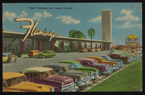
Artistic rendition of the Hotel Flamingo in Las Vegas, Nevada: postcard
Date
Archival Collection
Description
Image
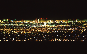
Views of Las Vegas Skyline, Nevada: photographic print
Date
Archival Collection
Description
The city of Las Vegas, NV. Photographs show the city skyline at night while the neon signs are lit and at dusk with the moon over the horizon.
Image
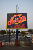
Juicy's Giant Burgers mounted sign, Reno, Nevada
Date
Archival Collection
Description
View of the sign for Juicy's Giant Bugers.
Image

The Lace flag mounted sign, Carson City, Nevada
Date
Archival Collection
Description
View of a sign for The Lace at dusk with unlit neon.
Image
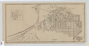
Cadastral map of Boulder City, Nevada, 1940
Date
Description
Image
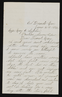
Letter from John M. Bunker, Eldorado Canyon, Nevada to Mary Etta Syphus, Panaca, Nevada
Date
Archival Collection
Description
From the Syphus-Bunker Papers (MS-00169). The folder contains an original handwritten letter, a typed transcription of the same letter, and a copy of original letter attached.
Text

Topographic map of groundwater in the southeast quadrangle of Las Vegas, Nevada, 1980
Date
Description
Text
Nevada Burial Records of Stewart Ranch
Date
Archival Collection
Description
The Nevada Burial Records of Stewart Ranch (1905-1913) consist of a ledger recording those buried at Stewart Ranch in Las Vegas, Nevada. The entries in the ledger document the names of the deceased and where they died. Some entries have additional information explaining how the person died and their height and weight.
Text
Las Vegas, Nevada - retirement of Lots 3 and 4
Date
Archival Collection
Description
Text