Search Results
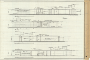
Architectural drawing of the Rugar residence, Las Vegas, Nevada, exterior elevations, December 31, 1962
Date
Archival Collection
Description
Drawings of exterior elevations A, B, C and D for the Rugar residence, Las Vegas, Nevada. "Sheet no. 8 of 20." "James Brooks McDaniel, A.I.A., Architect." "Job no. R62-1." "Drawn by J.M. Checked by J.Mc." "Scale: 1/4" = 1'-0"."
Site Name: Rugar residence
Image
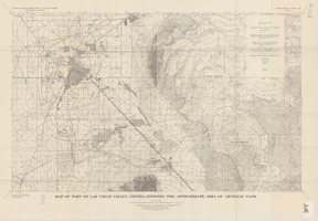
Map of part of Las Vegas Valley, Nevada, showing the approximate area of artesian flow, 1965
Date
Description
Image

Map of the Las Vegas ground-water basin, Clark, Nye, and Lincoln Counties, Nevada, 1965
Date
Description
Image
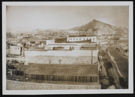
Goldfield and Tonopah, Nevada: photographic prints
Date
Archival Collection
Description
Image
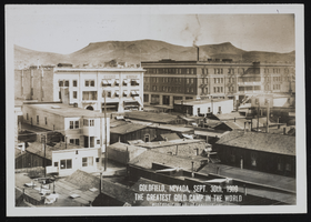
Goldfield and Tonopah, Nevada: photographic prints
Date
Archival Collection
Description
Image
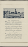
Tonopah, Nevada Mining Town Photograph Album
Identifier
Abstract
The Tonopah, Nevada Mining Town Photograph Album (approximately 1908) consists of twenty-two photographs in a leather-bound album. The photographs depict businesses, townspeople, street scenes, and mining operations in Tonopah, Nevada and the surrounding areas of Goldfield, Nevada and Mina, Nevada. Also included are photographs of a fire on May 12, 1908 that destroyed a block of commercial buildings in Tonopah, which were taken by local photographer E. W. Smith., and views of the downtown area both before and after the fire.
Archival Collection
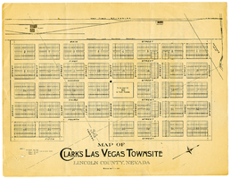
Map of Clark's Las Vegas Townsite, Lincoln County, Nevada, May 10, 1905
Date
Archival Collection
Description
Text
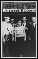
Diamond Jim's Nevada Club located in Las Vegas, Nevada: postcards
Date
Archival Collection
Description
Image

Map showing parts of eastern and southeastern Nevada and southwestern Utah, circa 1873
Date
Archival Collection
Description
Image