Search Results
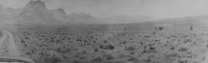
Photograph of the Old Spanish Trail, Southern Nevada, early 1900s
Date
1900 to 1930
Archival Collection
Description
Black and white view of the Old Spanish Trail in the early 1900s.
Image
Smoky Valley, Nevada and Round Mountain, Nevada, 1900-1988
Level of Description
Series
Scope and Contents
Materials contain photographs of the Smoky Valley and Round Mountain area from 1905 to 1980, and document the activities of the Carver, Carver-Duhme, Carver-Book, Rogers, Lofthouse-Berg, and Zaval families. Materials include photographs of Carver's Station, ranching, community events, animals, placer mining, Round Mountain Hotel, Round Mountain High School, mills, Main Street in Tonopah, and the Belmont Mine.
Archival Collection
Nye County, Nevada Photograph Collection
To request this item in person:
Collection Number: PH-00221
Collection Name: Nye County, Nevada Photograph Collection
Box/Folder: N/A
Collection Name: Nye County, Nevada Photograph Collection
Box/Folder: N/A
Archival Component
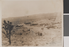
Photograph of Searchlight, Nevada, circa early 1900s
Date
1900 to 1930
Archival Collection
Description
A distant view of tents and cabins in Searchlight.
Image
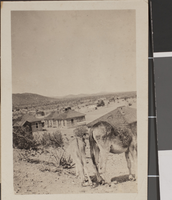
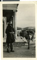
Photograph of Searchlight, Nevada, circa early 1900s
Date
1900 to 1930
Archival Collection
Description
Houses in Searchlight. In the foreground of the image are the backsides of two donkeys.
Image
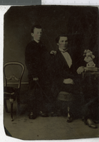
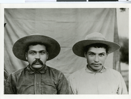
Tintype of unidentified men, Nevada, 1900-1910
Date
1900 to 1910
Archival Collection
Description
A photograph of two unidentified young gentlemen posing.
Image
Photograph of a prospector, Reno, Nevada, 1900-1930
Date
1900 to 1930
Archival Collection
Description
A picture of a prospector and his burro in front of the First State Bank.
Image
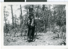
Photograph of Mrs. J.T. McWilliams, Nevada, 1900-1920
Date
1900 to 1920
Archival Collection
Description
A black and white picture of Mrs. J.T. McWilliams posing in a forest.
Image
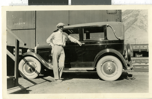
Photograph of Alfred Moser, Nevada, 1900-1930
Date
1900 to 1930
Archival Collection
Description
A picture of Alfred Arthur Moser. Handwritten inscription from behind photograph, "307 N. 9th St. Las Vegas, NV Phone 1137. Railroad yards-SPLA SLC." Street Address: 307 North 9th Street
Image
Boomtown, Inc.: annual reports, prospectus, advertisements, and Smith Barney stock reports, 1992-1996
Level of Description
File
Archival Collection
Gary W. Royer Collection on Gaming
To request this item in person:
Collection Number: MS-00658
Collection Name: Gary W. Royer Collection on Gaming
Box/Folder: Box 047 (Restrictions apply)
Collection Name: Gary W. Royer Collection on Gaming
Box/Folder: Box 047 (Restrictions apply)
Archival Component
Photograph of James and Tweed Wilson, Southern Nevada, circa 1900
Date
1898 to 1902
Archival Collection
Description
James and Tweed Wilson , circa 1900 (dup. #0010 0096)
Image