Search the Special Collections and Archives Portal
Search Results

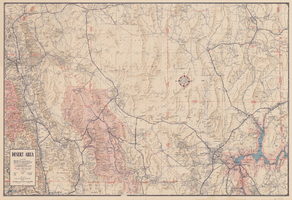
Map of desert area in southern Nevada and southeastern California, circa 1955
Date
1953 to 1957
Description
Covers the desert area in the Owens Valley, Death Valley, Las Vegas and Lake Mead region; bordered by Bishop and Inyokern, California, and Pioche and Lake Mead, Nevada. 'Cartography by W.T. Taylor, W.A. Neely. Color separation by H.P. Pflum; Relief by F.M. Burke; Typography by W.R. Williams. Field mapping by H.A. Cline, G.L. Boyd, K.R. Reed., W.A. Neely, R.P. Conklin.' 'Copyright by Automobile Club of Southern California.' Scale 1:483,537. 1 in. to approx. 8 miles (W 120°--W 114°/N 39°--N 33°). 'Map number 2217.'.
Text

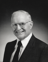
Photograph of Paul Fisher, Boulder City, Nevada, circa 1980s
Date
1980 to 1989
Archival Collection
Description
A portrait of Paul Fisher in Boulder City, Nevada. Fisher was the owner of the Fisher Pon Company, and a resident of Boulder City, Nevada.
Image

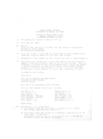
Meeting minutes for Consolidated Student Senate, University of Nevada, Las Vegas, February 1, 1974
Date
1974-02-01
Archival Collection
Description
Agenda and meeting minutes for the University of Nevada, Las Vegas Student Senate. CSUN Session 2 Meeting Minutes and Agendas.
Text
Southern and Central Nevada Papers, 1950-1984
Level of Description
Series
Scope and Contents
The Gilbert Buck Papers on southern and central Nevada (1950-1984) focus on water, sewer, public lands, (master reports, designs, standards, flood and drainage reports, and land specifications) and real estate (reports, housing and mobile home development information, newsletters, surveys, and Buck Realty negotiations). Also included are the books and information on seminars Gilbert Buck hosted on investing in raw land.
Archival Collection
Gilbert Buck Papers
To request this item in person:
Collection Number: MS-00281
Collection Name: Gilbert Buck Papers
Box/Folder: N/A
Collection Name: Gilbert Buck Papers
Box/Folder: N/A
Archival Component

UNLV students pose in fall color December 5, 2014 at the University of Nevada, Las Vegas: digital photographs
Date
2014-12-05
Archival Collection
Description
Photographs from the University of Nevada, Las Vegas Creative Services Records (2010s) (PH-00388-05).
Image

UNLV's Marya Shegog poses July 23, 2015 at the University of Nevada, Las Vegas: digital photographs
Date
2015-07-23
Archival Collection
Description
Photographs from the University of Nevada, Las Vegas Creative Services Records (2010s) (PH-00388-05).
Image

UNLV's Jill Zimbelman poses June 26, 2015 at the University of Nevada, Las Vegas: digital photographs
Date
2015-06-26
Archival Collection
Description
Photographs from the University of Nevada, Las Vegas Creative Services Records (2010s) (PH-00388-05).
Image

UNLV Telecom group poses for portrait September 1, 2015 at the University of Nevada, Las Vegas: digital photographs
Date
2015-09-01
Archival Collection
Description
Photographs from the University of Nevada, Las Vegas Creative Services Records (2010s) (PH-00388-05).
Image

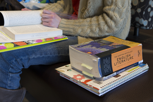
Students and campus scenes taken February 18, 2014 at the University of Nevada, Las Vegas: digital photographs
Date
2014-02-18
Archival Collection
Description
Photographs from the University of Nevada, Las Vegas Creative Services Records (2010s) (PH-00388-05).
Image

Scenes from the UNLV campus taken February 5, 2014 at the University of Nevada, Las Vegas: digital photographs
Date
2014-02-05
Archival Collection
Description
Photographs from the University of Nevada, Las Vegas Creative Services Records (2010s) (PH-00388-05).
Image
Pagination
Refine my results
Content Type
Creator or Contributor
Subject
Archival Collection
Digital Project
Resource Type
Year
Material Type
Place
Language
Records Classification
