Search the Special Collections and Archives Portal
Search Results
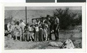
Photograph of people in Moapa, Nevada, 1927
Date
1927
Archival Collection
Description
Description given with photograph: "Moapa by pump station, 1927" List of names given on back of photograph: Mother; Gilda Mosbach; Roy and Earl Mosback; Bessie; Leon, jr.; Leon, sr.; Charlot and Rawhne Mosbach; Jim Adams; Frances Adows; Margy Earl Rockwell; Harry Jamison"
Image
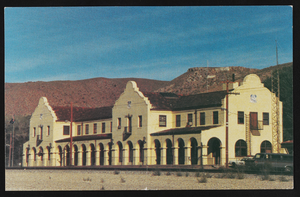
Railroad depot in Caliente, Nevada: postcard
Date
1940 (year approximate) to 1990 (year approximate)
Archival Collection
Description
From the Harvey's Hotel and Casino Postcard Collection (PH-00367) -- Caliente, named for its hot springs, is the largest city (pop. 1,200) in Lincoln County. The Mission-Style railroad depot was built in 1923. Amtrak trains stop daily with service to Salt Lake City and Las Vegas. The impressive structure also houses city offices, the Chamber of Commerce, and an art gallery.
Image
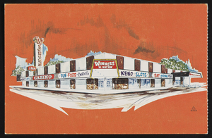
Winner's Inn in Winnemucca, Nevada: postcard
Date
1940 (year approximate) to 1990 (year approximate)
Archival Collection
Description
From the Harvey's Hotel and Casino Postcard Collection (PH-00367) -- Joe Mackie's Winners Inn. Winnemucca's newest Motor Hotel. Seventy five luxurious rooms, pool, TV, coffee shop, dining room, and show lounge. 150 liberal slots.
Image
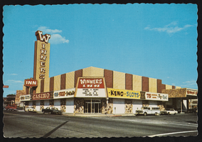
Winner's Inn in Winnemucca, Nevada: postcard
Date
1940 (year approximate) to 1990 (year approximate)
Archival Collection
Description
From the Harvey's Hotel and Casino Postcard Collection (PH-00367) -- Joe Mackie's Winners Inn. Winnemucca's newest Motor Hotel. Seventy five luxurious rooms, pool, TV, coffee shop, dining room, and show lounge. 150 liberal slots.
Image
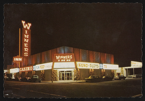
Winner's Inn in Winnemucca, Nevada: postcard
Date
1940 (year approximate) to 1990 (year approximate)
Archival Collection
Description
From the Harvey's Hotel and Casino Postcard Collection (PH-00367) -- Joe Mackie's Winners Inn. Winnemucca's newest Motor Hotel. Seventy five luxurious rooms, pool, TV, coffee shop, dining room, and show lounge. 150 liberal slots.
Image
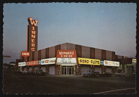
Winner's Inn in Winnemucca, Nevada: postcard
Date
1940 (year approximate) to 1990 (year approximate)
Archival Collection
Description
From the Harvey's Hotel and Casino Postcard Collection (PH-00367) -- Joe Mackie's Winners Inn. Winnemucca's newest Motor Hotel. Seventy five luxurious rooms, pool, TV, coffee shop, dining room, and show lounge. 150 liberal slots.
Image
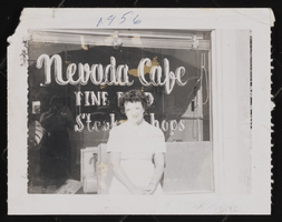
Photograph of a woman at the Nevada Cafe, Tonopah (Nev.), 1956
Date
1956
Archival Collection
Description
An unidentified woman standing in the front of the Nevada Cafe in Tonopah (Nev.), 1956
Image
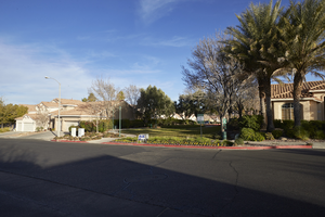
Paseo Verde Drive, Henderson, Nevada: digital photograph
Date
2018-02-03
Archival Collection
Description
Small neighborhood open spaces like this one in the Richmond Terrace Green Valley Ranch neighborhood are common along Paseo Verde Parkway near Valle Verde Drive in Henderson, Nevada.
Image
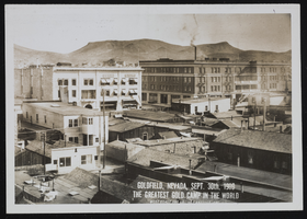
Goldfield and Tonopah, Nevada: photographic prints, image 001
Description
From the Nevada Mining Photograph Collection (PH-00361) -- Stamped on the photograph, "Goldfield, Nevada, Sept. 30th, 1909 The greatest gold camp in the world. West Coast Art Co. Los Angeles, Cal".
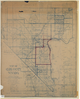
Map of Clark County, Nevada, 1927
Date
1927
Description
'Compiled by J.T. McWilliams from official county records, U.S. Land Dept. surveys, railroad co. field maps and many personal surveys. Made in 1927 by J.T. McWilliams, C.E.' Includes township and road districts, school districts, mining districts, railroads, wagon roads, trails, springs and artesian wells. Scale [ca. 1:316,800. 1 in. to approx. 5 miles] (W 116°--W 114°/N37--N35). Relief shown by hachures. Blueline print. Library's copy 1 has one area outlined by hand in red. Library's copy 2 has school districts outlined in red and green pencil and labeled in pencil by hand.
Image
Pagination
Refine my results
Content Type
Creator or Contributor
Subject
Archival Collection
Digital Project
Resource Type
Year
Material Type
Place
Language
Records Classification
