Search the Special Collections and Archives Portal
Search Results
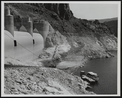
Nevada Spillway at the Hoover Dam: photographic print
Date
1959-03-06
Archival Collection
Description
From the Morgan Sweeney Photograph Collection (PH-00228). Low water as of 11:00 A.M at the Nevada spillway on May 13, 1954.
Image
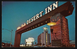
The Desert Inn in Las Vegas, Nevada: postcard
Date
1940 (year approximate) to 1990 (year approximate)
Archival Collection
Description
From Harvey's Hotel and Casino Postcard Collection (PH-00367) -- View of the Desert Inn sign and hotel tower in Las Vegas, Nevada.
Image
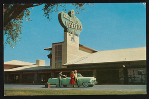
The Desert Inn in Las Vegas, Nevada: postcard
Date
1940 (year approximate) to 1990 (year approximate)
Archival Collection
Description
From Harvey's Hotel and Casino Postcard Collection (PH-00367) -- Guests arriving at Wilbur Clark's Desert Inn in Las Vegas, Nevada.
Image
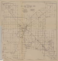
Map of Las Vegas Valley artesian basin, circa 1940
Date
1938 to 1942
Description
Scale [ca. 1:72,000. 1 in.=approx. 6,000 feet] (W 115°10´--W 115°/N 36°20´--N 36´). Shows wells, springs, boundary between valley fill and bedrock, and ground water district boundaries for Las Vegas Metropolitan Area and North Las Vegas. "Figure 1." Nevada. State Engineer
Image
Postcard of Eureka, Nevada, circa July 1913
Date
1913-06
Archival Collection
Description
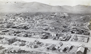
A view of Eureka, Nevada sent in July 1913. The postcard was addressed to Mrs. Helen J. Stewart, Las Vegas, Nevada, Clark County and read: "July 17, 1913, Dear Mrs. Stewart, Some time since you saw this ? does it look natural to you? Am having a lovely visit, it is so nice and cool here. Lovingly, Anna B."
Image
Pass in the Sierra Nevada Mountains of California: drawing
Date
1970
Archival Collection
Description
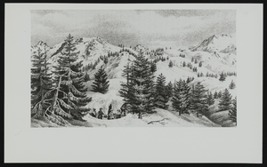
From the UNLV Special Collections Photograph Collection on Book Illustrations (PH-00170) -- Pass in the Sierra Nevada Mountains of California. Handwritten on verso: "Jackson, Donald, and Mary Lee Spence, editors. Expeditions of John Charles Fremont. Vol. 1, Urbana, Chicago, and London: University of Chicago Press, 1970. p. 636." [MLA8 citation format] "Pass in the Sierra Nevada of California".
Image
Map of Nevada, Lincoln County, Ely Range Quadrangle, Lincoln County (Nev.), 1921
Date
1921
Description
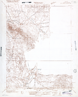
Map of Nevada, Lincoln County, Ely Range Quadrangle, Lincoln County (Nev.), 1921
Image
The Frontier Club in Las Vegas, Nevada: postcard
Date
1900 (year approximate) to 1999 (year approximate)
Archival Collection
Description
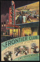
From the UNLV Libraries Single Item Accession Photograph Collection (PH-00171). Promotional postcard on the frontier Club, Las Vegas, Nevada
Image
University of Nevada, Las Vegas Institute for Security Studies Training Video on Terrorism
Identifier
UA-00026
Abstract
University of Nevada, Las Vegas Institute for Security Studies Training Video on Terrorism includes copies of the institute's training video for resort employees called "7 Signs of Terrorism" that was produced in 2008. The collection includes English language and Spanish language versions of the video.
Archival Collection
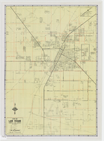
Map of metropolitan Las Vegas, Nevada area, circa 1957
Date
1955 to 1960
Description
Compiled and drawn by California State Automobile Association.--Panel ; "California State Automobile Association. Nevada Division." ; Includes indexes ; Includes inset maps of Nellis Air Force Base and area bounded on the north by Cheyenne Ave. and by Charleston Blvd. on the south. Signature of Elton M. Garrett of back of map. California State Automobile Association.
Text
Pagination
Refine my results
Content Type
Creator or Contributor
Subject
Archival Collection
Digital Project
Resource Type
Year
Material Type
Place
Language
Records Classification
