Search the Special Collections and Archives Portal
Search Results

Topographic map of groundwater in the southeast quadrangle of Las Vegas, Nevada, 1980
Date
Description
Text
Hotel Nevada, Las Vegas, Nevada, photograph and negative, approximately 1930 to 1931
Level of Description
Archival Collection
Collection Name: Elton and Madelaine Garrett Photograph and Architectural Drawing Collection
Box/Folder: Folder 05, Box 19
Archival Component
Hotel Nevada, Las Vegas, Nevada, photograph and negative, approximately 1930 to 1931
Level of Description
Archival Collection
Collection Name: Elton and Madelaine Garrett Photograph and Architectural Drawing Collection
Box/Folder: Folder 05, Box 19
Archival Component
Nevada Gaming Publishing, "Nevada Gaming Directory, Mail Merge Diskette", 1996
Level of Description
Archival Collection
Collection Name: Gary W. Royer Collection on Gaming
Box/Folder: Box 143 (Restrictions apply)
Archival Component

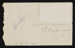
Letter and envelope from May [Bunker?]. Bunkerville, Nevada to John M. Bunker Eldorado Canyon, Nevada
Date
Archival Collection
Description
From the Syphus-Bunker Papers (MS-00169). The folder contains an original handwritten letter, a typed transcription of the same letter, the original envelope with the stamp removed, and a copy of the original letter.
Text

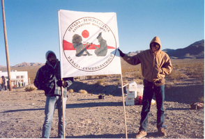
Two unidentified protestors hold a Nevada-Semipalatinsk sign: photographic print
Date
Archival Collection
Description
Image

University of Nevada, Las Vegas (UNLV) 29th commencement program
Date
Archival Collection
Description
Commencement program from University of Nevada, Las Vegas Commencement Programs and Graduation Lists (UA-00115).
Text

Photograph of Rioville, Nevada, circa 1900
Date
Archival Collection
Description
Rioville, also known as Bonelli's Landing, Nevada.
Transcribed Notes: Notes on attached sheet: Rioville, Nevada (also known as Bonelli's Landing). It now lies at the bottom of Lake Mead, formed behind Hoover Dam. Rioville was founded by Daniel Bonelli, a Mormon pioneer sent by Brigham Young, about 1865 at the mouth of the Virgin River.
Image
University of Nevada, Las Vegas Graduate Student Association Photographs
Identifier
Abstract
The University of Nevada, Las Vegas Graduate Student Association Photographs consist of photographs documenting the Graduate Student Association's elections, activities, and events from approximately 1980 to 1983. The collection includes color prints and polaroid photographs from art auctions, award ceremonies, picnic activities, and holiday events.
Archival Collection

Aid for AIDS of Nevada benefit show at the Huntridge Theater: flyer
Date
Archival Collection
Description
Text
