Search Results
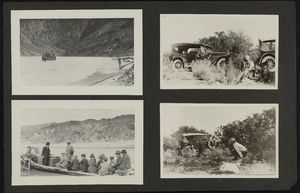
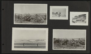
Album 6: scenes in Southern Nevada, including the Kiel Ranch, Rhyolite, Nevada, and Thomas, Nevada: photographic prints, image 004
Description
From the Maurine and Fred Wilson and Dr. William S. Park Photograph Albums (PH-00222) -- Album 6

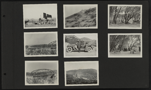
Album 6: scenes in Southern Nevada, including the Kiel Ranch, Rhyolite, Nevada, and Thomas, Nevada: photographic prints, image 005
Description
From the Maurine and Fred Wilson and Dr. William S. Park Photograph Albums (PH-00222) -- Album 6

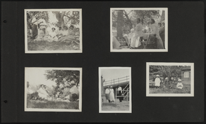
Album 6: scenes in Southern Nevada, including the Kiel Ranch, Rhyolite, Nevada, and Thomas, Nevada: photographic prints, image 006
Description
From the Maurine and Fred Wilson and Dr. William S. Park Photograph Albums (PH-00222) -- Album 6
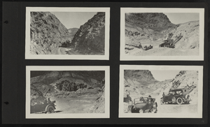
Album 6: scenes in Southern Nevada, including the Kiel Ranch, Rhyolite, Nevada, and Thomas, Nevada: photographic prints, image 007
Description
From the Maurine and Fred Wilson and Dr. William S. Park Photograph Albums (PH-00222) -- Album 6
Album 6: scenes in Southern Nevada, including the Kiel Ranch, Rhyolite, Nevada, and Thomas, Nevada: photographic prints, image 008
Description
From the Maurine and Fred Wilson and Dr. William S. Park Photograph Albums (PH-00222) -- Album 6

Album 6: scenes in Southern Nevada, including the Kiel Ranch, Rhyolite, Nevada, and Thomas, Nevada: photographic prints, image 009
Description
From the Maurine and Fred Wilson and Dr. William S. Park Photograph Albums (PH-00222) -- Album 6
Album 6: scenes in Southern Nevada, including the Kiel Ranch, Rhyolite, Nevada, and Thomas, Nevada: photographic prints, image 010
Description
From the Maurine and Fred Wilson and Dr. William S. Park Photograph Albums (PH-00222) -- Album 6

Album 6: scenes in Southern Nevada, including the Kiel Ranch, Rhyolite, Nevada, and Thomas, Nevada: photographic prints, image 011
Description
From the Maurine and Fred Wilson and Dr. William S. Park Photograph Albums (PH-00222) -- Album 6
Album 6: scenes in Southern Nevada, including the Kiel Ranch, Rhyolite, Nevada, and Thomas, Nevada: photographic prints, image 013
Description
From the Maurine and Fred Wilson and Dr. William S. Park Photograph Albums (PH-00222) -- Album 6

Album 6: scenes in Southern Nevada, including the Kiel Ranch, Rhyolite, Nevada, and Thomas, Nevada: photographic prints, image 014
Description
From the Maurine and Fred Wilson and Dr. William S. Park Photograph Albums (PH-00222) -- Album 6