Search the Special Collections and Archives Portal

Search Results
Display    Results Per Page
Displaying results 5271 - 5280 of 576376

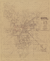
Las Vegas Valley map, Clark County, Nevada, June 1958

Date

1958

Description

'Compiled 1954. First revision - June 1958.' 'Area extends 9 miles north, 11 miles south, and 3 miles east, 3 miles west city limits of Las Vegas.' Original publisher: Campbell Realty. Scale [ca. 1:60,000. 1 in. to approx. 5,000 ft.]. Cadastral map. Hand-drawn red line around some sections on map.

Image

Balloon route excursion party, National Soldiers Home, Sawtelle, California. Jim Jeffries, C. A. Rinker, Rinker's girlfriend (identified from left to right): photographic print, approximately 1900-1910

Level of Description

Item

Archival Collection

C. A. Earle Rinker Photograph Collection of Goldfield, Nevada
To request this item in person:
Collection Number: PH-00350
Collection Name: C. A. Earle Rinker Photograph Collection of Goldfield, Nevada
Box/Folder: Folder 06

Archival Component
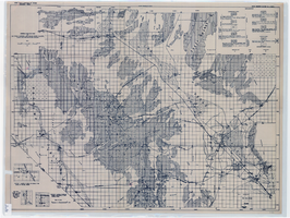
General geologic map of Las Vegas, Pahrump, and Indian Spring Valleys, Clark and Nye Counties, Nevada, 1948

Date

1948

Description

At top of map: 'United States Department of the Interior, Geological Survey. State Engineer of Nevada. Water resources bulletin No. 5, Plate 1.' Relief shown by spot heights. Includes 3 inset maps of wells and springs in the vicinity of Pahrump, Manse Ranch and Indian Springs, Nevada. Scale [ca. 1:126,720. 1 inch to approx. 2 miles] (W 116°--W 115°/N 40°--N 36°). Originally published as plate 1 in Geology and water resources of Las Vegas, Pahrump, and Indian Spring Valleys, Clark and Nye Counties, Nevada by George B. Maxey and C.H. Jameson (1948), which is number 5 of the Water resources bulletin published by the Nevada Office of the State Engineer.

Image
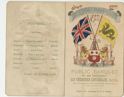
Menu for the public banquet to His Excellency Sir Chihchen Lofengluh, K.C.V.O., envoy extraordinary and Chinese Minister plenipotentiary to the Court of St. James, January, 12, 1900, South Western Hotel

Date

1900-01-12

Archival Collection

Description

Note: Mayor: Mr. Alderman G. A. Hussey Menu insert: Music Programs; Wine lists; Toasts Restaurant: South Western Location: Southampton, Hampshire, England

Text

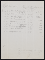
Various mining company records for Goldfield, Nevada

Date

1907 to 1921

Description

From the Charles S. Sprague and Benjamin Gill Papers on Nevada Mining (MS-00570).

Text

Topographic map of Nevada-California, Las Vegas quadrangle, 1951

Date

1951

Description

'Edition of Mar. 1908, reprinted 1951.' 'E.M. Douglas, geographer in charge; Topography and triangulation by R.H. Chapman, B.D. Stewart, J.E. Blackburn, and D.F.C. Moor. Surveyed in 1906-1907.' Scale 1:250,000 ; polyconic proj. (W 116°00--W 115°00/N 37°00--N 36°00). Relief shown by contours and spot heights. Title in lower-right corner: Nev.-Calif., Las Vegas. Contour interval 100 feet. Datum is mean sea level. U.S. Geological Survey

Image

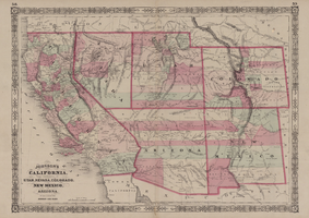
Map of California, with territories of Utah, Nevada, Colorado, New Mexico, and Arizona, 1864

Date

1864

Description

40 x 62 cm. Relief shown by hachures. Prime meridians: Greenwich and Washington. Page numbers at top: 58-59. "Entered according to act of Congress in the year 1864 by A. J. Johnson in the Clerk's Office of the District Court of the United States for the Southern District of New York." Original publisher: Johnson and Ward.

Image

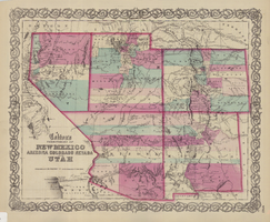
Map of the territories of New Mexico, Arizona, Colorado, Nevada, and Utah, 1855

Date

1855

Description

29 x 36 cm. Relief shown by hachures. Prime meridians: Greenwich and Washington. "Entered according to act of Congress in the year 1855 by J.H. Colton & Co. in the Clerk's Office of the Dist. Office of the U.S. for the Southern. Dist. of New York." Hand colored. Decorative border. Atlas p. number in lower-right margin: 67. Shows routes of explorers, proposed railroad routes, wagon route, mail route, Indian reserves and mines. On verso: History and statistical view of Mexico. Original publisher: J.H. Colton.

Image