Search the Special Collections and Archives Portal
Search Results
Congress Hotel, Dinner by the Chicago Association of Commerce in Honor of the Board of Trade of the City Chicago, menu, approximately 1900 to 1930
Level of Description
File
Archival Collection
UNLV University Libraries Menu Collection
To request this item in person:
Collection Number: MS-00436
Collection Name: UNLV University Libraries Menu Collection
Box/Folder: Box 106
Collection Name: UNLV University Libraries Menu Collection
Box/Folder: Box 106
Archival Component
The Royal Society anniversary dinner menu, St. Andrew's day, at the Hôtel Métropole, Whitehall Rooms, 1900 November 30
Level of Description
Item
Archival Collection
Bohn-Bettoni Menu Collection
To request this item in person:
Collection Number: MS-00793
Collection Name: Bohn-Bettoni Menu Collection
Box/Folder: Box 06
Collection Name: Bohn-Bettoni Menu Collection
Box/Folder: Box 06
Archival Component
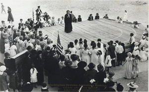
Postcard of commemoration of George Washington's birthday at Clark County High School, Las Vegas, circa mid 1900s
Date
1930 to 1949
Archival Collection
Description
Black and white image showing an overhead view of Washington's Birthday Anniversary Exercises at the Clark County High School, per the printed description at bottom of image.
Image
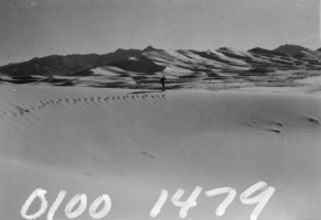
Film transparency of a man walking through desert sand dunes, Death Valley, California, circa mid 1900s
Date
1950 to 1999
Archival Collection
Description
Photograph of a man walking through Death Valley's sand dunes.
Image

Photograph of Jake Beckley, partner with Ed Von Tobel, Sr., next to supply wagon, LAs Vegas, circa 1900s
Date
1900 to 1909
Archival Collection
Description
Jake Beckley, partner with Ed Von Tobel, Sr., is shown next to supply wagon on its way to one of the mining camps of the Rhyolite or Beatty Districts. Physical object has an insert containg additional biographical information.
Image
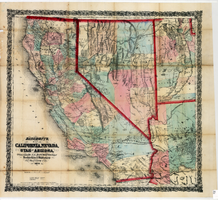
Bancroft's map of California, Nevada, Utah and Arizona, 1873
Date
1873
Description
Hand colored ; Relief shown by hachures and spot heights ; Prime meridian: Washington, D.C ; Shows railroads, proposed railroads and wagon roads, etc. Published by A.L. Bancroft & Company. Scale [ca. 1:1,520,640]. 1 in. to 24 miles (W 124°--W 111°/N 42°--N 32°).
Image
International Food Service Executives Association past presidents Frank Knapp, William R. Richter, Fred Klooz, and other unidentified men: photographic print, approximately 1925 to 1939
Level of Description
Item
Archival Collection
International Food Service Executives Association Photograph Collection
To request this item in person:
Collection Number: PH-00363
Collection Name: International Food Service Executives Association Photograph Collection
Box/Folder: Oversized Box SH-068
Collection Name: International Food Service Executives Association Photograph Collection
Box/Folder: Oversized Box SH-068
Archival Component
Four unidentified men standing outside Cassaway & Cope Hatters & Cleaners: photographic print, approximately 1900 to 1937
Level of Description
File
Archival Collection
Nevada Mining Photograph Collection
To request this item in person:
Collection Number: PH-00361
Collection Name: Nevada Mining Photograph Collection
Box/Folder: Oversized Box 22 (Restrictions apply)
Collection Name: Nevada Mining Photograph Collection
Box/Folder: Oversized Box 22 (Restrictions apply)
Archival Component
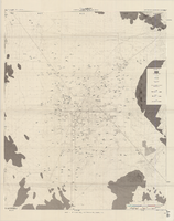
Map of well locations, Las Vegas Valley, Nevada, 1975
Date
1976
Description
'Cartography by Marj Thielke.' 'Prepared in cooperation with the State of Nevada, Department of Conservation and Natural Resources, Division of Water Resources.' Relief shown by contours. Shows township and range lines. Originally published as Plate 1 in Water-level changes associated with ground-water development in Las Vegas Valley, Nevada, 1971-75 : fourth progress report--summary of data / by James R. Harrill, published in 1976 by the Department of Conservation and Natural Resources, Division of Water Resources, as volume 22 of Water resources-information series report. Scale [ca. 1:69,696. 1 in.=approx. 1.1 miles] (W 115°20´--W 115°00´/N 36°20´--N 36°00´).
Image
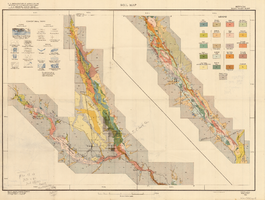
Soil map, Nevada, Moapa Valley sheet, 1923
Date
1923
Archival Collection
Description
'U.S. Department of Agriculture, Bureau of Chemistry and Soils; C.A. Browne, Acting Chief; Curtis F. Marbut, in charge, Soil Survey.' 'Macy H. Lapham, Inspector, District 5. Soils surveyed by F.O. Youngs, in charge, and E.J. Carpenter.' 'Field Operations, Bureau of Soils, 1923.' 'A, Hoen & Co. Lith. Baltimore, Md.' Shows township and range lines. Scale [1:63,360]. 1 in. = 1 mile (W 114°45´--W 114°18´/N 36°51´--N 36°24´). Library's copy has hand-written notes and has hand-drawn maps and notes on verso.
Image
Pagination
Refine my results
Content Type
Creator or Contributor
Subject
Archival Collection
Digital Project
Resource Type
Year
Material Type
Place
Language
Records Classification
