Search the Special Collections and Archives Portal
Search Results
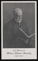
William H. Shockley, portrait with a book: photographic print
Date
Archival Collection
Description
Image
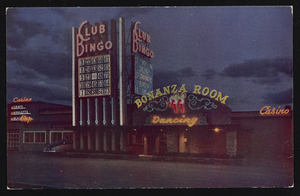
Club Bingo in Las Vegas, Nevada: postcard
Date
Archival Collection
Description
Image
Nevada Women's History Project Records
Identifier
Abstract
The Nevada Women's History Project Records (1995-2008) contain the early organizational records of the Nevada Women's History Project (NWHP), which was created to collect and disseminate information about women throughout Nevada's history. The collection reflects the early organization of the Nevada Women's History Project's (NWHP) Southern region and the variety of events and projects with which the organization was involved with across the state of Nevada. Materials include membership lists, meeting minutes, press releases, project files, and NWHP newsletters.
Archival Collection
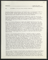
University of Nevada, Las Vegas law school facilities: memos
Date
Archival Collection
Description
Folder contains memorandums from the Dean of Administration to the Law School Advisory Committee and the Physical Plant Planning Committee. From the University of Nevada, Las Vegas William S. Boyd School of Law Records (UA-00048).
Text
UNLV History 117: Nevada History Photograph Collection
Identifier
Abstract
The UNLV History 117: Nevada History Photograph Collection contains photographic prints, negatives, and slides of Las Vegas and Boulder City, Nevada between approximately 1900 and 1959. These images were collected by students for University of Nevada, Las Vegas (UNLV) professor Ralph Roske’s class, History 117: Nevada History. The images primarily depict Las Vegas in the 1950s with people posing in front of and inside the El Rancho Vegas and the Last Frontier Village, including Eleanor Roosevelt, Joe E. Lewis, and Paul Newman. Earlier photographs from the 1920s include businesses, such as fireproofing stores, and significant individuals such as Ed W. Clark. Lastly, it contains two photographs of the Boulder City Airport.
Archival Collection
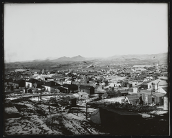
Tonopah, Nevada: photograph
Date
Archival Collection
Description
Image
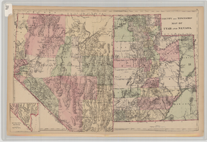
County and township map of Utah and Nevada, 1881
Date
Description
Image
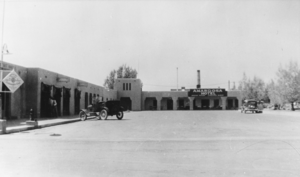
Amargosa Hotel, Beatty, Nevada: photographic print
Date
Archival Collection
Description
From the Nye County, Nevada Photograph Collection (PH-00221) -- Series III. Beatty, Nevada -- Subseries III.H. Miscellaneous
Image
T-Shirt Color: Gray; Front: Williamsburg Fire Dept. 1848-1998, Fire Dept. Emblem, Fire Engine And Fire Station; Back: 150 Years Williamsburg Fire Department, approximately 2001-2012
Level of Description
Archival Collection
Collection Name: New York-New York Hotel and Casino 9-11 Heroes Tribute Collection
Box/Folder: Box 168
Archival Component
T-Shirt Color: Navy Blue; Front: Celebrating 150 Years Holyoke Fire Dept. Preserving Life & Property Since 1851, HFD, Dept. Emblem; Back: Fire Rescue, approximately 2001-2012
Level of Description
Archival Collection
Collection Name: New York-New York Hotel and Casino 9-11 Heroes Tribute Collection
Box/Folder: Box 158
Archival Component
