Search the Special Collections and Archives Portal
Search Results
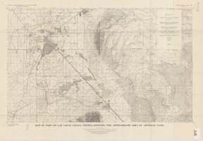
Map of part of Las Vegas Valley, Nevada, showing the approximate area of artesian flow, 1965
Date
1965
Description
At top of map: 'United States Department of the Interior, Geological Survey. Water supply paper 1780, plate 2.' At bottom of map: 'Base from U.S. Geological Survey Las Vegas (1952) and Henderson (1952) quadrangles.' 'Interior--Geological Survey, Washigton, D.C.--1965--W63358.' Relief shown by contours. Includes township and range lines. Thematic map. Scale 1:62,500 (W 115°15´--W 114°45´/N 36°15´--N 36°00´). Series: Water-supply paper (Washington, D.C.)
1780. Originally published as plate 2 of Available water supply of the Las Vegas ground-water basin, Nevada, by Glenn T. Malmberg, published by the Geological Survey in 1965 as its Water-supply paper 1780.
1780. Originally published as plate 2 of Available water supply of the Las Vegas ground-water basin, Nevada, by Glenn T. Malmberg, published by the Geological Survey in 1965 as its Water-supply paper 1780.
Image

Nevada Legislature in Carson City, Nevada: photographic prints
Date
1920 (year approximate) to 1929 (year approximate)
Archival Collection
Description
From the Albert S. Henderson Photograph Collection (PH-00317). Image 002 has identifications of those pictured.
Image
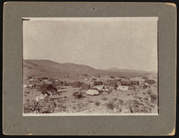
Town of Searchlight, Nevada: photographic print
Date
1900 to 1940
Archival Collection
Description
Town picture of Searchlight, Nevada.
Image

Blair, Nevada: photographic print
Date
1908
Archival Collection
Description
Photograph of Blair, Nevada in 1908.
Image
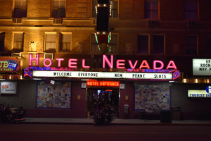
Hotel Nevada mounted Hotel Entrance wall sign, Ely, Nevada
Date
2016 (year approximate) to 2020 (year approximate)
Archival Collection
Description
View of a Hotel Nevada sign above the hotel entrance.
501 E Aultman St, Ely, NV 89301
Image
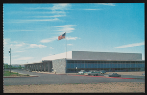
The convention center in Reno, Nevada: postcard
Date
1940 (year approximate) to 1990 (year approximate)
Archival Collection
Description
From the Harvey's Hotel and Casino Postcard Collection (PH-00367) -- Inscription with the postcards reads: "It opened in Nevada Centennial year 1964. The center is located on U.S. Highway 395 going South through Reno. It will accommodate about 7,000 pople and will attract numerous conventions and athletic events."
Image
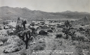
Postcard showing Searchlight, Nevada, circa 1930s
Date
1930 to 1939
Archival Collection
Description
The view of the small town of Searchlight, Nevada. Formed in 1897, Searchlight is an old boomtown that was made popular when George Frederick Colton discovered gold at the location where the town is now built. Unnamed buildings cluster together in the center of the postcard while rocky terrain decorated with small shrubs and mines surround the city's outskirts. Transcribed onto the bottom of the postcard: "Searchlight, Nevada; Duplex Mine In Foreground." The Frasher's Foto logo is also printed onto the bottom right corner.
Image
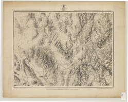
Map showing parts of eastern and southeastern Nevada and southwestern Utah, circa 1873
Date
1869
1872 to 1873
Archival Collection
Description
Scale 1:506,880. 1 in. to 8 miles (W 117°30--W 114°45/N 37°20--N 40°00). Relief shown by hachures and spot heights. At top left: 'Explorations & surveys west of the one-hundredth meridian.' At top right: 'Parts of Eastern & Southeastern Nevada & Southwestern Utah. Atlas sheet number 66.' At bottom left: 'Expeditions of 1869, 1872 & 1873.' At bottom right: ' 1st Lieut. Geo. M. Wheeler, Corps of Engineers, com'd'g.' Seal of the War Department, Corps of Engineers, U.S. Army at top center of map. Originally published as part of the geological atlas which is an appendix to the Survey's Report upon United States geographical surveys west of the one hundredth meridian, published in 1876?
Image
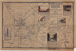
Map of Boulder Dam area and Las Vegas, Nevada, October 7, 1930
Date
1930-10-07
Description
'F.V. Owen, publisher ... Los Angeles, California. Topography by C.H. Fenner, C.E. Decorations by L.J. Bergère. Gov't. data, H.A. Shamberger, C.E. Copyright, 1930, by F.V. Owen.' At bottom right of map: 'Dated Oct. 7th, 1930.' Relief shown by contours and spot heights. Contour lines are 100 feet. Incudes six hand-colored illustrations showing local points of interest. Includes information on Hoover Dam, and chart of mileages from Las Vegas. Scale [ca. 1:63,360]. 1 inch to 1 mile
Text

The Nevada Club in Reno, Nevada: postcard
Date
1956-12-23
Archival Collection
Description
From Harvey's Hotel and Casino Postcard Collection (PH-00367). The Nevada Club in Reno, Nevada. The postcard is inscribed to Miss Sherrill Ann Stolts from her Grandma on August 14, 1952.
Image
Pagination
Refine my results
Content Type
Creator or Contributor
Subject
Archival Collection
Digital Project
Resource Type
Year
Material Type
Place
Language
Records Classification
